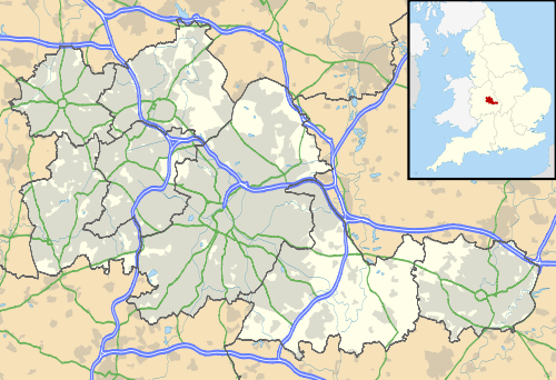
Civil parishes in the West Midlands (county)
A civil parish is a subnational entity, forming the lowest unit of local government in England. There are 18 civil parishes in the ceremonial county of West Midlands, most of the county being unparished; Dudley, Sandwell, Walsall and Wolverhampton are completely unparished. At the 2001 census, there were 89,621 people living in the 18 parishes, accounting for 3.5 per cent of the county's population.
History
Parishes arose from Church of England divisions, and were originally purely ecclesiastical divisions. Over time they acquired civil administration powers.[1]
The Highways Act 1555 made parishes responsible for the upkeep of roads. Every adult inhabitant of the parish was obliged to work four days a year on the roads, providing their own tools, carts and horses; the work was overseen by an unpaid local appointee, the Surveyor of Highways.[2]
The poor were looked after by the monasteries, until their dissolution. In 1572, magistrates were given power to 'survey the poor' and impose taxes for their relief. This system was made more formal by the Poor Law Act 1601, which made parishes responsible for administering the Poor Law; overseers were appointed to charge a rate to support the poor of the parish.[3] The 19th century saw an increase in the responsibility of parishes, although the Poor Law powers were transferred to Poor Law Unions.[4] The Public Health Act 1872 grouped parishes into Rural Sanitary Districts, based on the Poor Law Unions; these subsequently formed the basis for Rural Districts.[5]
Parishes were run by vestries, meeting annually to appoint officials, and were generally identical to ecclesiastical parishes,[6] although some townships in large parishes administered the Poor Law themselves; under the Divided Parishes and Poor Law Amendment Act 1882, all extra-parochial areas and townships that levied a separate rate became independent civil parishes.[7]
Civil parishes in their modern sense date from the Local Government Act 1894, which abolished vestries; established elected parish councils in all rural parishes with more than 300 electors; grouped rural parishes into Rural Districts; and aligned parish boundaries with county and borough boundaries.[7] Urban civil parishes continued to exist, and were generally coterminous with the Urban District, Municipal Borough or County Borough in which they were situated; many large towns contained a number of parishes, and these were usually merged into one. Parish councils were not formed in urban areas, and the only function of the parish was to elect guardians to Poor Law Unions; with the abolition of the Poor Law system in 1930 the parishes had only a nominal existence.[8]
The Local Government Act 1972 retained civil parishes in rural areas, and many former Urban Districts and Municipal Boroughs that were being abolished, were replaced by new successor parishes; urban areas that were considered too large to be single parishes became unparished areas.[9]

The current position
Recent governments have encouraged the formation of town and parish councils in unparished areas, and the Local Government and Rating Act 1997 gave local residents the right to demand the creation of a new civil parish.[10]
A parish council can become a town council unilaterally, simply by resolution;[9] and a civil parish can also gain city status, but only if that is granted by the Crown.[9] The chairman of a town or city council is called a mayor.[9] The Local Government and Public Involvement in Health Act 2007 introduced alternative names: a parish council can now choose to be called a community; village; or neighbourhood council.[11]
List of civil parishes and unparished areas


See also
References
- ↑ Angus Winchester, 2000, Discovering Parish Boundaries. Shire Publications. Princes Risborough, 96 pages ISBN 978-0-7478-0470-3
- ↑ RAC Foundation : What Went Wrong? British Highway Development Before Motorways Retrieved 22 August 2009
- ↑ The Victorian Web : The Poor Law : Introduction Retrieved 22 August 2009
- ↑ Staffordshire University : Poor Law Unions and Registration Districts Archived 14 September 2012 at Archive.is Retrieved 22 August 2009
- ↑ A Vision of Britain Through Time : Status Details for Rural Sanitary District Retrieved 22 August 2009
- ↑ Robert Tittler, The Reformation and the Towns in England, 1998, Oxford University Press, 395 pages, ISBN 978-0-19-820718-4
- 1 2 Modern British Surnames : Selected Events in the History of Civil Registration and Boundary Changes 1801-1996 Archived 1 August 2010 at the Wayback Machine. Retrieved 22 August 2009
- ↑ Alex MacMorran and T R Colquhoun Dill, The Local Government Act 1894 and the Subsequent Statutes Affecting Parish Councils, 1907, Butterworth and Co, London, 626 pages
- 1 2 3 4 Office of Public Sector Information : Local Government Act 1972 Archived 5 December 2012 at Archive.is Retrieved 22 August 2009
- ↑ Office of Public Sector Information : Local Government and Rating Act 1997 Archived 5 August 2012 at Archive.is Retrieved 22 August 2009
- ↑ Office of Public Sector Information : Local Government and Public Involvement in Health Act 2007 Archived 5 August 2012 at Archive.is Retrieved 22 August 2009
- ↑ A Vision of Britain Through Time : Birmingham County Borough Archived 30 September 2007 at the Wayback Machine. Retrieved 16 September 2009
- ↑ Office for National Statistics : Census 2001 : Urban Areas : Table KS01 : Usual Resident Population Acocks Green; Aston; Bartley Green; Billesley; Bournville; Brandwood; Edgbaston; Erdington; Fox Hollies; Hall Green; Handsworth; Harborne; Hodge Hill (part); Kings Norton; Kingsbury (part); Kingstanding; Ladywood; Longbridge (part); Moseley; Nechells; Northfield; Oscott; Perry Bar; Quinton; Sandwell; Selly Oak; Shard End (part); Small Heath; Soho; Sparkbrook; Sparkhill; Stockland Green; Sutton Vesey (part); Washwood Heath; Weoley; and Yardley wards. Retrieved 26 August 2009
- ↑ A Vision of Britain Through Time : Bromsgrove Rural District Retrieved 16 September 2009
- ↑ Office for National Statistics : Census 2001 : Parish Headcounts : Birmingham Retrieved 16 September 2009
- ↑ A Vision of Britain Through Time : Sutton Coldfield Municipal Borough Retrieved 16 September 2009
- ↑ Office for National Statistics : Census 2001 : Urban Areas : Table KS01 : Usual Resident Population Hodge Hill (part); Kingsbury (part); Shard End (part); Sheldon; Sutton Four Oaks; Sutton New Hall; and Sutton Vesey (part) wards. Retrieved 26 August 2009
- 1 2 3 4 5 6 7 8 9 10 11 12 13 14 A Vision of Britain Through Time : Meriden Rural District Archived 30 September 2007 at the Wayback Machine. Retrieved 16 September 2009
- 1 2 Office for National Statistics : Census 2001 : Parish Headcounts : Coventry Retrieved 16 September 2009
- ↑ A Vision of Britain Through Time : Coventry County Borough Retrieved 16 September 2009
- ↑ Office for National Statistics : Census 2001 : Urban Areas : Table KS01 : Usual Resident Population Bablake (part); Binley and Willenhall; Cheylesmore; Earlsdon; Foleshill; Henley; Holbrook; Longford; Lower Stoke; Radford; Sherbourne; St Michael's; Upper Stoke; Wainbody; Whoberley; Woodlands; and Wyken wards. Retrieved 26 August 2009
- ↑ "The Coventry City Council (Reorganisation of Community Governance) Order 2015" (PDF). Lgbce. Retrieved 16 March 2018.
- ↑ A Vision of Britain Through Time : Dudley County Borough Archived 3 November 2007 at the Wayback Machine. Retrieved 16 September 2009
- ↑ Office for National Statistics : Census 2001 : Urban Areas : Table KS01 : Usual Resident Population Amblecote (part); Brierley Hill; Brockmoor and Pensnett; Castle and Priory; Coseley East; Coseley West; Gornal; Kingswinford North and Wall Heath; Kingswinford South; Netherton and Woodside; Quarry Bank and Cradley (part); Sedgley; St Andrews; St James's; St Thomas's; and Wordsley wards. Retrieved 26 August 2009
- ↑ A Vision of Britain Through Time : Halesowen Municipal Borough Retrieved 16 September 2009
- ↑ Office for National Statistics : Census 2001 : Urban Areas : Table KS01 : Usual Resident Population Belle Vale and Hasbury; Halesowen North; Halesowen South; Hayley Green; and Quarry Bank and Cradley (part) wards. Retrieved 26 August 2009
- ↑ A Vision of Britain Through Time : Stourbridge Municipal Borough Retrieved 16 September 2009
- ↑ Office for National Statistics : Census 2001 : Urban Areas : Table KS01 : Usual Resident Population Amblecote (part); Lye and Wollescote; Norton; Pedmore and Stourbridge East; and Wollaston and Stourbridge West wards. Retrieved 26 August 2009
- ↑ A Vision of Britain Through Time : Warley County Borough Archived 30 September 2007 at the Wayback Machine. Retrieved 17 September 2009
- ↑ Office for National Statistics : Census 2001 : Urban Areas : Table KS01 : Usual Resident Population Abbey; Blackheath; Bristnall; Cradley Heath and Old Hill; Langley; Old Warley; Oldbury; Rowley; Smethwick; Soho and Victoria; St Pauls; Tipton Green (part); and Tividale wards. Retrieved 26 August 2009
- ↑ A Vision of Britain Through Time : West Bromwich County Borough Retrieved 17 September 2009
- ↑ Office for National Statistics : Census 2001 : Urban Areas : Table KS01 : Usual Resident Population Charlemont; Friar Park; Great Barr; Great Bridge; Greets Green and Lyng; Hateley Heath; Newton; Princes End; Tipton Green (part); Wednesbury North; Wednesbury South; and West Bromwich Central wards. Retrieved 26 August 2009
- 1 2 3 4 5 6 7 8 9 10 11 12 13 Office for National Statistics : Census 2001 : Parish Headcounts : Solihull Retrieved 22 November 2009
- ↑ "Bulletin of change to local authority arrangements, areas and names in England" (PDF). Lgbce. Archived from the original (PDF) on 12 January 2018. Retrieved 16 March 2018.
- 1 2 3 4 A Vision of Britain Through Time : Stratford on Avon Rural District Retrieved 22 November 2009
- 1 2 3 Hockley Heath Parish Council : The New Parishes Archived 31 May 2009 at the Wayback Machine. Retrieved 22 November 2009
- 1 2 3 Population included in Hockley Heath
- ↑ Population includes Cheswick Green; Dickens Heath; and Tidbury Green
- ↑ A Vision of Britain Through Time : Solihull County Borough Retrieved 17 September 2009
- ↑ Office for National Statistics : Census 2001 : Urban Areas : Table KS01 : Usual Resident Population Bickenhill (part); Elmdon; Knowle; Lyndon; Olton; Packwood (part); Shirley East; Shirley South; Shirley West; Silhill; and St Alphege wards. Retrieved 26 August 2009
- ↑ A Vision of Britain Through Time : Aldridge-Brownhills Urban District Retrieved 25 November 2009
- ↑ Office for National Statistics : Census 2001 : Urban Areas : Table KS01 : Usual Resident Population Aldridge Central and South; Aldridge North and Walsall Wood; Brownhills; Hatherton Rushall (part); Pelsall; Pheasey; and Streetly wards. Retrieved 26 August 2009
- ↑ A Vision of Britain Through Time : Walsall County Borough Retrieved 25 November 2009
- ↑ Office for National Statistics : Census 2001 : Urban Areas : Table KS01 : Usual Resident Population Bentley and Darlaston North; Birchills Leamore; Blakenall; Bloxwich East; Bloxwich West; Darlaston South; Hatherton Rushall (part); Paddock; Palfrey; Pleck; Short heath; St Matthew's; Willenhall North; and Willenhall South wards. Retrieved 26 August 2009
- ↑ A Vision of Britain Through Time : Wolverhampton County Borough Archived 1 October 2007 at the Wayback Machine. Retrieved 25 November 2009
- ↑ Office for National Statistics : Census 2001 : Urban Areas : Table KS01 : Usual Resident Population : Wolverhampton City Retrieved 25 November 2009