List of Sydney Ferries wharves
|
by Transport for New South Wales, updated November 2017. |
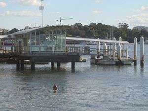
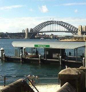
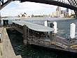
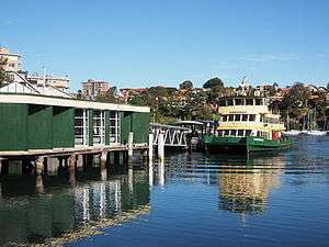
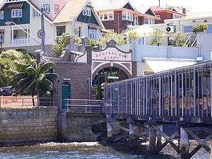
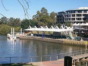
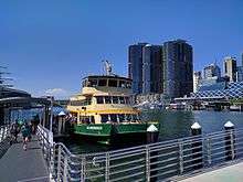
Sydney Ferries is the brand name for a metropolitan ferry service operating in Sydney Harbour, connecting a network of 36 wharves on the waterway and its various inlets and tributaries. Currently, Sydney Ferries operates seven distinct service routes across the harbour, all originating from or terminating at Circular Quay ferry wharf, one of only five wharves on the network to be regularly serviced by more than one route, with the other four being Balmain East, Barangaroo, McMahons Point, and Milsons Point, all serviced by both the F3 Parramatta River and F4 Darling Harbour services. The network's extent reaches Parramatta ferry wharf at its most westerly, and Manly ferry wharf at its most easterly.
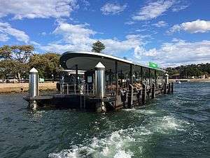
Wharves
In service
.jpg)
To be commissioned
| Name | Image | Coordinates | Bs | Route(s) | Date opened | Interchanges |
|---|---|---|---|---|---|---|
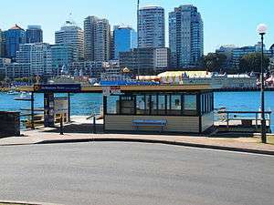
| Rhodes | .jpg) |
33°49′23″S 151°05′33″E / 33.82306°S 151.09250°E | 1 |
|
Decommissioned
| Name | Image | Coordinates | Bs | Route(s) | Date opened | Decommissioned | Previous names[lower-alpha 1] |
|---|---|---|---|---|---|---|---|
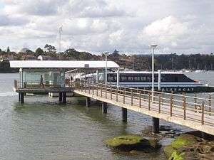
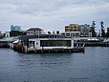
| Aquarium |  |
33°52′10.9″S 151°12′04.2″E / 33.869694°S 151.201167°E | 1 | ■ Darling Harbour |
|
|
|
| Balmain West | 33°51′18.0″S 151°10′07.0″E / 33.855000°S 151.168611°E | 1 | ■ Balmain/Woolwich |
| |||
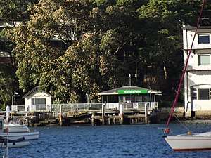
| Bayview Park | 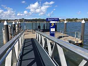 |
33°51′23.6″S 151°07′19.4″E / 33.856556°S 151.122056°E | 1 | ■ Parramatta River |
|
|
|
| Birkenhead | 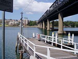 |
33°51′27.7″S 151°09′40.6″E / 33.857694°S 151.161278°E | 1 | ■ Balmain/Woolwich |
|
| |
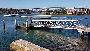
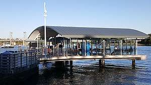
| Darling Harbour | 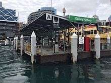 |
33°52′00.7″S 151°12′03.0″E / 33.866861°S 151.200833°E | 2 | <noinclude> |
|
|
References
- Notes
- 1 2 Ferry wharf names as they appeared in Sydney Ferries maps from 1992, 1995, 2002, 2006, July 2008, December 2008, 2010, and 2011.
- ↑ A $50,000 effort by the Department of Transport to restore the structure of the wharf, mostly damaged after a century of use.[2]
- ↑ A two-storey upgrade to Wharf 3, which allowed berthing of the larger Freshwater-class ferries.[9]
- ↑ Reconstruction of the wharf's gangway and pontoon after a collision with a vessel due to a faulty starboard engine.[10]
- ↑ Reconstruction after the original wharf was a casualty of the June 2007 extratropical cyclone that hit New South Wales.[14]
- ↑ Entirely rebuilt after a fire in 1939 destroyed the entire wharf structure.[23]
- ↑ Reconstruction and partial renovation of the wharf after severe damage caused by a collision with the MV Borrowdale on 6 September 1987.[35]
- Citations
- ↑ RPS Australia staff (August 2012). "Commuter Wharf Upgrade - Statement of Heritage Impact Balmain Thames Street Wharf, NSW" (PDF). RPS Group, Roads and Maritime Services. Transport for New South Wales. Archived from the original (PDF) on 29 June 2017. Retrieved 29 June 2017.
- ↑ Office of Environment and Heritage staff (November 2012). "Thames Street Wharf". New South Wales Office of Environment and Heritage. Government of New South Wales. Archived from the original on 29 June 2017. Retrieved 29 June 2017.
- ↑ Transport for New Souh Wales staff (May 2013). "Sydney's Ferry Future - Modernising Sydney's Ferries" (PDF). Transport for New South Wales. Government of New South Wales. Archived from the original (PDF) on 29 June 2017. Retrieved 29 June 2017.
- ↑ Roads and Maritime Services staff (June 2014). "Balmain East Wharf upgrade – Environmental and socio-economic impacts" (PDF). Roads and Maritime Services. Transport for New South Wales. Archived from the original (PDF) on 8 May 2017. Retrieved 8 May 2017.
- ↑ Transport for New South Wales staff (17 June 2015). "Balmain East Wharf to reopen tomorrow". Transport for New South Wales. Government of New South Wales. Archived from the original on 8 May 2017. Retrieved 8 May 2017.
- 1 2 O'Sullivan, Matt (26 June 2017). "Sydney's new ferry hub at Barangaroo opens to commuters". The Sydney Morning Herald. Fairfax Media. Archived from the original on 27 June 2017. Retrieved 27 June 2017.
- 1 2 McPhee, Sarah (26 June 2017). "New Barangaroo Wharf open for ferries". News.com.au. News Corp Australia. Archived from the original on 27 June 2017. Retrieved 27 June 2017.
- ↑ Roads and Maritime Services staff (July 2017). "Chiswick Wharf upgrade - July 2017 poster" (PDF). Roads and Maritime Services. Government of New South Wales. Archived from the original (PDF) on 24 September 2017. Retrieved 24 September 2017.
- 1 2 3 4 5 6 7 8 9 10 Office of Environment and Heritage staff (November 2012). "Circular Quay Ferry Wharves". New South Wales Office of Environment and Heritage. Government of New South Wales. Archived from the original on 8 May 2017. Retrieved 8 May 2017.
- 1 2 3 Farina, Deborah (February 2017). "Cockatoo Island Wharf Upgrade - Statement of Heritage Impact" (PDF). RPS Group. p. 30. Archived from the original (PDF) on 28 July 2017. Retrieved 28 July 2017.
- 1 2 Roads and Maritime Services staff (February 2017). "Cockatoo Island Wharf Upgrade - Submissions report" (PDF). Roads and Maritime Services. Government of New South Wales. pp. 12, 18. Archived from the original (PDF) on 28 July 2017. Retrieved 28 July 2017.
- ↑ Roads and Maritime Services staff (August 2017). "Cockatoo Island Wharf upgrade - Opening Information August 2017" (PDF). Roads and Maritime Services. Government of New South Wales. Archived from the original (PDF) on 9 August 2017. Retrieved 9 August 2017.
- ↑ Roads and Maritime Services staff (May 2014). "Cremorne Point Wharf upgrade – Environmental and socio-economic impacts" (PDF). Roads and Maritime Services. Transport for New South Wales. Archived from the original (PDF) on 8 May 2017. Retrieved 8 May 2017.
- ↑ Australian Associated Press (14 September 2007). "Refurbished Cremorne Wharf to reopen". ABC News Australia. Australian Broadcasting Corporation. Archived from the original on 8 May 2017. Retrieved 8 May 2017.
- ↑ Transport for New South Wales staff (January 2015). "To the Householder - Cremorne Point Wharf Upgrade" (PDF). Roads and Maritime Services. Transport for New South Wales. Archived from the original (PDF) on 8 May 2017. Retrieved 8 May 2017.
- 1 2 Farina, Deborah (January 2014). "Statement of Heritage Impact - Drummoyne Ferry Wharf, NSW" (PDF). RPS Group. p. 20. Archived from the original (PDF) on 28 July 2017. Retrieved 28 July 2017.
- ↑ Office of Environment and Heritage staff (November 2012). "Wolseley Street Wharf". New South Wales Office of Environment and Heritage. Government of New South Wales. Archived from the original on 28 July 2017. Retrieved 28 July 2017.
- ↑ Roads and Maritime Services staff (September 2014). "Drummoyne (Wolseley Street) Wharf Upgrade - Completed". Roads and Maritime Services. Government of New South Wales. Archived from the original on 28 July 2017. Retrieved 28 July 2017.
- ↑ Office of Environment and Heritage staff (November 2012). "Greenwich Point Wharf". New South Wales Office of Environment and Heritage. Government of New South Wales. Archived from the original on 28 July 2017. Retrieved 28 July 2017.
- ↑ Farina, Deborah (October 2012). "Commuter Wharf Upgrade - Statement of Heritage Impact - Huntleys Point Wharf, NSW" (PDF). RPS Group, Roads and Maritime Services. p. 19. Archived from the original (PDF) on 23 September 2017. Retrieved 23 September 2017.
- ↑ Transport for New South Wales staff (23 April 2013). "Huntleys Point Wharf open for commuters". Transport for New South Wales. Government of New South Wales. Archived from the original on 23 September 2017. Retrieved 23 September 2017.
- ↑ Morcombe, John (26 June 2015). "Manly had its own fun pier for almost 60 years". Manly Daily (The Daily Telegraph NewsLocal). News Corp Australia. Archived from the original on 7 May 2017. Retrieved 7 May 2017.
- ↑ Office of Environment and Heritage staff (2011). "Manly Wharf". Heritage Council of New South Wales. New South Wales Office of Environment and Heritage. Archived from the original on 7 May 2017. Retrieved 7 May 2017.
- ↑ Roads and Maritime Services staff (February 2015). "McMahons Point Wharf upgrade – Environmental and socio-economic impacts" (PDF). Roads and Maritime Services. Transport for New South Wales. Archived from the original (PDF) on 7 May 2017. Retrieved 7 May 2017.
- ↑ Transport for New South Wales staff (19 October 2016). "New McMahons Point ferry wharf to open tomorrow". Transport for New South Wales. Government of New South Wales. Archived from the original on 8 May 2017. Retrieved 8 May 2017.
- ↑ "Old Milsons Point tram Depot and wharf". New South Wales State Archives & Records. Government of New South Wales. Archived from the original on 3 October 2017. Retrieved 3 October 2017.
- ↑ Sydney Ferries staff (22 November 2010). "Milsons Point / Luna Park Wharf re-opens Monday, 29 November 2010". Sydney Ferries. Sydney Ferries Corporation. Archived from the original on 24 February 2011. Retrieved 7 May 2017.
- 1 2 O'Sullivan, Matt (26 April 2017). "Six years after last revamp, Milsons Point wharf undergoes another makeover". The Sydney Morning Herald. Fairfax Media. Archived from the original on 7 May 2017. Retrieved 7 May 2017.
- ↑ Office of Environment and Heritage staff (November 2012). "Mosman Wharf". New South Wales Office of Environment and Heritage. Government of New South Wales. Archived from the original on 8 May 2017. Retrieved 8 May 2017.
- ↑ Roads and Maritime Services staff (March 2014). "Mosman Bay ferry wharf upgrade – Environmental and socio-economic impacts" (PDF). Roads and Maritime Services. Transport for New South Wales. Archived from the original (PDF) on 8 May 2017. Retrieved 8 May 2017.
- ↑ King, Rosie (17 September 2014). "After being closed for almost six months, the new and improved Mosman Bay Wharf is set to open on time". Mosman Daily (The Daily Telegraph NewsLocal). News Corp Australia. Archived from the original on 8 May 2017. Retrieved 8 May 2017.
- ↑ Peter Freeman Conservation Architects & Planners (April 2010). "Neutral bay / Hayes Street Ferry Wharf Heritage Assessment" (PDF). Roads and Maritime Services. Transport for New South Wales. Archived from the original (PDF) on 8 May 2017. Retrieved 8 May 2017.
- ↑ Roads and Maritime Services staff (July 2014). "Pyrmont Bay Wharf upgrade – Environmental and socio-economic impacts" (PDF). Roads and Maritime Services. Transport for New South Wales. Archived from the original (PDF) on 8 May 2017. Retrieved 8 May 2017.
- ↑ Transport for New South Wales staff (25 August 2015). "New Pyrmont Bay Wharf to Reopen to Ferry Customers". Transport for New South Wales. Government of New South Wales. Archived from the original on 8 May 2017. Retrieved 8 May 2017.
- 1 2 Peter Freeman Conservation Architects & Planners (February 2012). "Rose Bay Ferry Wharf Heritage Assessment" (PDF). Roads and Maritime Services. Transport for New South Wales. Archived from the original (PDF) on 8 May 2017. Retrieved 8 May 2017.
- ↑ Sydney Heritage Fleet staff (11 August 2017). "North Shore Steam Ferry Company". Sydney Heritage Fleet. Archived from the original on 13 August 2017. Retrieved 13 August 2017.
- ↑ Godden Mackay Logan (January 2004). "Taronga Zoo Archaeological Management Plan" (PDF). Mosman Council. Retrieved 8 May 2017.
- 1 2 Office of Environment and Heritage staff (November 2012). "Valentia Street Wharf and Waiting Shed". New South Wales Office of Environment and Heritage. Government of New South Wales. Archived from the original on 28 July 2017. Retrieved 28 July 2017.
- ↑ O’Rourke, Jim (24 October 2016). "Commuters travelling from the Rhodes peninsula have been promised a ferry service before March 2019". Inner West Courier (The Daily Telegraph NewsLocal). News Corp Australia. Archived from the original on 9 May 2017. Retrieved 8 May 2017.
- ↑ Sydney Ferries staff (October 2010). "Frequently Asked Questions". Sydney Ferries. Sydney Ferries Corporation. Archived from the original on 24 February 2011. Retrieved 8 May 2017.
- ↑ Carey, Alexis (8 August 2013). "Anger over ferry wharf closure". Inner West Courier (The Daily Telegraph NewsLocal). News Corp Australia. Archived from the original on 8 May 2017. Retrieved 8 May 2017.
- 1 2 Saulwick, Jacob (22 May 2013). "Ferries ahoy as minister pushes the boat out". The Sydney Morning Herald. Fairfax Media. Archived from the original on 8 May 2017. Retrieved 8 May 2017.
- ↑ Office of Environment and Heritage staff (28 November 2008). "Bayview Park". Heritage Council of New South Wales. New South Wales Office of Environment and Heritage. Archived from the original on 5 November 2017. Retrieved 5 November 2017.
- ↑ Hall, Louise (25 October 2010). "Left standing on the wharf - 27,000 ferry commuters". The Sydney Morning Herald. Fairfax Media. Archived from the original on 8 May 2017. Retrieved 8 May 2017.
External links
| Wikimedia Commons has media related to Ferry wharves serviced by Sydney Ferries. |
- Transport for New South Wales public website
This article is issued from
Wikipedia.
The text is licensed under Creative Commons - Attribution - Sharealike.
Additional terms may apply for the media files.