List of Cultural Properties of Japan - structures (Miyagi)
This list is of the Cultural Properties of Japan designated in the category of structures (建造物 kenzōbutsu) for the Prefecture of Miyagi.[1]
National Cultural Properties
As of 1 August 2015, twenty Important Cultural Properties (including three *National Treasures) with forty-two component structures have been designated, being of national significance.[2][3][4]
Prefectural Cultural Properties
As of 1 May 2014, thirty-six properties have been designated at a prefectural level.[4][5]
_honden.JPG)

Municipal Cultural Properties
As of 1 May 2014, one hundred and twenty properties have been designated at a municipal level.[6]
| Property | Date | Municipality | Comments | Image | Coordinates | Ref. |
|---|---|---|---|---|---|---|
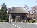
| Dainen-ji Sōmon 大年寺惣門 Dainenji sōmon | Edo period | Sendai | 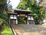 | 38°14′13″N 140°52′44″E / 38.236965°N 140.878976°E | ||
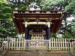
| Jōkaku-ji Sanmon 成覚寺山門(旧浄眼院殿霊屋門) Jōkakuji sanmon (kyū-Jōgan-in den tamaya mon) | 1687 | Sendai | 38°15′18″N 140°53′21″E / 38.254946°N 140.889236°E | |||
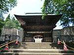
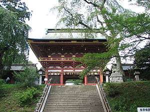
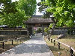
| Rinnō-ji Sanmon 輪王寺山門 Rinnōji sanmon | 1691 | Sendai | 38°17′00″N 140°51′33″E / 38.283398°N 140.859039°E | |||
Registered Cultural Properties
As of 1 August 2015, ninety-seven properties at thirty-three sites have been registered (as opposed to designated) at a national level.[7][8]
| Property | Date | Municipality | Comments | Image | Coordinates | Ref. |
|---|---|---|---|---|---|---|
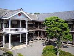
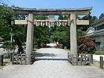
| Ōsaki Hachimangū Shamusho 大崎八幡宮社務所 Ōsaki Hachimangū shamusho | late Taishō period | Sendai | 38°16′18″N 140°50′40″E / 38.27158003°N 140.84452527°E | |||
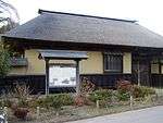
| Ōsaki Hachimangū Former Chief Priest's Quarters 大崎八幡宮旧宮司宿舎 Ōsaki Hachimangū kyū-gūji shukusha | late Taishō period | Sendai |  | 38°16′17″N 140°50′40″E / 38.27143735°N 140.84448562°E | ||
| Ōsaki Hachimangū Shinmesha 大崎八幡宮神馬舎 Ōsaki Hachimangū shinmesha | late Taishō period | Sendai | renovated in 2010 | 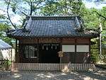 | 38°16′18″N 140°50′43″E / 38.27168109°N 140.84516374°E | |
| National Treasures |    | |
|---|---|---|
| Important Cultural Properties |
| |
| Hokkaidō | ||
| Tōhoku |
| |
| Kantō |
| |
| Chūbu |
| |
| Kansai |
| |
| Chūgoku |
| |
| Shikoku | ||
| Kyūshū |
| |
| Okinawa | ||
1 | ||
See also
References
- ↑ "Pamphlet on Cultural Properties". Agency for Cultural Affairs. Retrieved 3 August 2015.
- ↑ 国宝・重要文化財 [Number of National Treasures and Important Cultural Properties by Prefecture] (in Japanese). Agency for Cultural Affairs. 1 August 2015. Retrieved 3 August 2015.
- ↑ "Database of National Cultural Properties: 国宝・重要文化財(建造物) (宮城県)" (in Japanese). Agency for Cultural Affairs. Retrieved 3 August 2015.
- 1 2 宮城県の国・県指定文化財 [National and Prefectural Cultural Properties of Miyagi Prefecture] (in Japanese). Miyagi Prefecture. 9 July 2012. Archived from the original on 12 January 2013. Retrieved 3 August 2015.
- ↑ 都道府県別指定等文化財件数(都道府県分) [Number of Prefectural Cultural Properties by Prefecture] (in Japanese). Agency for Cultural Affairs. 1 May 2014. Retrieved 3 August 2015.
- ↑ 都道府県別指定等文化財件数(市町村分) [Number of Municipal Cultural Properties by Prefecture] (in Japanese). Agency for Cultural Affairs. 1 May 2014. Retrieved 3 August 2015.
- ↑ 登録文化財 [Number of Registered Cultural Properties by Prefecture] (PDF) (in Japanese). Agency for Cultural Affairs. 1 August 2015. Retrieved 3 August 2015.
- ↑ 宮城県の国登録文化財一覧表 [List of Registered Cultural Properties of Miyagi Prefecture] (in Japanese). Miyagi Prefecture. 16 August 2012. Retrieved 3 August 2015.
External links
- (in Japanese) Cultural Properties in Miyagi Prefecture
This article is issued from
Wikipedia.
The text is licensed under Creative Commons - Attribution - Sharealike.
Additional terms may apply for the media files.