Liberty, Saskatchewan
| Liberty | |
|---|---|
| Village | |
| Village of Liberty | |
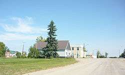 Lincoln Street | |
 Liberty Location of Liberty in Saskatchewan  Liberty Liberty (Canada) | |
| Coordinates: 51°09′11″N 105°26′13″W / 51.153°N 105.437°W | |
| Country |
|
| Province |
|
| Region | Central |
| Census division | 11 |
| Rural Municipality | Big Arm No. 251 |
| Government | |
| • Type | Municipal |
| • Governing body | Liberty Village Council |
| • Mayor | Jennifer Langlois |
| • Administrator | Yvonne (Bonny) Goodsman |
| Area | |
| • Total | 1.37 km2 (0.53 sq mi) |
| Population (2016) | |
| • Total | 78 |
| • Density | 57.1/km2 (148/sq mi) |
| Time zone | UTC-6 (CST) |
| Postal code | S0G 3A0 |
| Area code(s) | 306 |
| Highways |
|
| Railways | Canadian Pacific Railway |
| [1][2][3][4] | |
Liberty is a village within the Rural Municipality of Big Arm No. 251, in the province of Saskatchewan, Canada. Liberty had a population of 78 in the 2016 Canada Census, (a -11.4% decrease from 88 in the 2011 Canada Census). The village is located along Highway 2 120 km north of the provincial capital, Regina.
Demographics
| Canada census – Liberty, Saskatchewan community profile | |||
|---|---|---|---|
| 2016 | 2011 | 2006 | |
| Population: | 78 (-11.4% from 2011) | 88 (20.5% from 2006) | 73 (-22.3% from 2001) |
| Land area: | 1.37 km2 (0.53 sq mi) | 1.37 km2 (0.53 sq mi) | 1.37 km2 (0.53 sq mi) |
| Population density: | 57.1/km2 (148/sq mi) | 64.4/km2 (167/sq mi) | 53.4/km2 (138/sq mi) |
| Median age: | 46.5 (M: 51.5, F: 42.5) | 49.5 (M: 57.3, F: 42.5) | 57.5 (M: 57.8, F: 55.5) |
| Total private dwellings: | 50 | 47 | 50 |
| Median household income: | |||
| References: 2016[5] 2011[6] 2006[7] earlier[8] | |||
See also
References
- ↑ National Archives, Archivia Net, Post Offices and Postmasters, archived from the original on October 6, 2006
- ↑ Government of Saskatchewan, MRD Home, Municipal Directory System, archived from the original on November 21, 2008
- ↑ Canadian Textiles Institute. (2005), CTI Determine your provincial constituency, archived from the original on 2007-09-11
- ↑ Commissioner of Canada Elections, Chief Electoral Officer of Canada (2005), Elections Canada On-line, archived from the original on April 21, 2007
- ↑ "2016 Community Profiles". Canada 2016 Census. Statistics Canada. February 21, 2017. Retrieved 2017-03-15.
- ↑ "2011 Community Profiles". Canada 2011 Census. Statistics Canada. July 5, 2013. Retrieved 2012-10-14.
- ↑ "2006 Community Profiles". Canada 2006 Census. Statistics Canada. March 30, 2011. Retrieved 2010-09-11.
- ↑ "2001 Community Profiles". Canada 2001 Census. Statistics Canada. February 17, 2012.
External links
- Saskatchewan City & Town Maps
- Saskatchewan Gen Web - One Room School Project
- Post Offices and Postmasters - ArchiviaNet - Library and Archives Canada
- Saskatchewan Gen Web Region
- Online Historical Map Digitization Project
- GeoNames Query
- 2006 Community Profiles
- Saskatchewan Roman Catholic Churches ~ Online Parish Registers ~ History >> Chamberlain, Indian Head, Liberty, Lumsden, Rouleau.
Places adjacent to Liberty, Saskatchewan | ||||||||||
|---|---|---|---|---|---|---|---|---|---|---|
| ||||||||||
| Subdivisions | |
|---|---|
| Communities | |
| Cities | |
| Topics |
|
| |

This article is issued from
Wikipedia.
The text is licensed under Creative Commons - Attribution - Sharealike.
Additional terms may apply for the media files.