Elstow, Saskatchewan
| Elstow | |
|---|---|
| Special service area | |
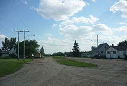 Bedford Street | |
 Location of Elstow in Saskatchewan  Elstow, Saskatchewan (Canada) | |
| Coordinates: 51°59′35″N 106°04′44″W / 51.993°N 106.079°W | |
| Country | Canada |
| Province | Saskatchewan |
| Region | Saskatchewan |
| Census division | 15 |
| Rural Municipality | Blucher |
| Post office founded | December 15, 1907 (closed August 15, 1986) |
| Village[1] | December 17, 1908 |
| Dissolved[2] | December 31, 2014 |
| Area | |
| • Total | 0.58 km2 (0.22 sq mi) |
| Population (2006) | |
| • Total | 91 |
| • Density | 155.6/km2 (403/sq mi) |
| Time zone | CST |
| Postal code | S0K 1M0 |
| Area code(s) | 306 |
| Highways | Highway 16 |
| [3][4][5][6] | |
Elstow is a special service area within the Rural Municipality of Blucher No. 343 in Saskatchewan, Canada.[1] It dissolved from village status on December 31, 2014.[1] It was originally incorporated as a village on December 17, 1908.[2]
Demographics
| Canada census – Elstow, Saskatchewan community profile | |||
|---|---|---|---|
| 2011 | 2006 | ||
| Population: | 89 (-2.2% from 2006) | 91 (−6.2% from 2001) | |
| Land area: | 0.63 km2 (0.24 sq mi) | 0.58 km2 (0.22 sq mi) | |
| Population density: | 142.4/km2 (369/sq mi) | 155.6/km2 (403/sq mi) | |
| Median age: | 43.8 (M: 45.0, F: 40.5) | 39.5 (M: 36.2, F: 41.5) | |
| Total private dwellings: | 45 | 38 | |
| Median household income: | $N/A | $N/A | |
| References: 2011[7] 2006[8] earlier[9] | |||
See also
References
- 1 2 3 "Urban Municipality Incorporations" (PDF). Saskatchewan Ministry of Government Relations. p. 11. Archived from the original on October 15, 2014. Retrieved February 5, 2017.
- 1 2 "Minister's Order: Notice of Dissolution – Village of Elstow". Saskatchewan Queen's Printer. December 24, 2014. p. 2753. Retrieved February 5, 2017.
- ↑ National Archives, Archivia Net, Post Offices and Postmasters, archived from the original on 2006-10-06
- ↑ Government of Saskatchewan, MRD Home, Municipal Directory System, archived from the original (– Scholar search) on November 21, 2008
- ↑ Canadian Textiles Institute. (2005), CTI Determine your provincial constituency, archived from the original on 2007-09-11
- ↑ Commissioner of Canada Elections, Chief Electoral Officer of Canada (2005), Elections Canada On-line, archived from the original on 2007-04-21
- ↑ "2011 Community Profiles". Canada 2011 Census. Statistics Canada. July 5, 2013. Retrieved 2012-07-08.
- ↑ "2006 Community Profiles". Canada 2006 Census. Statistics Canada. March 30, 2011. Retrieved 2011-03-12.
- ↑ "2001 Community Profiles". Canada 2001 Census. Statistics Canada. February 17, 2012.
| Subdivisions | |
|---|---|
| Communities | |
| Cities | |
| Topics |
|
| |
This article is issued from
Wikipedia.
The text is licensed under Creative Commons - Attribution - Sharealike.
Additional terms may apply for the media files.