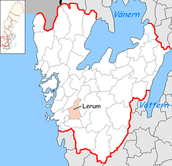
Lerum Municipality
| Lerum Municipality Lerums kommun | ||
|---|---|---|
| Municipality | ||
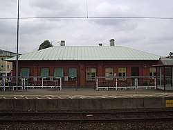 Lerum Railway Station | ||
| ||
 | ||
| Country | Sweden | |
| County | Västra Götaland County | |
| Seat | Lerum | |
| Area[1] | ||
| • Total | 308.38 km2 (119.07 sq mi) | |
| • Land | 258.61 km2 (99.85 sq mi) | |
| • Water | 49.77 km2 (19.22 sq mi) | |
| Area as of 1 January 2014. | ||
| Population (31 December 2017)[2] | ||
| • Total | 41,510 | |
| • Density | 130/km2 (350/sq mi) | |
| Time zone | UTC+1 (CET) | |
| • Summer (DST) | UTC+2 (CEST) | |
| ISO 3166 code | SE | |
| Province | Västergötland | |
| Municipal code | 1441 | |
| Website | www.lerum.se | |
| Density is calculated using land area only. | ||

Lerum Municipality (Lerums kommun) is a municipality in Västra Götaland County in western Sweden, situated just east of Gothenburg. Its seat is located in the town of Lerum.
In 1969 the municipality got its present size when "old" Lerum was amalgamated with Skallsjö and Stora Lundby.
In 2007, Lerum Municipality launched a new logotype to be used instead of its official municipal coat of arms which features the head of an ox and three oak leaves.[3] Municipal officials and PR staff felt the coat "outdated". Although no longer used, the coat of arms still has official status. The new logotype features a multi-coloured weaving pattern.
Localities
References
- ↑ "Statistiska centralbyrån, Kommunarealer den 1 januari 2014" (Microsoft Excel) (in Swedish). Statistics Sweden. Retrieved 2014-04-18.
- ↑ "Folkmängd i riket, län och kommuner 31 december 2017" (in Swedish). Statistics Sweden. February 21, 2018. Retrieved February 21, 2018.
- ↑ Lerum Municipality: Lerums logotyp Archived 2010-08-29 at the Wayback Machine., accessed on February 16, 2009 (in Swedish)
External links
- Lerum Municipality - Official site
- Visitlerum.nu - Official tourist site
This article is issued from
Wikipedia.
The text is licensed under Creative Commons - Attribution - Sharealike.
Additional terms may apply for the media files.