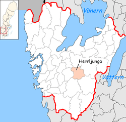
Herrljunga Municipality
| Herrljunga Municipality Herrljunga kommun | ||
|---|---|---|
| Municipality | ||
| ||
 | ||
| Country | Sweden | |
| County | Västra Götaland County | |
| Seat | Herrljunga | |
| Area[1] | ||
| • Total | 509.54 km2 (196.73 sq mi) | |
| • Land | 497.55 km2 (192.11 sq mi) | |
| • Water | 11.99 km2 (4.63 sq mi) | |
| Area as of 1 January 2014. | ||
| Population (31 December 2017)[2] | ||
| • Total | 9,485 | |
| • Density | 19/km2 (48/sq mi) | |
| Time zone | UTC+1 (CET) | |
| • Summer (DST) | UTC+2 (CEST) | |
| ISO 3166 code | SE | |
| Province | Västergötland | |
| Municipal code | 1466 | |
| Website | www.herrljunga.se | |

Herrljunga Municipality (Herrljunga kommun) is a municipality in Västra Götaland County in western Sweden. Its seat is located in the town of Herrljunga.
The local government reform of 1952 formed two municipalities, Herrljunga and Gäsene, in the area. Before that the number was 22. In 1974 they were merged to form the present entity.
Localities
55% of the population live in built-up areas. The largest of them are:
- Annelund
- Fåglavik
- Herrljunga
- Hudene
- Ljung
References
- ↑ "Statistiska centralbyrån, Kommunarealer den 1 januari 2014" (Microsoft Excel) (in Swedish). Statistics Sweden. Retrieved 2014-04-18.
- ↑ "Folkmängd i riket, län och kommuner 31 december 2017" (in Swedish). Statistics Sweden. February 21, 2018. Retrieved February 21, 2018.
External links
- Herrljunga Municipality - Official site
- Herrljunga Cider - In Swedish, English and German
- Herrljunga Cider UK Distributor - In English
This article is issued from
Wikipedia.
The text is licensed under Creative Commons - Attribution - Sharealike.
Additional terms may apply for the media files.