Tanum Municipality
| Tanum Municipality Tanums kommun | ||
|---|---|---|
| Municipality | ||
| ||
 | ||
| Country | Sweden | |
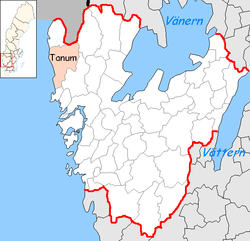
| County | Västra Götaland County | |
| Seat | Tanumshede | |
| Area[1] | ||
| • Total | 2,351.35 km2 (907.86 sq mi) | |
| • Land | 917.24 km2 (354.15 sq mi) | |
| • Water | 1,434.11 km2 (553.71 sq mi) | |
| Area as of 1 January 2014. | ||
| Population (31 December 2017)[2] | ||
| • Total | 12,763 | |
| • Density | 5.4/km2 (14/sq mi) | |
| Time zone | UTC+1 (CET) | |
| • Summer (DST) | UTC+2 (CEST) | |
| ISO 3166 code | SE | |
| Province | Bohuslän | |
| Municipal code | 1435 | |
| Website | www.tanum.se | |

Tanum Municipality (Tanums kommun) is a municipality in Västra Götaland County in western Sweden. Its seat is located in the town of Tanumshede, with 1,600 inhabitants.
The present municipality was formed in 1971 through the amalgamation of three former units. Before the subdivision reform of 1952 there were seven entities in the area.
Etymology
The parish is named after the old farm Tanum (Norse Túnheimr), since the first church was built there. The first element is tún 'country courtyard', the last element is heimr 'homestead, farm'.
Sights

The rock carvings at Tanum have been declared a UNESCO World Heritage Site. The heritage area is located around the seat of Tanumshede, covering an area of 18 km2.
Most carvings show men and ships. Several show animals such as oxen and horses.

Tanum Municipality has made its rock carving the subject of its coat of arms.
The Greby grave field, the largest grave field in Bohuslän, lies near the locality of Grebbestad.
Tanum is one of the first municipalities to require urine-separation toilets to help combat the looming global shortage of phosphorus. Urine is the most concentrated source of phosphorus according to Associate Professor Cynthia Mitchell, of the Institute for Sustainable Futures at the University of Technology, Sydney (UTS).
Towns
References
- ↑ "Statistiska centralbyrån, Kommunarealer den 1 januari 2014" (Microsoft Excel) (in Swedish). Statistics Sweden. Retrieved 2014-04-18.
- ↑ "Folkmängd i riket, län och kommuner 31 december 2017" (in Swedish). Statistics Sweden. February 21, 2018. Retrieved February 21, 2018.
External links
- Tanum Municipality - Official site
- Tanums Hällristningsmuseum Underslös - Underslös Museum and Rock Art Research Centre