Stenungsund Municipality
| Stenungsund Municipality Stenungsunds kommun | ||
|---|---|---|
| Municipality | ||
| ||
 | ||
| Country | Sweden | |
| County | Västra Götaland County | |
| Seat | Stenungsund | |
| Area[1] | ||
| • Total | 301.09 km2 (116.25 sq mi) | |
| • Land | 251.91 km2 (97.26 sq mi) | |
| • Water | 49.18 km2 (18.99 sq mi) | |
| Area as of 1 January 2014. | ||
| Population (31 December 2017)[2] | ||
| • Total | 26,224 | |
| • Density | 87/km2 (230/sq mi) | |
| Time zone | UTC+1 (CET) | |
| • Summer (DST) | UTC+2 (CEST) | |
| ISO 3166 code | SE | |
| Province | Bohuslän | |
| Municipal code | 1415 | |
| Website | www.stenungsund.se | |

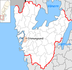
Stenungsund Municipality (Stenungsunds kommun) is a municipality in Västra Götaland County in western Sweden. Its seat is located in the town of Stenungsund. The municipality is situated by the sea inside the islands Orust and Tjörn and traversed by the E6 and Bohus Line, in which it has three stops (Stora Höga, Stenungsund and Svenshögen).
The municipality was formed through amalgamation in 1952. In 1971 a parish from a dissolved municipality was added.
The coat of arms was registered in 1977. The device in the upper half is a hydrocarbon molecule, which alludes to the petrochemical industry in the municipality.
Localities (urban areas)
|
Smaller localities (villages)
|
|
The seat is located right by the European route E6 highway and the railway Bohus Line, Bohusbanan.
In 2006, archaeological excavations in the area revealed a series of burial sites dating between 1 AD and 300 AD.
Notable corporations
- Hogia (Official website), one of Sweden's largest native computer software developers
Since the 1950s, Stenungsund Municipality has become the center for the petrochemical industry. Its distinguished silhouette is four giant chimneys, belonging to a large power plant.
Sports
The following sports clubs are located in Stenungsund Municipality:
- Stenungsunds IF
- Vallens IF
- Stss, Tjörn Runt
- Stenungsund HF
See also
References
- ↑ "Statistiska centralbyrån, Kommunarealer den 1 januari 2014" (Microsoft Excel) (in Swedish). Statistics Sweden. Retrieved 2014-04-18.
- ↑ "Folkmängd i riket, län och kommuner 31 december 2017" (in Swedish). Statistics Sweden. February 21, 2018. Retrieved February 21, 2018.
External links
- Stenungsund Municipality - Official site