Lengerich, Westphalia
| Lengerich | ||
|---|---|---|
| ||
 Lengerich Location of Lengerich within Steinfurt district 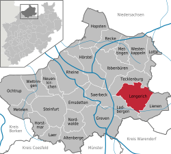 | ||
| Coordinates: 52°10′30″N 7°52′0″E / 52.17500°N 7.86667°ECoordinates: 52°10′30″N 7°52′0″E / 52.17500°N 7.86667°E | ||
| Country | Germany | |
| State | North Rhine-Westphalia | |
| Admin. region | Münster | |
| District | Steinfurt | |
| Government | ||
| • Mayor | Wilhelm Möhrke (none) | |
| Area | ||
| • Total | 90.71 km2 (35.02 sq mi) | |
| Elevation | 80 m (260 ft) | |
| Population (2016-12-31)[1] | ||
| • Total | 22,530 | |
| • Density | 250/km2 (640/sq mi) | |
| Time zone | CET/CEST (UTC+1/+2) | |
| Postal codes | 49525 | |
| Dialling codes |
05481 05482 (Wechte) | |
| Vehicle registration | ST, TE, BF | |
| Website | www.lengerich.de | |
_COA.svg.png)
Lengerich is a town in the district of Steinfurt, in North Rhine-Westphalia, Germany. It is situated on the southern slope of the Teutoburg Forest, approx. 15 km south-west of Osnabrück and 30 km north-east of Münster.
Transportation
Lengerich is situated at the Wanne-Eickel-Hamburg railway and offers hourly connections to Münster and Osnabrück.
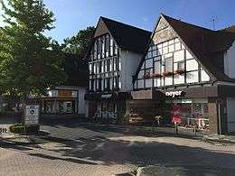
Half-timbered house
Mayors
The mayor is the pharmacist Wilhelm Möhrke (independent), the predecessor was Friedrich Prigge.
International relations
Lengerich, Westphalia is twinned with:
Lengerich's neighboring municipalities, Ladbergen and Lienen, are sister cities in the United States with Wapakoneta's neighbors New Knoxville and Saint Marys, respectively.
Sons and daughters of the town
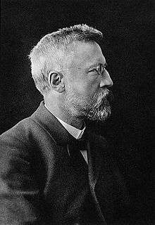
Rudolf Smend
- Rudolf Smend (1851-1913), Theologian (Old Testament)
- Julius Smend (1857-1930), theologian
- Friedrich Kipp (1878-1953), writer
- Wolfgang Streeck (born 1946), sociologist and director at the Max Planck Institute for Society Research in Cologne
- Wolfgang Sidka (born 1954), football professional and coach
References
- ↑ "Amtliche Bevölkerungszahlen" (in German). Landesbetrieb Information und Technik NRW. Retrieved 2018-02-24.
External links
- Official website

Towns and municipalities in Steinfurt (district) | ||
|---|---|---|
This article is issued from
Wikipedia.
The text is licensed under Creative Commons - Attribution - Sharealike.
Additional terms may apply for the media files.