Laer
| Laer | ||
|---|---|---|
| ||
 Laer Location of Laer within Steinfurt district 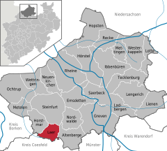  | ||
| Coordinates: 52°03′17″N 7°21′25″E / 52.05472°N 7.35694°ECoordinates: 52°03′17″N 7°21′25″E / 52.05472°N 7.35694°E | ||
| Country | Germany | |
| State | North Rhine-Westphalia | |
| Admin. region | Münster | |
| District | Steinfurt | |
| Government | ||
| • Mayor | Peter Maier[1] (SPD) | |
| Area | ||
| • Total | 35.05 km2 (13.53 sq mi) | |
| Elevation | 77 m (253 ft) | |
| Population (2016-12-31)[2] | ||
| • Total | 6,745 | |
| • Density | 190/km2 (500/sq mi) | |
| Time zone | CET/CEST (UTC+1/+2) | |
| Postal codes | 48366 | |
| Dialling codes | 02554 | |
| Vehicle registration | ST | |
| Website | www.laer.de | |

Laer is a municipality in the district of Steinfurt, in North Rhine-Westphalia, Germany. It is situated approximately 10 kilometres (6.2 mi) south of Steinfurt and 20 kilometres (12 mi) north-west of Münster.
Gallery
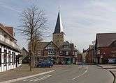 Laer, church (Pfarrkirche Sankt Bartholomäus)
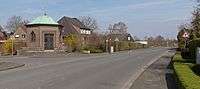 Laer, chapel in the street
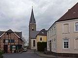 Holthausen, church (Pfarrkirche Sankt Marien)
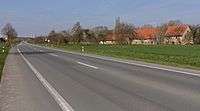 Altenburg, street view from local road
References
This article is issued from
Wikipedia.
The text is licensed under Creative Commons - Attribution - Sharealike.
Additional terms may apply for the media files.