Lebanon, Ohio
| City of Lebanon, Ohio | |
|---|---|
| City | |
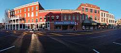 Broadway Street | |
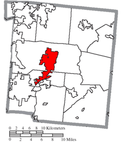
 Location of Lebanon, Ohio | |
 Location of Lebanon in Warren County | |
| Coordinates: 39°25′36″N 84°12′45″W / 39.42667°N 84.21250°WCoordinates: 39°25′36″N 84°12′45″W / 39.42667°N 84.21250°W | |
| Country | United States |
| State | Ohio |
| County | Warren |
| Area[1] | |
| • Total | 12.97 sq mi (33.59 km2) |
| • Land | 12.96 sq mi (33.57 km2) |
| • Water | 0.01 sq mi (0.03 km2) |
| Elevation[2] | 768 ft (234 m) |
| Population (2010)[3] | |
| • Total | 20,033 |
| • Estimate (2012[4]) | 20,387 |
| • Density | 1,545.8/sq mi (596.8/km2) |
| Time zone | UTC-5 (Eastern (EST)) |
| • Summer (DST) | UTC-4 (EDT) |
| ZIP code | 45036 |
| Area code(s) | 513 |
| FIPS code | 39-42364[5] |
| GNIS feature ID | 1042462[2] |
| Website | http://www.ci.lebanon.oh.us |
Lebanon is a city in and the county seat of Warren County, Ohio, United States, in the state's southwestern region,[6] within the Cincinnati metropolitan area. The population was 20,033 at the 2010 census. The city has a symphony orchestra and chorus.
History
Lebanon is in the Symmes Purchase. The first European settler in what is now Lebanon was Ichabod Corwin uncle of Ohio Governor Thomas Corwin who came to Ohio from Bourbon County, Kentucky and settled on the north branch of Turtle Creek in March 1796. The site of his cabin is now on the grounds of Berry Intermediate School on North Broadway and is marked with a monument erected by the Warren County Historical Society.
The town was laid out in September 1802 on land owned by Ichabod Corwin, Silas Hurin, Ephraim Hathaway, and Samuel Manning in Sections 35 and 35 of Town 5, Range 3 North and Sections 5 and 6 of Town 4, Range 3 North of the Between the Miami Rivers Survey. Lebanon was named after the Biblical Lebanon because of the many juniper or Eastern Red cedar trees there, similar to the Lebanon Cedar.[7] It is known today as "The Cedar City".
City legend has it that Lebanon didn't grow as large as Cincinnati or Dayton because of the 'Shaker Curse.' During their migration, the Shakers decided an area outside of town was a suitable place for them to create a homeland for themselves. There was a disagreement with some of the locals and it was said the Shakers placed a curse on the city to hinder the city's prosperity. In reality, the Shakers thrived in the area, and built a settlement about 4 miles west of Lebanon called Union Village.[8] A local man, Malchalm Worley was their first convert. Since the Shakers did not engage in procreation, they relied on converts to increase their numbers. By 1900, there were almost no Shakers left in Ohio.[9]
Geography
According to the United States Census Bureau, the city has a total area of 12.97 square miles (33.59 km2), of which 12.96 square miles (33.57 km2) is land and 0.01 square miles (0.03 km2) is water.[1]
Major highways entering Lebanon
Demographics
| Historical population | |||
|---|---|---|---|
| Census | Pop. | %± | |
| 1820 | 1,079 | — | |
| 1830 | 1,165 | 8.0% | |
| 1840 | 1,528 | 31.2% | |
| 1850 | 2,088 | 36.6% | |
| 1860 | 2,559 | 22.6% | |
| 1870 | 2,749 | 7.4% | |
| 1880 | 2,703 | −1.7% | |
| 1890 | 3,050 | 12.8% | |
| 1900 | 2,867 | −6.0% | |
| 1910 | 2,698 | −5.9% | |
| 1920 | 3,396 | 25.9% | |
| 1930 | 3,222 | −5.1% | |
| 1940 | 3,896 | 20.9% | |
| 1950 | 4,818 | 23.7% | |
| 1960 | 5,993 | 24.4% | |
| 1970 | 7,934 | 32.4% | |
| 1980 | 9,620 | 21.3% | |
| 1990 | 10,453 | 8.7% | |
| 2000 | 16,962 | 62.3% | |
| 2010 | 20,033 | 18.1% | |
| Est. 2017 | 20,622 | [10] | 2.9% |
| Sources:[5][11][12][13][14][15][16][17] | |||
2010 census
As of the census[3] of 2010, there were 20,033 people, 7,436 households, and 5,213 families residing in the city. The population density was 1,545.8 inhabitants per square mile (596.8/km2). There were 7,920 housing units at an average density of 611.1 per square mile (235.9/km2). The racial makeup of the city was 92.7% White, 2.6% African American, 0.2% Native American, 0.8% Asian, 1.6% from other races, and 2.0% from two or more races. Hispanic or Latino of any race were 3.5% of the population.
There were 7,436 households of which 41.2% had children under the age of 18 living with them, 51.3% were married couples living together, 13.5% had a female householder with no husband present, 5.3% had a male householder with no wife present, and 29.9% were non-families. 24.4% of all households were made up of individuals and 7.9% had someone living alone who was 65 years of age or older. The average household size was 2.62 and the average family size was 3.12.
The median age in the city was 34.7 years. 29.2% of residents were under the age of 18; 7.3% were between the ages of 18 and 24; 29.5% were from 25 to 44; 23.9% were from 45 to 64; and 10.1% were 65 years of age or older. The gender makeup of the city was 49.0% male and 51.0% female.
2000 census
As of the census[5] of 2000, there were 16,962 people residing in the city. The population density was 1,440.6 people per square mile (556.4/km²). There were 6,218 housing units at an average density of 528.1 per square mile (204.0/km²). The racial makeup of the city was 90.98% White, 6.36% African American, 0.32% Native American, 0.64% Asian, 0.02% Pacific Islander, 0.37% from other races, and 1.31% from two or more races. Hispanic or Latino of any race were 1.13% of the population.
There were 5,887 households out of which 40.7% had children under the age of 18 living with them, 54.8% were married couples living together, 12.9% had a female householder with no husband present, and 28.5% were non-families. 24.3% of all households were made up of individuals and 8.6% had someone living alone who was 65 years of age or older. The average household size was 2.58 and the average family size was 3.08.
In the city, the population was spread out with 27.2% under the age of 18, 10.3% from 18 to 24, 36.8% from 25 to 44, 16.8% from 45 to 64, and 8.9% who were 65 years of age or older. The median age was 32 years. For every 100 females, there were 110.1 males. For every 100 females age 18 and over, there were 114.1 males.
The median income for a household in the city was $46,856, and the median income for a family was $52,578. Males had a median income of $40,361 versus $27,551 for females. The per capita income for the city was $20,897. About 4.7% of families and 6.4% of the population were below the poverty line, including 6.6% of those under age 18 and 6.3% of those age 65 or over.
Services
Lebanon lies largely within the Lebanon telephone exchange, but parts are in the Mason and South Lebanon exchanges. Local and long distance telephone services for the city are primarily provided by CenturyLink (formerly Embarq, Sprint's local telephone division) and Cincinnati Bell.
The city is one of the few in the nation to once operate a government-run cable television and telephone service, as well as being a fiber-to-the-neighborhood Internet service provider. Controversial since it began operation in 1999, the Lebanon telecommunications system had struggled to recover its expenses and had accumulated over $8 million in debt. However, residents in the area, at the time, paid up to 50% less for the aforementioned services than neighboring communities, therefore saving over $40 million of the residents' money. In the 2006 general election, however, voters approved the sale of this city-run telecommunications system to Cincinnati Bell.
Prisons operated by the Ohio Department of Corrections in the area include:
Education
Lebanon City Schools operates public schools:
- Bowman Primary School (K-2)
- Donovan Elementary School (3-4)
- Berry Intermediate School (5-6) (Temporarily moved into the Old Junior High School on Miller Road)
- Lebanon Junior High School (7-8)
- Lebanon High School (9-12)
The city is served by a lending library, the Lebanon Public Library.[18]
Media
- Today's Pulse (based in Liberty Township, Butler County)
Television
Landmarks and attractions

The Golden Lamb Inn
The Golden Lamb Inn is located in Lebanon on the corner of S. Broadway and Main St. It is recognized as Ohio's oldest inn, having been established in 1803 and has been visited by 12 presidents.[19]
Warren County Historical Society and Harmon Museum of Art and History
The Warren County Historical Museum is recognized as one of the nation's most outstanding county museums. It includes the Harmon Museum, housed in Harmon Hall, a three-story, 28,000-square-foot building with displays and exhibits of art and artifacts from prehistoric eras to the mid-20th century.[20]
Glendower Historic Mansion
The Glendower Historic Mansion, owned by the Warren County Historical Society, was erected circa 1845. It provides a classic example of residential Greek Revival architecture and a natural setting for many elegant Empire and Victorian furnishings from Warren County's past.
Lebanon Mason Monroe Railroad
Lebanon is home to the Lebanon Mason Monroe Railroad, where passengers follow an old stage coach route passing meadow, pasture, a rippling creek and wildflowers along the way.[21]
Countryside YMCA
The largest YMCA in the U.S.[22] consists of: four basketball gyms, two weight rooms, five indoor pools, one outdoor pool, tennis courts, baseball fields, racquetball courts, preschool and daycare, gymnastics center, outdoor soccer fields, five aerobics rooms, senior citizen center, two waterparks (one inside, one outside), sports medicine center, rock climbing wall, two indoor tracks, outdoor track, acres of forest and trails, pond, outdoor playground, locker rooms, outdoor volleyball, and flag football fields.
Harmon Golf Club
Harmon Golf Club is a nine-hole, par 36 public golf course located on South East Street. It was built in 1912.
Events
- Lebanon Blues Festival
- Warren County Fair
- Country Applefest
- Horse Drawn Carriage Parade and Christmas Festival
- Third Friday block party on Mulberry Street
In popular culture
The 1978 movie Harper Valley PTA with Barbara Eden and the 1994 movie Milk Money with Ed Harris and Melanie Griffith were both shot in Lebanon. The Village Ice Cream Parlor contains memorabilia from both movies.
In October 2013, a Hallmark Channel movie titled The Christmas Spirit was filmed in Lebanon.[23] In 2014, the movie Carol, starring Cate Blanchett was partially filmed in Lebanon.[24]
Notable people
- Neil Armstrong, first man to walk on the moon; made his home in Lebanon for 23 years after the moon landing
- Amos Booth, baseball player for Cincinnati Red Stockings 1876-77
- John Chivington, officer in American Civil War and Sand Creek Massacre
- Clay Clement, actor of 1930s films
- Thomas Corwin, Governor of Ohio from 1840 to 1842; U.S. Senator from 1845 to 1850
- Charles Cretors, invented the first popcorn machine in 1885
- Greg Demos, bass player for Guided by Voices
- George E. Gard, police chief of Los Angeles in 19th Century
- Woody Harrelson (moved from Texas at age 12),[25] film and TV actor, Emmy Award winner and three-time Academy Awards nominee
- Maldwyn Jones motorcycle racer who dominating half-mile dirt track racing during the second decade of the 20th century. Inducted in the American Motorcyclist Association Hall of Fame in 1998.
- Bruce Edwards Ivins, government scientist who committed suicide while under investigation for 2001 anthrax attacks
- Jill Jones, singer, songwriter, and actress
- Michael Larson, famous game show contestant on Press Your Luck in 1984
- Andrew McBurney, Lieutenant Governor of Ohio, 1866–1868
- John McLean, Associate Justice of the U.S. Supreme Court from 1829 to 1861
- Ormsby M. Mitchel, West Point grad, astronomer, surveyor, general from 1812-1825
- Marcus Mote, early Ohio artist
- Corwin M. Nixon, state representative 1962-1992, minority leader 1979-1992
- Gordon Ray Roberts, U.S. Army Medal of Honor recipient
- Marty Roe, lead singer of the band Diamond Rio
- Dean Roll, pro wrestler known as Shark Boy or Dean Baldwin
- Larry Sparks, bluegrass singer and guitarist
- Russel Wright, industrial designer and artist; responsible for wide acceptance of Modernism in America
- Casey Shaw, Joseph Casey Shaw (born July 20, 1975) is an American former basketball player who played as a center. After a collegiate career at the University of Toledo, he was drafted 37th overall by the Philadelphia 76ersin the 1998 NBA Draft.
- Scooter Gennett, is an MLB player for the Cincinnati Reds. He became the 17th player in history to hit 4 HRs in one game on June 6, 2017 vs the St. Louis Cardinals.
- Jeff Stacy, famous from To Catch a Predator.
See also
References
- 1 2 "US Gazetteer files 2010". United States Census Bureau. Archived from the original on 2012-07-14. Retrieved 2013-01-06.
- 1 2 "US Board on Geographic Names". United States Geological Survey. 2007-10-25. Retrieved 2008-01-31.
- 1 2 "American FactFinder". United States Census Bureau. Retrieved 2013-01-06.
- ↑ "Population Estimates". United States Census Bureau. Archived from the original on 2013-06-17. Retrieved 2013-06-17.
- 1 2 3 "American FactFinder". United States Census Bureau. Retrieved 2008-01-31.
- ↑ "Find a County". National Association of Counties. Retrieved 2011-06-07.
- ↑ Gannett, Henry (1905). The Origin of Certain Place Names in the United States. U.S. Government Printing Office. p. 183.
- ↑ http://www.historiclebanonohio.com/?q=book/export/html/43
- ↑ http://www.ohiohistorycentral.org/w/Shakers?rec=630
- ↑ "Population and Housing Unit Estimates". Retrieved May 26, 2018.
- ↑ "Population of Civil Divisions Less than Counties" (PDF). Statistics of the Population of the United States at the Tenth Census. U.S. Census Bureau. Retrieved 28 November 2013.
- ↑ "Population of Civil Divisions Less than Counties" (PDF). Statistics of the Population of the United States at the Tenth Census. U.S. Census Bureau. Retrieved 28 November 2013.
- ↑ "Population: Ohio" (PDF). 1910 U.S. Census. U.S. Census Bureau. Retrieved 28 November 2013.
- ↑ "Population: Ohio" (PDF). 1930 US Census. U.S. Census Bureau. Retrieved 28 November 2013.
- ↑ "Number of Inhabitants: Ohio" (PDF). 18th Census of the United States. U.S. Census Bureau. Retrieved 22 November 2013.
- ↑ "Ohio: Population and Housing Unit Counts" (PDF). U.S. Census Bureau. Retrieved 22 November 2013.
- ↑ "Incorporated Places and Minor Civil Divisions Datasets: Subcounty Population Estimates: April 1, 2010 to July 1, 2012". U.S. Census Bureau. Archived from the original on 17 June 2013. Retrieved 25 November 2013.
- ↑ "Homepage". Lebanon Public Library. Retrieved 3 March 2018.
- ↑ "Homepage". The Golden Lamb. Archived from the original on 21 November 2014. Retrieved 19 June 2014.
- ↑ http://www.wchsmuseum.org/
- ↑ http://www.lebanonrr.com/
- ↑ http://www.countrysideymca.org/about-us/
- ↑ http://www.wcpo.com/news/local-news/hallmark-channel-the-christmas-spirit-television-movie-being-filmed-in-lebanon Archived 2013-10-05 at the Wayback Machine., Scott Wegener, "Hallmark Channel 'The Christmas Spirit' television movie being filmed in Lebanon", WCPO.com, 2013-Oct-14, Retrieved 2013-Oct-14
- ↑ http://www.daytondailynews.com/news/news/blanchett-to-film-in-lebanon/nd6tc, Lawrence Budd, daytondailynews.com, 2014-Mar-06, Retrieved 2015-Jun-10
- ↑ http://nl.newsbank.com/nl-search/we/Archives?p_action=doc&p_docid=0F504F41A7D42079&p_docnum=1
Further reading
- Elva R. Adams. Warren County Revisited. [Lebanon, Ohio]: Warren County Historical Society, 1989.
- The Centennial Atlas of Warren County, Ohio. Lebanon, Ohio: The Centennial Atlas Association, 1903.
- John W. Hauck. Narrow Gauge in Ohio. Boulder, Colorado: Pruett Publishing, 1986. ISBN 0-87108-629-8
- Josiah Morrow. The History of Warren County, Ohio. Chicago: W.H. Beers, 1883. (Reprinted several times)
- Ohio Atlas & Gazetteer. 6th ed. Yarmouth, Maine: DeLorme, 2001. ISBN 0-89933-281-1
- William E. Smith. History of Southwestern Ohio: The Miami Valleys. New York: Lewis Historical Publishing, 1964. 3 vols.
- Warren County Engineer's Office. Official Highway Map 2003. Lebanon, Ohio: The Office, 2003.
External links
| Wikivoyage has a travel guide for Lebanon, Ohio. |
- Official site
- Historic Downtown Lebanon Ohio Attractions
- Lebanon Area Chamber of Commerce
- Lebanon City Schools
- Lebanon Mason Monroe Railroad
- Shaker Collection From the Rare Book and Special Collection Division at the Library of Congress

Municipalities and communities of Warren County, Ohio, United States | ||
|---|---|---|
| Cities | 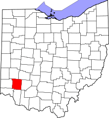 | |
| Villages | ||
| Townships | ||
| CDPs | ||
| Unincorporated communities |
| |
| Ghost towns | ||
| Footnotes | ‡This populated place also has portions in an adjacent county or counties | |