Laurentide Ice Sheet
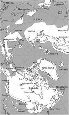
The Laurentide Ice Sheet was a massive sheet of ice that covered millions of square kilometers, including most of Canada and a large portion of the northern United States, multiple times during the Quaternary glacial epochs— from 2.588 ± 0.005 million years ago to the present.[1] The last advance covered most of northern North America between c. 95,000 and c. 20,000 years before the present day, and among other geomorphological effects, gouged out the five Great Lakes and the hosts of smaller lakes of the Canadian shield. These lakes extend from the eastern Northwest Territories, through most of northern Canada, and the upper Midwestern United States (Minnesota, Wisconsin, and Michigan) to the Finger Lakes, through Lake Champlain and Lake George areas of New York, across the northern Appalachians into and through all of New England and Nova Scotia. At times, the ice sheet's southern margin included the present-day sites of northeastern coastal towns and cities such as Portsmouth, New Hampshire, Boston, and New York City, and Great Lakes coastal cities and towns as far south as Chicago and St. Louis, Missouri—and then followed quite precisely the present course of the Missouri River up to the northern slopes of the Cypress Hills, beyond which it merged with the Cordilleran Ice Sheet. The ice coverage extended approximately as far south as 38 degrees latitude in the mid-continent.[2]
Description
This ice sheet was the primary feature of the Pleistocene epoch in North America, commonly referred to as the ice age. It was up to 2 mi (3.2 km) thick in Nunavik, Quebec, Canada but much thinner at its edges where nunataks were common in hilly areas. It created much of the surface geology of southern Canada and the northern United States, leaving behind glacially scoured valleys, moraines, eskers and glacial till. It also caused many changes to the shape, size, and drainage of the Great Lakes. As but one of many examples, near the end of the last ice age, Lake Iroquois extended well beyond the boundaries of present-day Lake Ontario, and drained down the Hudson River into the Atlantic Ocean.[3]
Its cycles of growth and melting were a decisive influence on global climate during its existence. This is because it served to divert the jet stream which would otherwise flow from the relatively warm Pacific Ocean through Montana and Minnesota to the south. This gave the southwestern United States, otherwise a desert, abundant rainfall during ice ages — in extreme contrast to most other parts of the world which became exceedingly dry, though the effect of ice sheets in Europe had an analogous effect on the rainfall in Afghanistan, parts of Iran, possibly western Pakistan in winter, as well as North Africa.

Its melting also caused major disruptions to the global climate cycle, because the huge influx of low-salinity water into the Arctic Ocean via the Mackenzie River[4] is believed to have disrupted the formation of North Atlantic Deep Water, the very saline, cold, deep water that flows from the Greenland Sea. This interrupted the thermohaline circulation, creating the brief Younger Dryas cold epoch and a temporary re-advance of the ice sheet,[5] which did not retreat from Nunavik until 6,500 years ago.
Some people have argued that huge influxes of fresh water stopped the feeding of the ice sheet and starved it, aiding the retreat that had already begun. This is a controversial position because it is known that the North Atlantic was very cold throughout glacial periods and it is likely that the anticyclone on top of the ice sheet helped sustain it through moist easterly winds which encouraged snow-bearing winds from the south.
During the Pre-Illinoian Stage the Laurentide Ice Sheet extended even farther south, advancing as far as the Missouri and Ohio River valleys.
The ultimate collapse of the Laurentide Ice Sheet is also suspected to have influenced European agriculture indirectly through the rise of global sea levels.
Canada's oldest ice is a 20,000-year-old remnant of the Laurentide Ice Sheet called the Barnes Ice Cap, located on central Baffin Island.
Ice Centers
During the Late Pleistocene, the Laurentide ice sheet reached from the Rocky Mountains eastward through the Great Lakes, into New England, covering nearly all of Canada east of the Rocky Mountains.[6] Three major ice centers formed in North America: the Labrador, Keewatin, and Cordilleran. The Cordilleran covered the region from the Pacific Ocean to the eastern front of the Rocky Mountains and the Labrador and Keewatin fields are referred to as the Laurentide Ice Sheet. Central North America has evidence of the numerous lobes and sublobes. The Keewatin ice covered the western interior plains of North America from the Mackenzie River to the Missouri River and the upper reaches of the Mississippi River. The Labrador ice covered spread over eastern Canada and the northeastern part of the United States abutting the Keewatin lobe in the western Great Lakes and Mississippi valley.[6]
Cordilleran Ice Flow
Cordilleran Ice Sheet covered up to 2,500,000 square kilometres (970,000 sq mi) at the Last Glacial Maximum. The eastern edge abutted the Laurentide ice sheet. The sheet was anchored in the Coast Mountains of British Columbia and Alberta, south into the Cascade Range of Washington. This is one and a half times the water held in the Antarctic. Anchored in the mountain backbone of the west coast, the ice sheet dissipated north of the Alaska Range where the air was too dry to form glaciers.[6] It is believed that the Cordilleran ice melted rapidly, in less than four thousand years. The water created numerous Proglacial lake along the margins; i.e., Lake Missoula, often leading to catastrophic floods as with the Missoula Floods. Much of the topography of Eastern Washington and northern Montana and North Dakota was affected.[6]
Keewatin Ice Flow
Keewatin Ice flow has had four or five primary lobes identified ice divides extending from a dome over west-central Keewatin. Two of the lobes abut the adjacent Labrador and Baffin ice sheets. The primary lobes flow (1) towards Manitoba and Saskatchewan; (2) toward Hudson Bay; (3) towards the Gulf of Boothia, and (4) towards the Beaufort Sea.[7]
Labrador Ice Flow
Ice flowed across all of Maine and into the Gulf of St. Lawrence, completely covering the Maritime Provinces. The Appalachian Ice Complex, flowed from the Gaspé Peninsula over New Brunswick, the Magdalen Shelf, and Nova Scotia.[7] The Labrador flow extended across the mouth of the St. Lawrence River, reaching the Gaspé Peninsula and across Chaleur Bay. From the Escuminac center on the Magdalen Shelf, flowed onto the Acadian Peninsula of New Brunswick and southeastward, onto the Gaspe, burying the western end of Prince Edward Island and reached the head of Bay of Fundy. From the Gaspereau center, on the divide crossing New Brunswick flowed into the Bay of Fundy and Chaleur Bay.[7]
Baffin Ice Flow
The Baffin Ice Flow was circular and centered over the Foxe Basin. A major divide across the basin, created a westward flow across the Melville Peninsula, from an eastward flow over Baffin Island and Southampton Island. Across southern Baffin Island, two divides created four additional lobes. The Penny Ice Divide split the Cumberland Peninsula, where Pangnirtung created flow toward Home Bay on the north and Cumberland Sound on the south. The Amadjuak Ice Divide on the Hall Peninsula, where Iqaluit sits created a north flow into Cumberland Sound and a south flow into the Hudson Strait. A secondary Hall Ice Divide formed a link to a local ice cap on the Hall Peninsula. The current ice caps on the Baffin Island is thought to be a remnant from this time period, although it was not a part of the Baffin Ice Flow, but an autonomous flow.[7]
See also
References
- ↑ Cohen, K.M.; Finney, S.C.; Gibbard, P.L.; Fan, J.-X. "International Chronostratigraphic Chart 2013" (PDF). http://www.stratigraphy.org/icschart/chronostratchart2013-01.pdf. ICS. Retrieved 15 June 2014. External link in
|website=(help) - ↑ Dyke, A.S.; Prest, V.K. (1987). "Late Wisconsinan and Holocene History of the Laurentide Ice Sheet". Géographie physique et Quaternaire. 41 (2): 237–263.
- ↑ Flint, R.F. 1971. Glacial and Quaternary Geology. Wiley and Sons, NY. 892 p.
- ↑ Murton, J.B.; Bateman, M.D.; Dallimore, S.R; Teller, J.T.; Yang, Z. (2010). "Identification of Younger Dryas outburst flood path from Lake Agassiz to the Arctic Ocean". Nature. 464 (7289): 740–743. Bibcode:2010Natur.464..740M. doi:10.1038/nature08954. PMID 20360738.
- ↑ Broecker, W.S.; Denton, G.H. (1989). "The role of ocean-atmosphere reorganizations in glacial cycles". Geochimica et Cosmochimica Acta. 53 (10): 2465–2501. Bibcode:1989GeCoA..53.2465B. doi:10.1016/0016-7037(89)90123-3.
- 1 2 3 4 Geologic Framework and Glaciation of the Central Area, 1-1-2006; Christopher L. Hill; Boise State University, Boise, Idaho; 2006
- 1 2 3 4 Late Wisconsinan and Holocene History of the Laurentide Ice Sheet, 10.7202/032681ar; Arthur S. Dyke, Victor K. Prest; Geological Survey of Canada; Ottawa, Ontario; 1987; http://id.erudit.org/iderudit/032681ar
Further reading
- "Noah's Flood Kick-started European Farming?". University of Exeter. Retrieved 2007-11-20.
External links
- The Retreat of Glaciers in North America (MPEG-Video)