Landen
| Landen | |||
|---|---|---|---|
| Municipality | |||
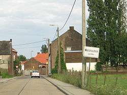 Walshoutem | |||
| |||
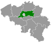
 Landen Location in Belgium
 | |||
| Coordinates: 50°45′N 05°05′E / 50.750°N 5.083°ECoordinates: 50°45′N 05°05′E / 50.750°N 5.083°E | |||
| Country | Belgium | ||
| Community | Flemish Community | ||
| Region | Flemish Region | ||
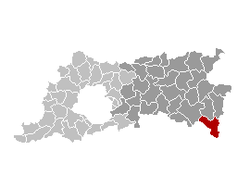
| Province | Flemish Brabant | ||
| Arrondissement | Leuven | ||
| Government | |||
| • Mayor | Chris Colsoul (CD&V) | ||
| • Governing party/ies | CD&V & SP.A | ||
| Area | |||
| • Total | 54.05 km2 (20.87 sq mi) | ||
| Population (1 January 2017)[1] | |||
| • Total | 15,919 | ||
| • Density | 290/km2 (760/sq mi) | ||
| Postal codes | 3400 | ||
| Area codes | 011 - 016 - 019 | ||
| Website | www.landen.be | ||


Landen (Dutch pronunciation: [ˈlɑndə(n)]) is a municipality located in the Belgian province of Flemish Brabant. The municipality comprises the city of Landen proper and the towns of Attenhoven, Eliksem, Ezemaal, Laar, Neerlanden, Neerwinden, Overwinden, Rumsdorp, Waasmont, Walsbets, Walshoutem, Wange and Wezeren. On January 1, 2006, Landen had a total population of 14,682. The total area is 54.05 km² which gives a population density of 272 inhabitants per km².
History
Landen is the birthplace of Pippin of Landen.
On the territory of the municipality two great battles were fought. The first was fought in 1693 during the Nine Years' War between the Anglo-Allied army under William III of England and the French under the Duke of Luxemburg, ending in a French victory. The second battle took place in 1793 during the French Revolutionary Wars between the Austrians under Prince Josias of Coburg and the French under General Dumouriez and ended in an Austrian victory (this second battle is usually called the Battle of Neerwinden).
Transport
The town is served by Landen railway station.
References
- ↑ Population per municipality as of 1 January 2017 (XLS; 397 KB)
External links

- (in Dutch) Official website
Places adjacent to Landen | |
|---|---|