Lampeter Velfrey
Lampeter Velfrey
| |
|---|---|
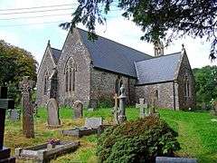 Parish Church of St Peter | |
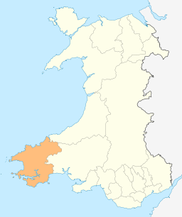
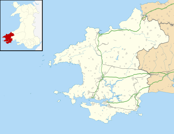 Lampeter Velfrey Lampeter Velfrey shown within Pembrokeshire | |
| Population | 1,172 |
| OS grid reference | SN11SE08 |
| • Cardiff | 68.0 mi (109.4 km) |
| • London | 196.0 mi (315.4 km) |
| Community |
|
| Principal area | |
| Country | Wales |
| Sovereign state | United Kingdom |
| Post town | Arberth |
| Postcode district | SA67 |
| Dialling code | 01834 |
| Police | Dyfed-Powys |
| Fire | Mid and West Wales |
| Ambulance | Welsh |
| EU Parliament | Wales |
| UK Parliament | |
| Welsh Assembly | |
Lampeter Velfrey (Welsh: Llanbedr Felfre) is a community and parish[1] in the county of Pembrokeshire, Wales, and is 68.0 miles (109.4 km) from Cardiff and 196.0 miles (315.4 km) from London.[2][3] In 2011 the population of Lampeter Velfrey was 1,172 with 20.2 per cent of them able to speak Welsh.[4]
The old Medieval spelling was "Velfre"[5]
Governance
An electoral ward of the same name exists. This ward stretches beyond the confines of Lampeter Velfrey with a total population of 1,598.[6]
History
The parish was in the former Narberth Hundred, and in the 1830s had a population of 984. Limestone was quarried locally for building and for lime. There was a parochial school in the 1800s. Local historian Geoffrey Morris was rector of Lampeter Velfrey parish until 2008 and wrote a history of the village in 2007.[7] Archives Wales holds a number of historical papers on the village and its former inhabitants.[8]
Worship
The parish church (Church in Wales) of St Peter is a Grade II-listed building, recorded by Cadw in 1971, and was first mentioned in records in 1291.[9] The present church, which may have replaced earlier chapelries, dates from the 13th and 14th centuries and was restored in the 19th and 20th centuries. The bell is dated 1639 and the early Henry Jones organ 1853.[10][11]
There are two Independent chapels in the village: Bryn Sion (established 1859) and Carfan (established 1804).[7]
References
- ↑ "GENUKI: Lampeter Velfrey pre-1850 parish map 122". Retrieved 24 September 2018.
- ↑ Felfre Bangor University Placenames Unit (Canolfan Bedwyr); accessed 9 May 2014
- ↑ Google Maps (Map). Google.
|access-date=requires|url=(help) - ↑ Welsh Government website; 2011 Census Returns and stats; accessed 9 May 2014
- ↑ " Google Books website; An Inventory of the Ancient Monuments of Wales; accessed 9 May 2014
- ↑ "Ward population 2011". Retrieved 19 April 2015.
- 1 2 "GENUKI: Lampeter Velfrey". Retrieved 24 September 2018.
- ↑ "Archives Wales: Lampeter Velfrey". Retrieved 24 September 2018.
- ↑ "Coflein: St Peter's Church, Lampeter Velfry". Retrieved 24 September 2018.
- ↑ "Parish of Lampeter Velfrey: St Peter". Retrieved 24 September 2018.
- ↑ "British Listed Buildings: Church of St. Peter". Retrieved 24 September 2018.
See also
External links
| Wikimedia Commons has media related to Lampeter Velfrey (community). |
| Wikimedia Commons has media related to Lampeter Velfrey. |
- Community Council website
- Historical information and further links on GENUKI
- Dyfed Family History Society: Information on Lampeter Velfrey churches, chapels and schools