Clydau
| Clydau | |
|---|---|
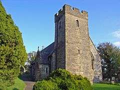 Clydau parish church | |
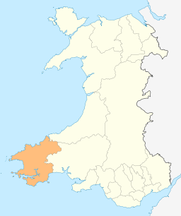
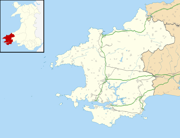 Clydau Clydau shown within Pembrokeshire | |
| Population | 715 (2011)[1] |
| Principal area | |
| Country | Wales |
| Sovereign state | United Kingdom |
| Post town | Llanfyrnach |
| Postcode district | SA35 0 |
| Dialling code | 01239 |
| Police | Dyfed-Powys |
| Fire | Mid and West Wales |
| Ambulance | Welsh |
| EU Parliament | Wales |
| UK Parliament | |
| Welsh Assembly | |
Clydau (sometimes Clydaï or Clydey) is a community and parish[2] in Pembrokeshire, Wales.
Name
The meaning of the Welsh placename is uncertain, although the church is now dedicated to Ste. Clydaï, an alleged daughter of Brychan.[3]
History
During the early Middle Ages, the present town was the site of Llangeneu ('St Ceneus'),[4] which was accounted one of the seven principal sees of Dyfed despite having no endowment of land.[5]
Settlement
The settlement consists of a small group of properties around the parish church, 5 miles (8.0 km) southwest of Newcastle Emlyn and 8 miles (13 km) southeast of Cardigan.
Community
Although the settlement of Clydau is tiny, the community is large, encompassing several other settlements and/or parishes including Bwlchygroes, Star, Tegryn, and a large number of scattered farms.[6] Clydau has its own elected community council and gives its name to an electoral ward of Pembrokeshire County Council. The electoral ward of Clydau covers the communities of Clydau and Boncath. In 2001 it had a population (2001) of 1,425, with 58% Welsh speakers, falling to 715 in 2011.[1]
Parish
The Afon Cneifa, a tributary of Afon Cych, divides the parish into two ancient divisions: Uwchlawrllan to the southeast and Islawrllan to the northwest. The population of the parish was 1,100 (1801), 1,457 (1851), 1,057 (1901), 829 (1951), 681 (2001), 715 (2011). The percentage of Welsh speakers was: 99 (1891), 97 (1931) and 91 (1971).
The 14th century Grade II-listed parish church is dedicated to Ste. Clydaï.[7]
References
- 1 2 "Community population 2011". Retrieved 17 April 2015.
- ↑ "GENUKI: Clydey". Retrieved 27 November 2017.
- ↑ Charles, B. G., The Placenames of Pembrokeshire, National Library of Wales, Aberystwyth, 1992, ISBN 0-907158-58-7, p 678
- ↑ James, Heather. "The Geography of the Cult of St Davids" in St David of Wales: Cult, Church and Nation, p. 59. Boydell Press, 2007. Accessed 26 Mar 2013.
- ↑ Wade-Evans, Arthur. Welsh Medieval Law, p. 263.
- ↑ "GENUKI: 1850 Parish map". Retrieved 27 November 2017.
- ↑ "British Listed Buildings: Church of Saint Clydai, Clydau". Retrieved 18 September 2016.