Manorbier
Manorbier
| |
|---|---|
%2C_Manorbier_-_geograph.org.uk_-_928809.jpg) The Village Street | |
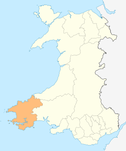
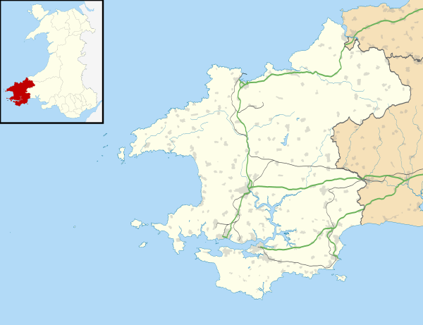 Manorbier Manorbier shown within Pembrokeshire | |
| Population | 1,327 (2011)[1] |
| Community |
|
| Principal area | |
| Ceremonial county | |
| Country | Wales |
| Sovereign state | United Kingdom |
| Post town | TENBY |
| Postcode district | SA70 |
| Dialling code | 01834 |
| Police | Dyfed-Powys |
| Fire | Mid and West Wales |
| Ambulance | Welsh |
| EU Parliament | Wales |
| UK Parliament | |
| Welsh Assembly | |
Manorbier (/ˌmænərˈbɪər/; Welsh: Maenorbŷr [mɑɨnɔrˈbɨːr]) is a village, community and parish on the south coast of Pembrokeshire, Wales. An electoral ward with the same name exists. This ward stretches inland to St Florence and had a total population at the 2011 Census of 2,083.[2]. Manorbier is twinned with Vernou-la-Celle-sur-Seine, France.
The name means the 'Manor of Pŷr'. The village is served by Manorbier railway station on the West Wales Line.
History
Fossils can be found along the stream bed, although some are of poor quality, and along the cliffs to the side of the beach the rock formations are revealed as vertical beds. The evidence of early human habitation consists of many flint microliths, housed in museums around the area, from the Mesolithic and Neolithic ages. The King's Quoit cromlech is the most notable monument in the local area and is to be found to the south east of Manorbier bay and beach.
Later evidence points to occupation of The Dak with the finding of a perforated mace head as well as Bronze age burial mounds on the Ridgeway. Fortifications also seem to have been prominent including an Iron Age enclosure near Manorbier station and the site of a multivallate, meaning multiple ditches, promontory fort at Old Castle Head where there are remains of hut platforms within the ditches. A well-restored lime kiln is in Mud Lane behind the castle. To the east of Manorbier, on the side of the road to Lydstep, is an area of strip lynchets dating to early Anglo Saxon times and perhaps as early as the Bronze Age.
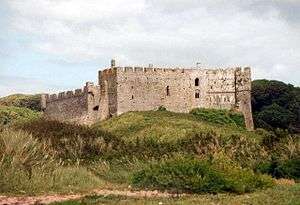
The Norman knight Odo de Barri was granted the lands of Manorbier, Penally and Begelly in gratitude for his military help in conquering Pembrokeshire after 1103. The first Manorbier Castle was motte and bailey style, with the stone walls being added in the next century by later Normans. Giraldus Cambrensis, son of William de Barri, was born in the village in 1146, and called it "the pleasantest place in Wales".[3]
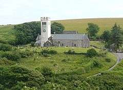
St James's parish church dates from the 12th century and is a Grade I listed building.[4] A large number of other buildings and structures in the parish are listed.[5]
There was a World War II Royal Air Force airfield, RAF Manorbier, which was operational from 1933 to 1 September 1946.[6]
Railway
Manorbier railway station on the Pembroke Dock branch of the West Wales Line is operated by Transport for Wales Rail, who also manage the station. Trains stop here on request every two hours in each direction, westwards to Pembroke Dock and eastwards to Tenby, Whitland, Carmarthen and Swansea.
Tourism
Manorbier is within the Pembrokeshire Coast National Park and is a popular tourist attraction with Manorbier Castle, St James's Church, the sandy beach, cliffs, and part of the Wales Coast Path.

References
- ↑ "Community population 2011". Retrieved 20 April 2011.
- ↑ "Ward population 2011". Retrieved 20 April 2015.
- ↑ Manorbier Castle
- ↑ "British Listed Buildings: St James' Church, Manorbier". Retrieved 28 March 2016.
- ↑ "British Listed Buildings: Listed Buildings in Manorbier, Pembrokeshire, Wales". Retrieved 26 September 2017.
- ↑ "Manorbier". Airfields of Britain Conservation Trust. Retrieved 26 September 2017.
External links
| Wikimedia Commons has media related to Manorbier. |

- Map sources for Manorbier
- Photos of Manorbier and surrounding area on geograph.org.uk
- Historical information and sources on GENUKI