Kartsakhi Lake
| Kartsakhi Lake Georgian: კარწახის ტბა Turkish: Aktaş Gölü | |
|---|---|
 View of the lake from the Georgian side | |
 Kartsakhi Lake  Kartsakhi Lake | |
| Coordinates | 41°12′54″N 43°13′16″E / 41.21500°N 43.22111°ECoordinates: 41°12′54″N 43°13′16″E / 41.21500°N 43.22111°E |
| Catchment area | 158 km2 (61 sq mi) |
| Basin countries | Georgia, Turkey |
| Surface area | 26.3 km2 (10.2 sq mi) |
| Max. depth | 1 m (3 ft 3 in) |
| Water volume | 19.3 km3 (4.6 cu mi) |
| Salinity | 880 ‰ |
| Surface elevation | 1,800 m (5,900 ft) |
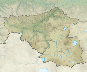
Kartsakhi Lake (Georgian: კარწახის ტბა, karts'akhis tba), or Lake Khozapini (Georgian: ხოზაფინის ტბა, khozap'inis tba; Turkish: Hazapin Gölü), or Lake Aktaş (Turkish: Aktaş Gölü), is a soda lake in the Caucasus Mountains. It sits on the international border between Georgia (53%) and Turkey (47%).
It is the second largest lake in Georgia, covering an area of 26.3 or 26.6 square kilometres at an altitude of 1799 m.[1][2] It is fed by a number of creeks. During the rainy season its excess water discharges to Kura River.[3]An important bird habitat, it holds one of the largest populations of Eurasian eagle-owl in the country, with the Dalmatian pelican and great white pelican.[4] The village of Kartsakhi lies near its northeastern bank.
References
- ↑ Hlavinek, Petr (2008). Dangerous pollutants (xenobiotics) in urban waters cycle. Springer. p. 37. ISBN 978-1-4020-6800-3. Retrieved 6 October 2011.
- ↑ Prokhorov, Aleksandr Mikhaĭlovich (1982). Great Soviet encyclopedia. Macmillan. p. 195. Retrieved 6 October 2011.
- ↑ Wetland page (in Turkish)
- ↑ Evans, M. I.; Heath, Melanie F.; International, BirdLife (2000). Important bird areas in Europe: priority sites for conservation. BirdLife International. p. 255. ISBN 978-0-946888-35-1. Retrieved 6 October 2011.
| Eastern Georgia |
| ||||
|---|---|---|---|---|---|
| Western Georgia |
| ||||
| Wikimedia Commons has media related to Lake Kartsakhi. |
This article is issued from
Wikipedia.
The text is licensed under Creative Commons - Attribution - Sharealike.
Additional terms may apply for the media files.