Madatapa Lake
| Madatapa Lake მადათაფა | |
|---|---|
 Madatapa Lake 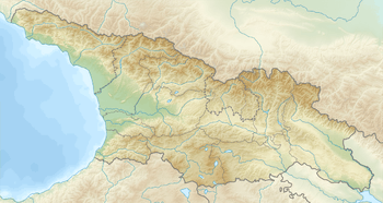 Madatapa Lake | |
| Coordinates | 41°10′46″N 43°46′59″E / 41.17944°N 43.78306°ECoordinates: 41°10′46″N 43°46′59″E / 41.17944°N 43.78306°E |
| Primary outflows | Madatapa river |
| Catchment area | 136 km2 (53 sq mi) |
| Basin countries | Georgia |
| Surface area | 8.78 km2 (3.39 sq mi) |
| Average depth | 1.5 m (4 ft 11 in) |
| Max. depth | 1.7 m (5 ft 7 in) |
| Water volume | 97 km3 (23 cu mi) |
| Surface elevation | 2,108 m (6,916 ft) |
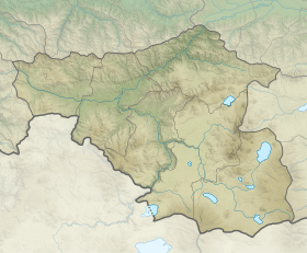
Madatapa Lake (Georgian: მადათაფა) is a lake in the Samtskhe-Javakheti region of southeastern Georgia, near the Armenian border, north of Bavra. Covering an area of 885 hectares (2,190 acres) at an altitude of 2,108 m (6,916 ft), the lake is noted for its Paravan race of common carp and has been considered as a commercial fishing production site.[1] It is found in one of the most earthquake-prone areas of the Caucasus.[2] A shallow lake, it, along with Khanchali Lake, is one of the most important in the country for breeding and staging waterbirds, including the endangered Dalmatian pelican.[3]
The villages of Zhdanovakani, Epremovka, Troitskoye and Sameba lie around the lake. Biketi Lake lies to the north.
References
- ↑ Petr, T. (1999). Fish and fisheries at higher altitudes: Asia. Food & Agriculture Org. p. 298. ISBN 978-92-5-104309-7. Retrieved 6 October 2011.
- ↑ Savarenskiĭ, E. F; Kharin, D. A; Gubin, Igor'Evgenèvic (1 January 1962). Earthquakes in the U.S.S.R. U.S. Atomic Energy Commission, Division of Technical Information, available from the Office of Technical Services, Dept. of Commerce, Washington. p. 282. Retrieved 6 October 2011.
- ↑ Evans, M. I.; Heath, Melanie F. (2000). Important bird areas in Europe: priority sites for conservation. BirdLife International. p. 255. ISBN 978-0-946888-35-1. Retrieved 6 October 2011.
| Eastern Georgia |
| ||||
|---|---|---|---|---|---|
| Western Georgia |
| ||||
This article is issued from
Wikipedia.
The text is licensed under Creative Commons - Attribution - Sharealike.
Additional terms may apply for the media files.