Paravani Lake
| Paravani lake ფარავნის ტბა | |
|---|---|
 | |
 Paravani lake 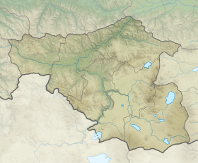 Paravani lake | |
| Coordinates | 41°27′50″N 43°48′50″E / 41.46389°N 43.81389°ECoordinates: 41°27′50″N 43°48′50″E / 41.46389°N 43.81389°E |
| Primary inflows | Shaori, Sabadostskali, Rodionovskis Tskali, precipitation, underground springs |
| Primary outflows | Paravani river |
| Catchment area | 234 km2 (90 sq mi) |
| Basin countries | Georgia |
| Surface area | 37.5 km2 (14.5 sq mi) |
| Average depth | 2.2 m (7 ft 3 in) |
| Max. depth | 3.3 m (11 ft) |
| Water volume | 91 km3 (22 cu mi) |
| Surface elevation | 2,073 m (6,801 ft) |
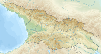
Paravani lake (Georgian: ფარავნის ტბა) is a volcanic lake in Georgia, located in Javakheti Plateau between Abul-Samsari and Javakheti Ranges.
Geography and hydrography
Paravani Lake is located 2,073 m (6,801 ft) above sea level and has a surface area of 37.5 km2 (14.5 sq mi) and a drainage basin of 234 km2 (90 sq mi). Its maximum and average depths are 3.3 m (11 ft) and 2.2 m (7 ft 3 in) respectively. The volume of the lake is 91,000,000 m3 (3.2×10⁹ cu ft). The water level is low during October and November and is high during May and June. The lake is frozen during wintertime and the thickness of the ice ranges from 47 to 73 cm (19 to 29 in).[1]
In addition to the small rivers of Shaori, Sabadostskali, and Rodionovskis Tskali, the lake gets its water from snow, rain, and underground springs.
The Paravani River begins from the southern part of the lake, and connects to the Mtkvari River to the right. The lake is a popular destination for fishing.
Notes and references
- ↑ Apkhazava, I. Ed. Georgian Encyclopedia. Vol. X. Tbilisi, Georgia: 1985.
External links
| Wikimedia Commons has media related to Paravani Lake. |
| Eastern Georgia |
| ||||
|---|---|---|---|---|---|
| Western Georgia |
| ||||