L'Hôpital-le-Grand
| L'Hôpital-le-Grand | ||
|---|---|---|
| Commune | ||
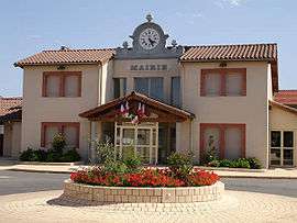 The town hall in L'Hôpital-le-Grand | ||
| ||
 L'Hôpital-le-Grand Location within Auvergne-Rhône-Alpes region  L'Hôpital-le-Grand | ||
| Coordinates: 45°35′39″N 4°11′55″E / 45.5942°N 4.1986°ECoordinates: 45°35′39″N 4°11′55″E / 45.5942°N 4.1986°E | ||
| Country | France | |
| Region | Auvergne-Rhône-Alpes | |
| Department | Loire | |
| Arrondissement | Montbrison | |
| Canton | Montbrison | |
| Intercommunality | Communauté d'agglomération Loire Forez | |
| Government | ||
| • Mayor (2008–2014) | Yves Lachaud | |
| Area1 | 12.86 km2 (4.97 sq mi) | |
| Population (1999)2 | 596 | |
| • Density | 46/km2 (120/sq mi) | |
| Time zone | UTC+1 (CET) | |
| • Summer (DST) | UTC+2 (CEST) | |
| INSEE/Postal code | 42108 /42210 | |
| Elevation |
352–380 m (1,155–1,247 ft) (avg. 375 m or 1,230 ft) | |
|
1 French Land Register data, which excludes lakes, ponds, glaciers > 1 km2 (0.386 sq mi or 247 acres) and river estuaries. 2 Population without double counting: residents of multiple communes (e.g., students and military personnel) only counted once. | ||
.svg.png)
L'Hôpital-le-Grand is a commune in the Loire department in central France.
Geography
L'Hôpital Le Grand is situated near Boisset-lès-Montrond, Craintilleux, Sury-le-Contal, and Montbrison.
See also
| Wikimedia Commons has media related to L'Hôpital-le-Grand. |
This article is issued from
Wikipedia.
The text is licensed under Creative Commons - Attribution - Sharealike.
Additional terms may apply for the media files.