Saint-Christo-en-Jarez
| Saint-Christo-en-Jarez | |
|---|---|
| Commune | |
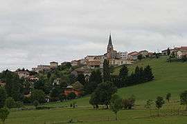 A general view of Saint-Christo-en-Jarez | |
 Saint-Christo-en-Jarez Location within Auvergne-Rhône-Alpes region  Saint-Christo-en-Jarez | |
| Coordinates: 45°32′44″N 4°29′15″E / 45.5456°N 4.4875°ECoordinates: 45°32′44″N 4°29′15″E / 45.5456°N 4.4875°E | |
| Country | France |
| Region | Auvergne-Rhône-Alpes |
| Department | Loire |
| Arrondissement | Saint-Étienne |
| Canton | Sorbiers |
| Intercommunality | Saint-Étienne Métropole |
| Government | |
| • Mayor | Rémi Guyot |
| Area1 | 21.77 km2 (8.41 sq mi) |
| Population (1999)2 | 1,365 |
| • Density | 63/km2 (160/sq mi) |
| Time zone | UTC+1 (CET) |
| • Summer (DST) | UTC+2 (CEST) |
| INSEE/Postal code | 42208 /42320 |
| Elevation |
540–885 m (1,772–2,904 ft) (avg. 810 m or 2,660 ft) |
|
1 French Land Register data, which excludes lakes, ponds, glaciers > 1 km2 (0.386 sq mi or 247 acres) and river estuaries. 2 Population without double counting: residents of multiple communes (e.g., students and military personnel) only counted once. | |
Saint-Christo-en-Jarez is a commune in the Loire department in central France.
Twin towns
Saint-Christo-en-Jarez is twinned with:

See also
References
| Wikimedia Commons has media related to Saint-Christo-en-Jarez. |
This article is issued from
Wikipedia.
The text is licensed under Creative Commons - Attribution - Sharealike.
Additional terms may apply for the media files.