Roisey
| Roisey | |
|---|---|
| Commune | |
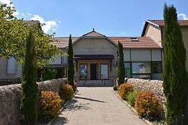 Roisey's town hall in April 2015. | |
 Roisey Location within Auvergne-Rhône-Alpes region  Roisey | |
| Coordinates: 45°23′18″N 4°40′22″E / 45.3883°N 4.6728°ECoordinates: 45°23′18″N 4°40′22″E / 45.3883°N 4.6728°E | |
| Country | France |
| Region | Auvergne-Rhône-Alpes |
| Department | Loire |
| Arrondissement | Saint-Étienne |
| Canton | Le Pilat |
| Intercommunality | Communauté de communes du Pilat rhodanien |
| Government | |
| • Mayor | Michèle Perez |
| Area1 | 13.03 km2 (5.03 sq mi) |
| Population (1999)2 | 698 |
| • Density | 54/km2 (140/sq mi) |
| Time zone | UTC+1 (CET) |
| • Summer (DST) | UTC+2 (CEST) |
| INSEE/Postal code | 42191 /42520 |
| Elevation |
390–1,343 m (1,280–4,406 ft) (avg. 510 m or 1,670 ft) |
|
1 French Land Register data, which excludes lakes, ponds, glaciers > 1 km2 (0.386 sq mi or 247 acres) and river estuaries. 2 Population without double counting: residents of multiple communes (e.g., students and military personnel) only counted once. | |
Roisey is a commune in the Loire department in central France.
See also
| Wikimedia Commons has media related to Roisey. |
This article is issued from
Wikipedia.
The text is licensed under Creative Commons - Attribution - Sharealike.
Additional terms may apply for the media files.