Kyawkku State
| Kyawkku Hsiwan | |||||
| State of the Shan States | |||||
| |||||
 | |||||
| History | |||||
| • | Kyawkku Hsiwan state founded | c. 1600 | |||
| • | Merged with Poila State | 1922 | |||
| Area | |||||
| • | 1901 Census of India | 243 km2 (94 sq mi) | |||
| Population | |||||
| • | 1901 Census of India | 4,771 | |||
| Density | 19.6 /km2 (50.9 /sq mi) | ||||
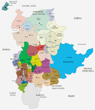
Kyawkku (also known as Kyawkku Hsiwan or Kyakku) was a Shan state in the Myelat region of what is today Burma. Its capital was the village of Kyawkku (Myinkyado) which had 344 inhabitants in 1901.
History
Kyawkku was founded around 1600 CE. It was a tributary of Burma until 1887, when the Shan states submitted to British rule after the fall of the Konbaung dynasty. The state was merged with Poila in 1922.[1]
Rulers
The title of Kyawkku's rulers was Ngwegunhmu.[2]
- .... - .... Nga San Bon
- .... - .... Nga San Mya
- .... - 1783 Nga San Ma
- 1783 - 1820 Nga Kaw Tha
- 1820 - 1821 Nga Thi Ri
- 1821 - 1843 Nga Chit Win
- 1844 - 1852 Nga Shwe Maung I (1st time)
- 1852 - 1856 Nga Shwe Yit -Regent
- 1856 - 1863 Nga Shwe Maung I (2nd time)
- 1863 - 1865 Nga Yan Kon -Regent
- 1865 - 1873 Nga San
- 1873 - 1874 Nga Shwe Maung II -Regent
- 1874 - 1876 Nga Tha U -Regent
- 1876 - 1877 Nga Tun -Regent
- 1877 - 1881 Nga Pai Su (Nga Pyan)
- 1881 - 1922? Nga Thaing (b. 1873 - d. 1922?)
References
- ↑ "WHKMLA : History of the Shan States". 18 May 2010. Retrieved 21 December 2010.
- ↑ Ben Cahoon (2000). "World Statesmen.org: Shan and Karenni States of Burma". Retrieved 14 May 2016.
Coordinates: 21°48′N 96°55′E / 21.800°N 96.917°E
This article is issued from
Wikipedia.
The text is licensed under Creative Commons - Attribution - Sharealike.
Additional terms may apply for the media files.