Kentucky Route 36
| ||||
|---|---|---|---|---|
 | ||||
| Route information | ||||
| Maintained by KYTC | ||||
| Length | 149.793 mi[1] (241.068 km) | |||
| Major junctions | ||||
| West end |
| |||
| ||||
| East end |
| |||
| Location | ||||
| Counties | Trimble, Carroll, Owen, Grant, Harrison, Bourbon, Nicholas, Bath, Menifee | |||
| Highway system | ||||
| ||||

Kentucky Route 36 (KY 36) is a 149.793-mile-long (241.068 km) state highway in Kentucky that runs from US 421 in Milton to US 460 in Frenchburg.
Major intersections
| County | Location | mi[1] | km | Destinations | Notes |
|---|---|---|---|---|---|
| Trimble | Milton | 0.000 | 0.000 | Western terminus | |
| Carroll | | 7.505 | 12.078 | Eastern terminus of KY 1492 | |
| Prestonville | 10.343 | 16.645 | West end of US 42 concurrency | ||
| 11.379 | 18.313 | Northern terminus of KY 55 | |||
| Kentucky River | 11.525 11.767 | 18.548 18.937 | Carrollton-Prestonville Bridge | ||
| Carrollton | 12.643 | 20.347 | |||
| 13.042 | 20.989 | East end of US-42 concurrency; northern terminus of KY 227; west end of KY 227 concurrency | |||
| 13.908 | 22.383 | East end of KY-227 concurrency | |||
| 15.490 | 24.929 | Southern terminus of KY 2350 | |||
| Easterday | 18.549 | 29.852 | Western end of KY 1112 overlap | ||
| 18.807 | 30.267 | Eastern terminus of KY 1112 overlap | |||
| Whites Run | 20.455 | 32.919 | Western terminus of KY 2984 | ||
| | 21.649 | 34.841 | Eastern terminus of KY 1204 | ||
| | 24.093 | 38.774 | West end of KY 467 concurrency | ||
| Sanders | 28.126 | 45.264 | East end of KY 467 concurrency; southern terminus of KY 47 | ||
| Owen | New Liberty | 31.996 | 51.493 | West end of KY 227 concurrency | |
| 32.500 | 52.304 | East end of KY 227 concurrency | |||
| | 35.451 | 57.053 | West end of concurrency with US 127 | ||
| Long Ridge | 38.259 | 61.572 | East end of concurrency with US 127 | ||
| Owen–Grant county line | Jonesville | 42.243 | 67.984 | Eastern terminus of KY 3102 | |
| Grant | 43.525 | 70.047 | Southern terminus of KY 1132 | ||
| Four Corners | 50.977 | 82.040 | |||
| Williamstown | 53.835 | 86.639 | Northern terminus of KY 1995 | ||
| 57.285– 57.542 | 92.191– 92.605 | I-75 exit 154 | |||
| 58.004 | 93.348 | West end of US 25 concurrency | |||
| 59.452 | 95.679 | East end of US 25 concurrency | |||
| Cordova | 65.738 | 105.795 | West end of KY 330 concurrency | ||
| 65.792 | 105.882 | East end of KY 330 concurrency | |||
| Harrison | | 69.957 | 112.585 | Western terminus of KY 1032 | |
| Breckenridge | 78.344 | 126.082 | Northern terminus of KY 1842 | ||
| 79.771 | 128.379 | Southern terminus of KY 1054 | |||
| | 82.350 | 132.529 | Southern terminus of KY 1743 | ||
| Cynthiana | 83.729 | 134.749 | |||
| 84.311 | 135.685 | Eastern terminus of KY 356, northern terminus of KY 3016. | |||
| 84.649 | 136.229 | West end of US 27 Bus./US 62 concurrency | |||
| 84.710 | 136.328 | East end of US 27 Bus./US 62 concurrency; west end of KY 32 concurrency | |||
| 85.210 | 137.132 | Northern terminus of KY 985 | |||
| 86.242 | 138.793 | Northern terminus of KY 1940 | |||
| Bourbon | | 87.788 | 141.281 | Northern terminus of KY 1879 | |
| Nicholas | | 88.403 | 142.271 | Eastern terminus of KY 1298 | |
| | 99.508 | 160.143 | East end of KY 32 concurrency; west end of US 68 concurrency | ||
| | 100.511 | 161.757 | East end of US 68 concurrency | ||
| Carlisle | 103.586 | 166.706 | Northern terminus of KY 13 | ||
| 103.794 | 167.040 | West end of KY 32 concurrency | |||
| 104.200 | 167.694 | Northern terminus of KY 3316 | |||
| 104.328 | 167.900 | East end of KY 32 concurrency | |||
| 104.677 | 168.461 | Northern terminus of KY 1285 | |||
| | 112.467 | 180.998 | Southern terminus of KY 928 | ||
| Moorefield | 114.658 | 184.524 | West end of KY 57 concurrency | ||
| 114.893 | 184.902 | East end of KY 57 concurrency | |||
| Bath | | 118.125 | 190.104 | West end of KY 11 concurrency | |
| Sharpsburg | 120.266 | 193.549 | East end of KY 11 concurrency | ||
| | 122.285 | 196.799 | Southern terminus of KY 3288 | ||
| Reynoldsville | 126.346 | 203.334 | Southern terminus of KY 1325 | ||
| | 128.727 | 207.166 | Southern terminus of KY 1944 | ||
| Owingsville | 131.223 | 211.183 | West end of US 60 concurrency | ||
| 131.625 | 211.830 | East end of US 60 concurrency | |||
| 132.874– 133.090 | 213.840– 214.188 | I-64 exit 121 | |||
| | 134.660 | 216.714 | West end of KY 965 concurrency | ||
| Olympia | 136.882 | 220.290 | East end of KY 965 concurrency | ||
| Olympia Springs | 140.282 | 225.762 | Southern terminus of KY 3290 | ||
| | 143.154 | 230.384 | Southern terminus of KY 211 | ||
| Menifee | Frenchburg | 148.177 | 238.468 | Southern terminus of KY 1274 | |
| 149.793 | 241.068 | Eastern terminus | |||
1.000 mi = 1.609 km; 1.000 km = 0.621 mi
| |||||
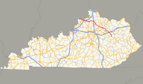
Route map:
References
- 1 2 Commonwealth of Kentucky. "Official DMI Route Log". Retrieved March 10, 2015.
This article is issued from
Wikipedia.
The text is licensed under Creative Commons - Attribution - Sharealike.
Additional terms may apply for the media files.