Kazincbarcika District
| Kazincbarcika District Kazincbarcikai járás | ||
|---|---|---|
| Districts of Hungary | ||
| ||
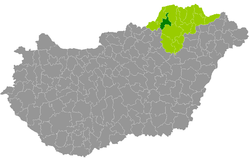 Kazincbarcika District within Hungary and Borsod-Abaúj-Zemplén County. | ||
| Country |
| |
| County | Borsod-Abaúj-Zemplén | |
| District seat | Kazincbarcika | |
| Area | ||
| • Total | 341.70 km2 (131.93 sq mi) | |
| Area rank | 12th in Borsod-Abaúj-Zemplén | |
| Population (2011 census) | ||
| • Total | 66,470 | |
| • Rank | 2nd in Borsod-Abaúj-Zemplén | |
| • Density | 193/km2 (500/sq mi) | |

Kazincbarcika (Hungarian: Kazincbarcikai járás) is a district in north-western part of Borsod-Abaúj-Zemplén County. Kazincbarcika is also the name of the town where the district seat is found. The district is located in the Northern Hungary Statistical Region.
Geography
Kazincbarcika District borders with Edelény District northeast, Miskolc District to the southeast, Bélapátfalva District (Heves County) to the southwest, Ózd District to the west, Putnok District to the northwest. The number of the inhabited places in Kazincbarcika District is 22.
Municipalities
The district has 3 town, 2 large villages and 17 villages. (ordered by population, as of 1 January 2012)[1]
- Alacska (748)
- Alsótelekes (135)
- Bánhorváti (1,335)
- Berente (1,117)
- Dédestapolcsány (1,426)
- Felsőtelekes (683)
- Izsófalva (1,739)
- Kazincbarcika (28,664) – district seat
- Kurityán (1,598)
- Mályinka (475)
- Múcsony (3,095)
- Nagybarca (1,049)
- Ormosbánya (1,670)
- Rudabánya (2,488)
- Rudolftelep (714)
- Sajógalgóc (365)
- Sajóivánka (605)
- Sajókaza (3,403)
- Sajószentpéter (11,965)
- Szuhakálló (946)
- Tardona (1,011)
- Vadna (597)
The bolded municipalities are cities, italics municipalities are large villages.
Demographics
Religion in Kazincbarcika District (2011 census)
In 2011, it had a population of 66,470 and the population density was 195/km².
| Year | County population[2] | Change |
|---|---|---|
| 2011 | 66,470 | n/a |
Ethnicity
Besides the Hungarian majority, the main minorities are the Roma (approx. 4,000), German (350), Polish and Rusyn (150).
Total population (2011 census): 66,470
Ethnic groups (2011 census):[3] Identified themselves: 63,350 persons:
- Hungarians: 58,247 (91.94%)
- Gypsies: 3,919 (6.18%)
- Others and indefinable: 1,184 (1.87%)
Approx. 3,000 persons in Kazincbarcika District did not declare their ethnic group at the 2011 census.
Religion
Religious adherence in the county according to 2011 census:[4]
- Catholic – 20,582 (Roman Catholic – 17,135; Greek Catholic – 3,444);
- Reformed – 14,222;
- Evangelical – 422;
- other religions – 1,167;
- Non-religious – 12,810;
- Atheism – 790;
- Undeclared – 16,477.
Gallery
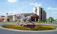 Kazincbarcika, the district seat
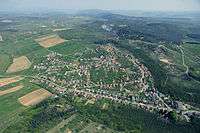 Aerial view of Rudabánya
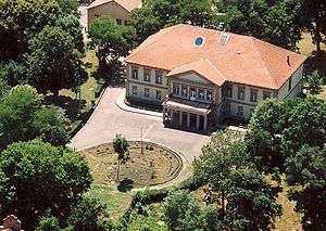 Pallavicini Mansion in Kurityán
_3.jpg) Reformed Church in Mályinka
Reformed Church in Mályinka Sajó river near Sajószentpéter
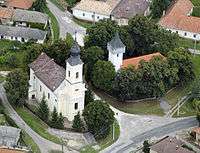 Aerial view of Bánhorváti
See also
References
- ↑ A KSH 2012. évi helységnévkönyve
- ↑ népesség.com, "Kazincbarcikai járás népessége"
- ↑ 4.1.6.1 A népesség nemzetiség szerint, 2011, (in Hungarian)
- ↑ 4.1.7.1 A népesség vallás, felekezet szerint, 2011, (in Hungarian)
External links
| Towns (3) |
| |
|---|---|---|
| Large villages (2) | ||
| Villages (17) | ||
Coordinates: 48°19′00″N 20°35′00″E / 48.3167°N 20.5833°E