Tokaj District
| Tokaj District Tokaji járás | ||
|---|---|---|
| Districts of Hungary | ||
| ||
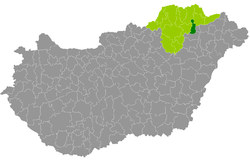 Tokaj District within Hungary and Borsod-Abaúj-Zemplén County. | ||
| Country |
| |
| County | Borsod-Abaúj-Zemplén | |
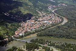
| District seat | Tokaj | |
| Area | ||
| • Total | 255.81 km2 (98.77 sq mi) | |
| Area rank | 15th in Borsod-Abaúj-Zemplén | |
| Population (2011 census) | ||
| • Total | 13,331 | |
| • Rank | 16th in Borsod-Abaúj-Zemplén | |
| • Density | 52/km2 (130/sq mi) | |
Tokaj (Hungarian: Tokaji járás) is a district in eastern part of Borsod-Abaúj-Zemplén County. Tokaj is also the name of the town where the district seat is found. The district is located in the Northern Hungary Statistical Region.
Geography
Tokaj District borders with Gönc District to the north, Sárospatak District and Nyíregyháza District (Szabolcs-Szatmár-Bereg County) to the east, Tiszavasvári District (Szabolcs-Szatmár-Bereg County) to the south, Szerencs District to the west. The number of the inhabited places in Tokaj District is 11.
Municipalities
The district has 1 town and 10 villages. (ordered by population, as of 1 January 2012)[1]
- Bodrogkeresztúr (1,107)
- Bodrogkisfalud (836)
- Csobaj (702)
- Erdőbénye (1,018)
- Szegi (296)
- Szegilong (203)
- Taktabáj (575)
- Tarcal (2,824)
- Tiszaladány (670)
- Tiszatardos (223)
- Tokaj (4,839) – district seat
The bolded municipality is city.
Demographics
Religion in Tokaj District (2011 census)
In 2011, it had a population of 13,331 and the population density was 52/km².
| Year | County population[2] | Change |
|---|---|---|
| 2011 | 13,331 | n/a |
Ethnicity
Besides the Hungarian majority, the main minority is the Roma (approx. 650).
Total population (2011 census): 13,331
Ethnic groups (2011 census):[3] Identified themselves: 12,653 persons:
- Hungarians: 11,848 (93.64%)
- Gypsies: 620 (4.90%)
- Others and indefinable: 185 (1.46%)
Approx. 500 persons in Tokaj District did not declare their ethnic group at the 2011 census.
Religion
Religious adherence in the county according to 2011 census:[4]
- Catholic – 5,655 (Roman Catholic – 4,655; Greek Catholic – 998);
- Reformed – 3,436;
- Evangelical – 41;
- other religions – 95;
- Non-religious – 1,096;
- Atheism – 89;
- Undeclared – 2,919.
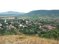
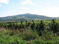
Gallery
See also
References
- ↑ A KSH 2012. évi helységnévkönyve
- ↑ népesség.com, "Tokaji járás népessége"
- ↑ 4.1.6.1 A népesség nemzetiség szerint, 2011, (in Hungarian)
- ↑ 4.1.7.1 A népesség vallás, felekezet szerint, 2011, (in Hungarian)
External links
| Town (1) |
| |
|---|---|---|
| Villages (10) | ||
Coordinates: 48°10′00″N 21°22′00″E / 48.1667°N 21.3667°E