Kallakurichi
| Kallakurichi Kallai | |
|---|---|
| City | |
| Nickname(s): Sugarcane city | |
 Kallakurichi Location in Tamil Nadu, India | |
| Coordinates: 11°44′17″N 78°57′43″E / 11.738°N 78.962°ECoordinates: 11°44′17″N 78°57′43″E / 11.738°N 78.962°E | |
| Country |
|
| State | Tamil Nadu |
| District | Villupuram |
| Named for | Agriculture |
| Government | |
| • Type | First Grade Municipality |
| • Body | Kallakurichi Municipal Council |
| Population (2015) | |
| • Total | 57,628 |
| Languages | |
| • Official | Tamil |
| Time zone | UTC+5:30 (IST) |
| PIN | 606 202 |
| Telephone code | 0-4151 |
| Vehicle registration | TN-15 |
Kallakurichi is a municipality of Viluppuram district, Tamil Nadu, India and a Parliamentary constituency in Tamil Nadu. As of 2015, the town had a population of 57,628[1]
Demographics
According to 2011 census, Kallakkurichi had a population of 52,507 with a sex-ratio of 984 females for every 1,000 males, much above the national average of 929.[2] A total of 5,541 were under the age of six, constituting 2,914 males and 2,627 females. Scheduled Castes and Scheduled Tribes accounted for 15.49% and .27% of the population respectively. The average literacy of the town was 77.08%, compared to the national average of 72.99%.[2] The town had a total of 12801 households. There were a total of 19,013 workers, comprising 471 cultivators, 840 main agricultural labourers, 537 in house hold industries, 14,673 other workers, 2,492 marginal workers, 33 marginal cultivators, 414 marginal agricultural labourers, 102 marginal workers in household industries and 1,943 other marginal workers.[3] As per the religious census of 2011, Kallakkurichi had 83.87% Hindus, 13.4% Muslims, 1.72% Christians, 0.04% Sikhs, 0.02% Buddhists, 0.17% Jains, 0.71% following other religions and 0.08% following no religion or did not indicate any religious preference.[4]
About Municipality
Prior to 1960, Kallakurichi was considered a village. That year, Kallakurichi became Town Panchayat, then was subsequently upgraded to Special Grade Town Panchayat. On 20 October 2004, it was further upgraded to Third Grade Municipality. Later, on 8 September 2010, this municipality was upgraded to First Grade Municipality. The area of this municipality is 11.69 km2 divided into 21 wards.
Climate
The climate is moderate, with the maximum temperature being 38 °C and the minimum at 21 °C. The town gets its rainfall from the northeast monsoon during the winter months and the southwest monsoon during the summer months. The average annual rainfall is 1,070 mm.[5]
Transport
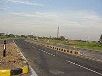
The town is well connected by roads, with frequent buses from Salem, Coimbatore, Tiruppur, Viluppuram, Sankarapuram, Thirukovilur, Chennai, Bangalore, Erode, Cuddalore, Chidambaram, Pondy, Thiruvannamalai, Tindivanam, Vellore, Hosur, Trichy, Perambalur, Rasipuram, Thuraiyur, Namakkal and other surrounding towns. Kallakurichi is on National Highway 79, which is a four-lane dual carriage road network connecting Chennai and Viluppuram with Salem, Coimbatore, Erode, Tirupur, Palagat and Cochin. It is also located on two state highways - SH-6 (Kallakurichi-Sankarapuram- Thiruvannamalai, Vellore, and Tirupathi) and SH-204(Kallakurichi to Veppur, Trichy Road).
Train
The Chinnasalem town's railway station serves trains on the route to Mettur, Cuddalore, Nagore, Pondicherry, Salem, Coimbatore, Mangalore, Bangalore, Chennai and Mumbai.
- Salem to Vriddhachalam passenger
- Bangalore to Karaikkal Fast passenger
- Salem to chennai egmore to dadar express
- Puducherry to Mangalore weekly express
- Yeshwantpur(Bangalore) to Puducherry garib rath
- Erode to chennai egmore special daytime intercity express
Kallakurichi is not connected by railway.Recent Railway Budget announced a new line from Chinna Salem to Kallakurichi which connects with Salem to Vridhachalam BG line. The nearest domestic airport is in Salem, but this airport is currently not in use. Chennai and Trichy are the nearest international airports.
Tourism
Kallakurichi is nearer to Kalvarayan Hills. The proximity of clouds fall near the peak of Vellimalai hilltop is a popular tourist spot for locals during the monsoon season. Vellimalai is a pristine unexplored location.
list of tourist spots :
- Megam falls (kalvarayan hills)
- Periyar falls (kalvarayan hills)
- Gomukhi dam (basement of kalvarayan hills)
- Boating house ( kalvarayan hills)
- kalvarayan hills Valley view spot.
Economy
Kallakurichi is an emerging agricultural town in Villupuram district. There are over 20 Rice processing units or modern rice (mills) both small and big in this town. Textiles, Jewellery and agricultural feeds are major businesses. The town has two government co-operative sugar mills and one private sugar mill is there, and some solvent extraction plants. There are many poultry farms in and around Kallakurichi.The name is derived due to the green lusture of this village along the banks of the river gomuki which nourishes the village by its water. It was under the great chola empire. The principal occupation of this village is agriculture. There are a number of temples in around the village. The famous temples are Suambu sree annamaliyar temple, sree sadaiappa temple, lord venkateshwara temple, drowpathi amman temple, periyayi and kattery temples. These temples are located in the north of the village in the farmyards. The car festival for sree sadaippa temple is conducted once in every twelve years. Thenkeeranur is the largest revenue village in the kallakurichi taluk. It has two large lakes for irrigation one in the north and the other in the south. A Co-operative society bank is located here to help the farming community.
Education
Kallakurichi is an educational center of Western Villupuram District, having many schools and colleges in and around the locality.It has one middle school which was given the land and built by late sri |Swaminathan pillai the then president of this village.It has a primary health care centre .
See also
References
- ↑ "About city". Kallakurichi municipality. 2015. Retrieved 2013-08-08.
- 1 2 "Census Info 2011 Final population totals". Office of The Registrar General and Census Commissioner, Ministry of Home Affairs, Government of India. 2013. Retrieved 26 January 2014.
- ↑ "Census Info 2011 Final population totals - Kallakkurichi". Office of The Registrar General and Census Commissioner, Ministry of Home Affairs, Government of India. 2013. Retrieved 26 January 2014.
- ↑ "Population By Religious Community - Tamil Nadu" (XLS). Office of The Registrar General and Census Commissioner, Ministry of Home Affairs, Government of India. 2011. Retrieved 13 September 2015.
- ↑ "About city". Kallakurichi municipality. 2011. Retrieved 2013-08-08.
External links
| Wikimedia Commons has media related to Kallakurichi. |