Jil, Armenia
- For the village in Azerbaijan, see Cil, Azerbaijan.
Coordinates: 40°27′16″N 45°27′13″E / 40.45444°N 45.45361°E
| Jil Ջիլ | |
|---|---|
 Jil Ջիլ | |
| Coordinates: 40°27′16″N 45°27′13″E / 40.45444°N 45.45361°E | |
| Country | Armenia |
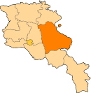
| Marz (Province) | Gegharkunik |
| Founded | 12th century |
| Population (2001) | |
| • Total | 680 |
| Time zone | UTC+4 ( ) |
Jil (Armenian: Ջիլ), is a village located near the northern shore of Lake Sevan in the Gegharkunik Province of Armenia. It was founded in the 12th century. Most of the beach in close proximity to the village remains uninhibited with a strip of forested land that lines the shore. 2 km north of the village is the Dashti-ler Fort.[1]
In 1902 German map it is mentioned as the main settlement in area between present-day villages Shoghakat and Big Masra.[2]
See also
References
- ↑ Kiesling, Brady (2005). Rediscovering Armenia: Guide (2nd ed.). Yerevan: Matit Graphic Design Studio. p. 84. ISBN 99941-0-121-8.
- ↑ "Composite Map: 44-49. Eurpaeisches Russland und Nord-Skandinavien in 6 Blaettern. - David Rumsey Historical Map Collection". www.davidrumsey.com. Retrieved 2018-10-02.
- Jil, Armenia at GEOnet Names Server
- Report of the results of the 2001 Armenian Census, National Statistical Service of the Republic of Armenia
- Brady Kiesling, Rediscovering Armenia, p. 49; original archived at Archive.org, and current version online on Armeniapedia.org.
This article is issued from
Wikipedia.
The text is licensed under Creative Commons - Attribution - Sharealike.
Additional terms may apply for the media files.