Artanish
| Artanish Արտանիշ | |
|---|---|
 Artanish Արտանիշ | |
| Coordinates: 40°29′50″N 45°21′52″E / 40.49722°N 45.36444°ECoordinates: 40°29′50″N 45°21′52″E / 40.49722°N 45.36444°E | |
| Country | Armenia |
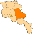
| Marz (Province) | Gegharkunik |
| Elevation | 1,924 m (6,312 ft) |
| Population (2001) | |
| • Total | 735 |
| Time zone | UTC+4 (GMT+4) |
| Postal code | 1308 |
Artanish (Armenian: Արտանիշ) is a village in the Gegharkunik Province of Armenia. On a hill just to the west are the ruins of cyclopean fortresses, and nearby is a church and cemetery.[1]
Nature
Vicinity of the village host 111 species of butterflies and are recognized as Prime Butterfly Area "Artanish-Shorzha".[2] Also the area is known as one of the Key Birding Sites of Armenia. [3]
See also
References
- ↑ Kiesling, Brady; Kojian, Raffi (2005). Rediscovering Armenia: Guide (2nd ed.). Yerevan: Matit Graphic Design Studio. p. 84. ISBN 99941-0-121-8.
- ↑ Prime Butterfly Area "Artanish-Shorzha". Butterfly Conservation Armenia, 2016. http://www.butterfly-conservation-armenia.org/artanish-shorzha.html
- ↑ Birdwatching. Armenian Bird Census Council. 2016. http://www.abcc-am.org/birdwatching.html
- Artanish at GEOnet Names Server
- Report of the results of the 2001 Armenian Census, National Statistical Service of the Republic of Armenia
- Brady Kiesling, Rediscovering Armenia, p. 49; original archived at Archive.org, and current version online on Armeniapedia.org.
This article is issued from
Wikipedia.
The text is licensed under Creative Commons - Attribution - Sharealike.
Additional terms may apply for the media files.