Mililani, Hawaii
| Mililani, Hawaiʻi | |
|---|---|
| City | |
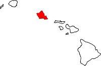
 Location in Honolulu County and the state of Hawaii | |
| Coordinates: 21°26′45″N 158°0′51″W / 21.44583°N 158.01417°W | |
| Country |
|
| State |
|
| City & County |
|
| Area | |
| • Total | 6.6 sq mi (17.1 km2) |
| • Land | 6.6 sq mi (17.1 km2) |
| • Water | 0.0 sq mi (0.0 km2) |
| Elevation[1] | 627 ft (191 m) |
| Population (2010) | |
| • Total | 48,668 |
| • Density | 7,400/sq mi (2,800/km2) |
| Time zone | UTC-10 (Hawaiʻi-Aleutian) |
| ZIP code | 96789[2] |
| Area code(s) | 808 |
| GNIS feature ID | 2414101[1] |
Mililani is a city located near the center of the island of Oʻahu in Honolulu County, Hawaii, United States. It consists of two census-designated places, Mililani Town, with a population of 27,629 at the 2010 census,[3] and Mililani Mauka, with a 2010 census population of 21,039.
History
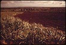
Mililani sits on former plantation fields owned by Castle & Cooke, which began planning for its development in the early 1960s under its Oceanic Properties subsidiary. Castle & Cooke's plan was to make Mililani Town a satellite city by using a prestigious group of planners and architects to satisfy Oahu's great pent-up demand for housing with a sensitively designed, affordable new community of a type unique in Hawaii. Architect and developer Al Boeke, who would later create the planned community of Sea Ranch, California, was the development director of Mililani.[4] The first homes in Mililani went on sale on June 3, 1968.
In 1976, the Interstate H-2 opened, cutting travel time from Mililani to Honolulu in half. In 1986, Mililani was named an All-America City. It is the only community in Hawaii ever to receive this distinction. Mililani is the third wealthiest zip code (96789) in the state of Hawaii, according to the 2006 ranking by Pacific Business News.
Although it is largely a bedroom community for Honolulu, Mililani has its own commercial shopping centers, schools (such as Mililani High School), parks, community centers, and a golf course, and resembles a modern American suburban town. Mililani homeowners must pay dues to the Mililani Town Association, which enforces covenants and design standards, and provides recreational facilities including several pools.
The Mililani Golf Club is a par-72, 6,455-yard course that is open to the public. The Mililani Technology Park is a nearby campus-like park that is zoned for high-tech industries.
The older portion of Mililani to the west of Interstate H-2 is known as Mililani Town. The newer portion of Mililani to the east of Interstate H-2 is known as Mililani Mauka. Almost all of Mililani's commercial and retail centers are in Mililani Town. A third region of Mililani is Launani Valley, a secluded, master planned development located below Mililani Tech Park on Wikao Street. The area was developed by Towne and contains a blend of townhome and single family units.
On April 6, 1990, ground was broken for Mililani Mauka, a newer and more upscale community east of the Interstate H-2. The first homeowners moved into Mauka in 1992.
In 2003 Mililani was designated as the pilot site for the City and County of Honolulu's curbside recycling program.[5] In 2005, Money magazine named Mililani as one of the best places to live in the U.S.[6] In 2006, Mililani Ike Elementary School first grade teacher Phyllis Nakama-Kawamoto was named Hawaii's American Star of Teaching by the U.S. Department of Education.[7]
Geography
Mililani Town is located at 21°26′46″N 158°00′51″W / 21.4460°N 158.0142°W,[8] near the center of Oʻahu Island, on the plateau or "central valley" between the two volcanic mountains that comprise the island. It is in the Central District and the City & County of Honolulu. The town is somewhat physically confined between the two large central Oʻahu gulches of Waikele and Kīpapa.
Travelling north on either Kamehameha Highway (State Rte. 99) or Interstate H-2 connects the traveller with Wahiawā. Travelling south on either of these arteries connects to Waipiʻo.
According to the United States Census Bureau, the Mililani Town CDP has a total area of 4.0 square miles (10.4 km2), of which 7,386 square metres (79,500 sq ft), or 0.07%, is water.[9]
The U.S. postal code for Mililani is 96789.
Demographics
As of the census of 2010, there were 27,629 people, 8,963 households, and 3.13 people per household. The population density was 6,896.9 people per square mile. There were 9,272 housing units and the owner - occupied housing unit rate was 75.5%. The racial makeup of the CDP was 46.2% Asian, 15.6% White, 2.0% African American, 5.1% Pacific Islander, Hispanic or Latino of any race were 9.3%, 0.3% American Indian, 28.4% were Two or More Races of the population.
There were 9,010 households out of which 43.1% had children under the age of 18 living with them, 70.4% were married couples living together, 10.2% had a female householder with no husband present, and 14.6% were non-families. 10.6% of all households were made up of individuals and 2.0% had someone living alone who was 65 years of age or older. The average household size was 3.17 and the average family size was 3.41.
In the CDP the population was spread out with 27.2% under the age of 18, 9.2% from 18 to 24, 28.4% from 25 to 44, 28.1% from 45 to 64, and 7.1% who were 65 years of age or older. The median age was 36 years. For every 100 females, there were 99.7 males. For every 100 females age 18 and over, there were 98.1 males.
The median income for a household in the CDP was $73,067, and the median income for a family was $76,338. Males had a median income of $47,051 versus $31,976 for females. The per capita income for the CDP was $24,427. About 2.5% of families and 3.2% of the population were below the poverty line, including 4.2% of those under age 18 and 1.6% of those age 65 or over.
Government and infrastructure
The United States Postal Service operates the Mililani Post Office.[10]
In 2017, the state approved NRG Energy, Inc., to build a 14.7 megawatt solar farm project near Mililani called Lanikuhana Solar. HECO will buy electricity from this solar farm at 11.4 cents per kilowatt-hour (kWh) for 22 years. The Lanikuhana solar farm will be online by 2019.[11]
Education
Public schools in Mililani are operated by the Hawai'i Department of Education. Elementary schools in the CDP include Kipapa, Mililani Uka, and Mililani Waena. Mililani Ike and Mililani Mauka elementary schools are outside of the CDP. Mililani Middle School is outside of the CDP, while Mililani High School is located inside the CDP.[12]
Hanalani Schools is a private school located in Mililani. It has approximately 750 students spanning pre-K through 12th grade.
References
- 1 2 "Geographic Names Information System". United States Geological Survey. Retrieved 2008-01-31.
- ↑ United States Postal Service (2012). "USPS - Look Up a ZIP Code". Retrieved 2012-02-15.
- ↑ "Profile of General Population and Housing Characteristics: 2010 Demographic Profile Data (DP-1): Mililani Town CDP, Hawaii". U.S. Census Bureau, American Factfinder. Retrieved May 23, 2012.
- ↑ Hevesi, Dennis (2011-11-16). "Al Boeke, Architect Who Sought Ecological Harmony, Is Dead at 88". New York Times. Retrieved 2011-12-03.
- ↑ http://the.honoluluadvertiser.com/article/2003/Oct/26/ln/ln11a.html
- ↑ http://money.cnn.com/best/bplive/snapshots/35147.html
- ↑ http://starbulletin.com/2006/08/26/news/story08.html
- ↑ "US Gazetteer files: 2010, 2000, and 1990". United States Census Bureau. 2011-02-12. Retrieved 2011-04-23.
- ↑ "Geographic Identifiers: 2010 Demographic Profile Data (G001): Mililani Town CDP, Hawaii". U.S. Census Bureau, American Factfinder. Retrieved May 23, 2012.
- ↑ "Post Office Location - MILILANI." United States Postal Service. Retrieved on May 20, 2010.
- ↑ Mykleseth, Kathryn (July 27, 2017). "State approves three Oahu solar farms". Star-Advertiser. Honolulu. Retrieved July 28, 2017.
- ↑ "Mililani Town CDP Archived 2006-09-26 at the Wayback Machine.." U.S. Census Bureau. Retrieved on May 21, 2009.
External links
Islands, municipalities, and communities of Honolulu County, Hawaii, United States | ||
|---|---|---|
| CDPs |
|  |
| Unincorporated communities | ||