Interstate 295 (Maine)
| ||||
|---|---|---|---|---|
| Richard A. Coleman Highway | ||||
|
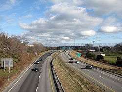
I-295 highlighted in red | ||||
| Route information | ||||
| Maintained by MaineDOT | ||||
| Length | 53.11 mi[1] (85.47 km) | |||
| Existed | 1960 – present | |||
| Major junctions | ||||
| South end |
| |||
| North end |
| |||
| Highway system | ||||
| ||||

Interstate 295 (I-295) is a 53.11-mile (85.47 km)-long auxiliary route in the U.S. state of Maine from I-95 in Scarborough to I-95 in West Gardiner. The highway was designated the Richard A. Coleman Highway in 2015 by the Maine Legislature.
Route description
Interstate 295 branches off from exit 44 of Interstate 95 (Maine Turnpike) providing access to downtown Portland, Maine, and then generally follows the Atlantic coast and Kennebec River until it merges back into I-95 in West Gardiner 52 miles (84 km) to the north at exit 103.
I-295's first exit is in South Portland, giving access to the Maine Mall (southbound) and U.S. 1 in South Portland and Scarborough (northbound); its last exit is Exit 51 (formerly Exit 28), which gives access to Gardiner. The route starts at Exit 44 (formerly Exit 6A) of I-95, and it has toll plazas just before its own Exit 1, and between Exit 51 and its northern terminus at I-95.
In 2015, the Maine Legislature unanimously voted to name the highway's entire length for Richard A. Coleman, a Maine Department of Transportation employee since 1956, who has been involved with many Maine transportation projects. He was involved in projects ranging from Maine's interstates to the Penobscot Narrows Bridge and Observatory. Coleman declined comment on the naming, only telling the Kennebec Journal that while the naming is humbling, he found it uncomfortable. Maine Sen. Roger Katz, the sponsor of the bill, said "Very few people have heard of Dick Coleman, but as he drives around the state, he must feel a great deal of pride looking at his decades of work." [2]
History
1960 to 2004
From its inception in 1960 to 2004, I-295 was an 11.02-mile (17.73 km) long route branching off the Maine Turnpike/I-95 to pass through downtown Portland. Four miles north of Portland the through freeway became I-95 at the junction with the Falmouth Spur, a connector carrying I-95 westward to the Maine Turnpike (I-95 and I-495(Former) at its Exit 9.
2004 extension
In 2004, to clear up confusion, I-95 was re-designated to continue along the Maine Turnpike for its entire length. I-295 was extended past the Falmouth Spur as a redesignation of I-95, to where it merges back into the Turnpike in West Gardiner 42 miles (68 km) to the north. The 4-mile (6.4 km) long Falmouth Spur officially became I-495 but was left unsigned.[3]
At the same time, the exits were re-numbered; previously they had been numbered more or less sequentially from south to north—there were skipped numbers, for example, there was no Exit 23. After the changes the exits re-numbered to mile-log in relation to the Scarborough junction, except for the exits in Portland and South Portland, which remained the same. Exits on Maine's I-95 were similarly re-numbered based on mileage.
Speed limits
The speed limit on Interstate 295 on the section past Tukey's Bridge to mile 51 in Gardiner was raised from 65 to 70 mph (105 to 113 km/h) on May 27, 2014. This occurred as the result of a new law passed in 2013 by the Maine Legislature allowing the Maine Department of Transportation to unilaterally set speed limits on Interstate highways with the approval of the Maine State Police, instead of appealing to the Legislature. [4] The speed limit was reverted from 70 to 65 mph (113 to 105 km/h) for a length of 22 miles (35 km) from the section past Tukey's Bridge to Topsham on March 27, 2017. [5]
Exit list
| County | Location[6] | mi[6] | km | Old exit | New exit | Destinations | Notes |
|---|---|---|---|---|---|---|---|
| Cumberland | Scarborough | 0.00 | 0.00 | – | Exit 44 on Maine Turnpike | ||
| 0.55 | 0.89 | Toll plaza | |||||
| South Portland | 1.26 | 2.03 | 1 | Northbound signage; northbound exit only | |||
| Southbound signage; southbound exit and northbound entrance | |||||||
| 1.99 | 3.20 | 2 | Southbound exit and northbound entrance | ||||
| 2.16 | 3.48 | 3 | Southbound exit and northbound entrance | ||||
| 3.19 | 5.13 | 4 | Casco Bay Drive – Portland Waterfront | Northbound signage; US 1 removed from Casco Bay Drive in May 2007 | |||
| Southbound signage; southern end of concurrency with US 1 | |||||||
| South Portland–Portland line | 3.70 | 5.95 | Fore River | ||||
| Portland | 4.46 | 7.18 | 5 | Signed as Exits 5A (east) and 5B (west) southbound | |||
| 5.35 | 8.61 | 6A | US 1 removed from Forest Avenue in May 2007 | ||||
| 6B | |||||||
| 5.89 | 9.48 | 7 | |||||
| 6.57 | 10.57 | 8 | Southbound signage; southbound exit and northbound entrance; southern end of concurrency with SR 26 | ||||
| 6.73 | 10.83 | 8 | Northbound signage; northbound exit and southbound entrance; northern end of concurrency with SR 26 | ||||
| 6.97 | 11.22 | 9 | Southbound signage; southbound exit and northbound entrance; US 1 removed from Baxter Boulevard in May 2007 | ||||
| 7.12 | 11.46 | 9 | Northbound signage; northbound exit and southbound entrance; northern end of concurrency with US 1 | ||||
| Falmouth | 9.45 | 15.21 | Ryan Quirion Guthrie Bridge over the Presumpscot River | ||||
| 10.62 | 17.09 | 10 | I-95 and Cumberland only appear on northbound signage | ||||
| 11.00 | 17.70 | 15 | 11 | Southbound exit and northbound entrance; former northern terminus; access via Falmouth Spur (formerly I-95) | |||
| Yarmouth | 15.24 | 24.53 | 16 | 15 | Northbound entrance added August 2013 | ||
| 16.35 | 26.31 | Royal River | |||||
| 17.24 | 27.75 | 17 | Freeport only appears on northbound signage | ||||
| Yarmouth–Freeport line | 17.98 | 28.94 | Cousins River | ||||
| Freeport | 20.65 | 33.23 | 19 | 20 | US 1 only appears on southbound signage | ||
| 22.25 | 35.81 | 20 | 22 | ||||
| 23.70 | 38.14 | 21 | 24 | Northbound exit and entrance | |||
| Brunswick | 28.38 | 45.67 | 22 | 28 | |||
| Cumberland–Sagadahoc county line | Brunswick–Topsham line | 30.02 | 48.31 | Androscoggin River | |||
| Sagadahoc | Topsham | 31.04 | 49.95 | 24A | 31A | Signed as Exit 31 northbound; Brunswick and Lewiston only appear on southbound signage; access to Bates College | |
| 24B | 31B | ||||||
| Bowdoinham | 37.10 | 59.71 | 25 | 37 | |||
| Richmond | 43.47 | 69.96 | 26 | 43 | |||
| Kennebec | Gardiner | 49.29 | 79.32 | 27 | 49 | ||
| Gardiner–West Gardiner line | 50.29 | 80.93 | Cobbosseecontee Stream | ||||
| West Gardiner | 51.48 | 82.85 | 28 | 51 | |||
| 51.70 | 83.20 | Toll plaza | |||||
| 52.27 | 84.12 | – | Exit 103 on Maine Turnpike | ||||
1.000 mi = 1.609 km; 1.000 km = 0.621 mi
| |||||||
References
- ↑ Floodgap Roadgap's RoadsAroundME Archived 2011-06-12 at Archive.is
- ↑ Koeing, Paul (April 20, 2015). "Interstate 295 to be named after Augusta resident, longtime transportation worker". Kennebec Journal. Retrieved April 20, 2015.
- ↑ "It's Time to Clear Up the confusion: Maine Interstate Re-designation 2004" (PDF). MaineDOT. May 20, 2003. Retrieved 2008-07-18.
- ↑ Koeing, Paul (May 27, 2014). "Speed limit increasing by 5 mph on parts of I-295, I-95". Kennebec Journal. Retrieved May 27, 2014.
- ↑ http://www.pressherald.com/2017/03/26/speed-limit-drops-monday-on-stretch-of-i-295/
- 1 2 "MaineDOT Public Map Viewer". Maine Department of Transportation. Retrieved April 8, 2017.
External links
Route map:
| Wikimedia Commons has media related to Interstate 295 (Maine). |
| ||