Cumberland, Maine
| Cumberland, Maine | |
|---|---|
| Town | |
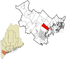 Location in Cumberland County and the state of Maine. | |
| Coordinates: 43°46′52″N 70°13′3″W / 43.78111°N 70.21750°WCoordinates: 43°46′52″N 70°13′3″W / 43.78111°N 70.21750°W | |
| Country | United States |
| State | Maine |
| County | Cumberland |
| Villages |
Cumberland Center Cumberland Foreside West Cumberland Wildwood Park |
| Area[1] | |
| • Total | 26.25 sq mi (67.99 km2) |
| • Land | 22.88 sq mi (59.26 km2) |
| • Water | 3.37 sq mi (8.73 km2) |
| Elevation | 0 ft (0 m) |
| Population (2010)[2] | |
| • Total | 7,211 |
| • Estimate (2012[3]) | 7,317 |
| • Density | 315.2/sq mi (121.7/km2) |
| Time zone | UTC-5 (Eastern (EST)) |
| • Summer (DST) | UTC-4 (EDT) |
| ZIP code | 04021 |
| Area code(s) | 207 |
| FIPS code | 23-15430 |
| GNIS feature ID | 0582427 |
| Website | www.cumberlandmaine.com |
Cumberland is a town in Cumberland County, Maine, United States. The population was 7,211 at the 2010 census. It is part of the Portland–South Portland–Biddeford, Maine Metropolitan Statistical Area. Cumberland is one of the wealthiest municipalities in the state.[4]
History
Cumberland, Maine (also known as Cumberland Center), was once part of North Yarmouth, but in 1821, it was incorporated as its own town. The town was officially named by Ephraim Sturdivant when the new town government elected him to do the task.
The Cumberland Fair, one of the state's larger agricultural fairs, has been held yearly in Cumberland at the end of September since 1868. This Portland suburb has a rich farming history, but only a small number of working farms remain, such as Sweetser's Apple Barrel & Orchards, Spring Brook Farms, and Double T Orchards. Chebeague Island, long a part of Cumberland, formed its own town in 2007.
Geography
According to the United States Census Bureau, the town has a total area of 26.25 square miles (67.99 km2), of which 22.88 square miles (59.26 km2) of it is land and 3.37 square miles (8.73 km2) is water.[1] The town stretches inland from Cumberland Foreside, on Casco Bay, to West Cumberland, which borders Windham.[5]
Near the center of the town, there is a small recreational park called Twin Brook. Run and maintained by the town, it is open to cross-country skiers, walkers, and sports practices. Local ballfields at Drowne Road School host the local Little League teams.
Cumberland has a few small businesses, some of which are on Route 26, also called the Gray Road. Across Main Street from the high school, there is a convenience store called Food Stop. New construction has brought two eateries to the town, Cumberland Food Company and Louie's Grille. There are also two dentists' offices and a post office. A new bank was built in 2010. The Cumberland Congregational Church is located in the center of the town.
Demographics
| Historical population | |||
|---|---|---|---|
| Census | Pop. | %± | |
| 1830 | 1,558 | — | |
| 1840 | 1,616 | 3.7% | |
| 1850 | 1,656 | 2.5% | |
| 1860 | 1,713 | 3.4% | |
| 1870 | 1,626 | −5.1% | |
| 1880 | 1,619 | −0.4% | |
| 1890 | 1,487 | −8.2% | |
| 1900 | 1,404 | −5.6% | |
| 1910 | 1,403 | −0.1% | |
| 1920 | 1,150 | −18.0% | |
| 1930 | 1,378 | 19.8% | |
| 1940 | 1,491 | 8.2% | |
| 1950 | 2,030 | 36.2% | |
| 1960 | 2,765 | 36.2% | |
| 1970 | 4,096 | 48.1% | |
| 1980 | 5,284 | 29.0% | |
| 1990 | 5,836 | 10.4% | |
| 2000 | 7,159 | 22.7% | |
| 2010 | 7,211 | 0.7% | |
| Est. 2014 | 7,550 | [6] | 4.7% |
| U.S. Decennial Census[7] | |||
2010 census
As of the census[2] of 2010, there were 7,211 people, 2,697 households, and 2,079 families residing in the town. The population density was 315.2 inhabitants per square mile (121.7/km2). There were 2,902 housing units at an average density of 126.8 per square mile (49.0/km2). The racial makeup of the town was 97.2% White, 0.5% African American, 0.2% Native American, 0.8% Asian, 0.3% from other races, and 1.0% from two or more races. Hispanic or Latino of any race were 1.2% of the population.
There were 2,697 households of which 37.9% had men under the age of 18 living with them, 67.4% were married couples living together, 6.5% had a female householder with no husband present, 3.2% had a male householder with no wife present, and 22.9% were non-families. 18.9% of all households were made up of individuals and 9% had someone living alone who was 65 years of age or older. The average household size was 2.67 and the average family size was 3.06.
The median age in the town was 45 years. 26.9% of residents were under the age of 18; 4.7% were between the ages of 18 and 24; 18.2% were from 25 to 44; 35.6% were from 45 to 64; and 14.5% were 65 years of age or older. The gender makeup of the town was 47.8% male and 52.2% female.
2000 census
As of the census[8] of 2000, there were 7,159 people, 2,548 households, and 2,046 families residing in the town. The population density was 274.6 people per square mile (106.0/km²). There were 2,945 housing units at an average density of 112.9 per square mile (43.6/km²). The racial makeup of the town was 98.76% White, 0.14% African American, 0.10% Native American, 0.42% Asian, 0.01% Pacific Islander, 0.13% from other races, and 0.45% from two or more races. Hispanic or Latino of any race were 0.66% of the population.
There were 2,548 households, of which 42.3% had children under the age of 18 living with them; 71.0% were married couples living together; 7.1% had a female householder with no husband present; and 19.7% were non-families. 15.7% of all households were made up of individuals and 7.2% had someone 65 or older living alone. The average household size was 2.80 and the average family size was 3.14.
In the town, the population was spread out, with 30.4% under the age of 18; 3.6% from 18 to 24; 27.7% from 25 to 44; 27.3% from 45 to 64, and 11.0% who were 65 or older. The median age was 39 years. For every 100 females, there were 93.3 males. For every 100 females age 18 and over, there were 91.4 males.
The median income for a household in the town was $67,556, and the median income for a family was $76,571. Males had a median income of $49,538 versus $37,367 for females. The per capita income for the town was $33,644. About 2.4% of families and 3.0% of the population were below the poverty line, including 0.8% of those under age 18 and 6.2% of those age 65 or over.
Education
The school system that serves Cumberland is known as Maine School Administrative District 51 or MSAD 51. There are 3 schools in the district – which also serves North Yarmouth, Maine: the Mabel I. Wilson School, Greely Middle School, and Greely High School. In June 2014, the district closed the North Yarmouth Memorial School and moved into the expanded the Greely Middle School. The Drowne Road School was closed in 2010 due to budget cuts, and the Greely Middle School replaced the Greely Junior High School in 2005. Jeff Porter is the superintendent of the district. [9]
Notable people
- Matt Apuzzo, 2012 Pulitzer Prize–winning journalist[10]
- Peter Askim, composer of modern classical music, conductor, music educator
- Joseph Brackett, American songwriter and Elder of The United Society of Believers in Christ's Second Appearing ("The Shakers"), author of "Simple Gifts"[11]
- Robert G. Dillenback, state legislator
- William J. Garsoe, state legislator and Maine House Minority Leader
- Hoddy Hildreth, state legislator and conservationist
- Stephen Moriarty, state legislator & attorney
- Captain Ephraim Sturdivant, namer of and treasurer for Cumberland
- Karl Turner, state legislator
References
- 1 2 "US Gazetteer files 2010". United States Census Bureau. Retrieved 2012-12-16.
- 1 2 "American FactFinder". United States Census Bureau. Retrieved 2012-12-16.
- ↑ "Population Estimates". United States Census Bureau. Archived from the original on 2013-06-17. Retrieved 2013-07-06.
- ↑ http://www.wmtw.com/article/new-data-maine-s-richest-towns/1970963
- ↑ Cumberland, Maine
- ↑ "Annual Estimates of the Resident Population for Incorporated Places: April 1, 2010 to July 1, 2014". Retrieved June 4, 2015.
- ↑ "Census of Population and Housing". Census.gov. Archived from the original on May 12, 2015. Retrieved June 4, 2015.
- ↑ "American FactFinder". United States Census Bureau. Archived from the original on 2013-09-11. Retrieved 2008-01-31.
- ↑ The school systems website
- ↑ http://www.politico.com/blogs/media/2013/12/aps-matt-apuzzo-to-new-york-times-179946.html
- ↑ "Joseph Brackett Day". American Music Preservation.com. Retrieved August 26, 2012.
External links
Municipalities and communities of Cumberland County, Maine, United States | ||
|---|---|---|
| Cities | 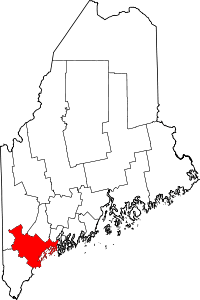 | |
| Towns | ||
| CDPs | ||
| Other villages | ||