Howard Township, Washington County, Indiana
| Howard Township | |
|---|---|
| Township | |
 Beck's Mill, a historic site in the township | |
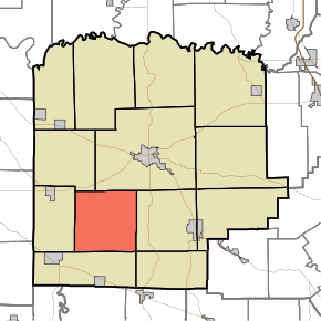 Location in Washington County | |
| Coordinates: 38°31′12″N 86°10′13″W / 38.52000°N 86.17028°WCoordinates: 38°31′12″N 86°10′13″W / 38.52000°N 86.17028°W | |
| Country | United States |
| State | Indiana |
| County | Washington |
| Government | |
| • Type | Indiana township |
| Area | |
| • Total | 36.13 sq mi (93.6 km2) |
| • Land | 35.82 sq mi (92.8 km2) |
| • Water | 0.3 sq mi (0.8 km2) 0.83% |
| Elevation | 764 ft (233 m) |
| Population (2010) | |
| • Total | 1,262 |
| • Density | 35.2/sq mi (13.6/km2) |
| ZIP codes | 47108, 47120, 47125, 47165, 47167 |
| GNIS feature ID | 0453421 |
Howard Township is one of thirteen townships in Washington County, Indiana, United States. As of the 2010 census, its population was 1,262 and it contained 494 housing units.[1] It was named for Gen. Tilghman Howard.[2]
Geography
According to the 2010 census, the township has a total area of 36.13 square miles (93.6 km2), of which 35.82 square miles (92.8 km2) (or 99.14%) is land and 0.3 square miles (0.78 km2) (or 0.83%) is water.[1]
Unincorporated towns
- Becks Mill at 38°32′07″N 86°09′20″W / 38.535336°N 86.155534°W
- Organ Springs at 38°28′36″N 86°09′53″W / 38.476726°N 86.164700°W
- Rosebud at 38°31′38″N 86°12′43″W / 38.527280°N 86.211925°W
(This list is based on USGS data and may include former settlements.)
Adjacent townships
- Washington Township (northeast)
- Pierce Township (east)
- Jackson Township (southeast)
- Posey Township (southwest)
- Madison Township (west)
- Vernon Township (northwest)
Cemeteries
The township contains these five cemeteries: Becks, Hall, Kansas Church, Smith-Miller Pioneer and Voyles.
School districts
- West Washington School Corporation
Political districts
- Indiana's 9th congressional district
- State House District 73
- State Senate District 44
References
- United States Census Bureau 2007 TIGER/Line Shapefiles
- United States Board on Geographic Names (GNIS)
- IndianaMap
- 1 2 "Population, Housing Units, Area, and Density: 2010 - County -- County Subdivision and Place -- 2010 Census Summary File 1". United States Census. Retrieved 2013-05-10.
- ↑ History of Lawrence, Orange, and Washington Counties, Indiana: From the Earliest Time to the Present. Higginson Book Company. 1884. p. 694.
External links
This article is issued from
Wikipedia.
The text is licensed under Creative Commons - Attribution - Sharealike.
Additional terms may apply for the media files.