Franklin Township, Washington County, Indiana
| Franklin Township | |
|---|---|
| Township | |
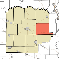 Location in Washington County | |
| Coordinates: 38°36′04″N 85°56′39″W / 38.60111°N 85.94417°WCoordinates: 38°36′04″N 85°56′39″W / 38.60111°N 85.94417°W | |
| Country | United States |
| State | Indiana |
| County | Washington |
| Government | |
| • Type | Indiana township |
| Area | |
| • Total | 44.31 sq mi (114.8 km2) |
| • Land | 44.25 sq mi (114.6 km2) |
| • Water | 0.06 sq mi (0.2 km2) 0.14% |
| Elevation | 860 ft (262 m) |
| Population (2010) | |
| • Total | 2,301 |
| • Density | 52/sq mi (20/km2) |
| Time zone | UTC-5 (EST) |
| • Summer (DST) | UTC-4 (EDT) |
| ZIP codes | 47126, 47165, 47167 |
| Area code(s) | 812 |
| GNIS feature ID | 0453315 |
Franklin Township is one of thirteen townships in Washington County, Indiana, United States. As of the 2010 census, its population was 2,301 and it contained 874 housing units.[1]
Geography
According to the 2010 census, the township has a total area of 44.31 square miles (114.8 km2), of which 44.25 square miles (114.6 km2) (or 99.86%) is land and 0.06 square miles (0.16 km2) (or 0.14%) is water.[1]
Unincorporated towns
- Bunker Hill at 38°34′25″N 85°53′40″W / 38.573671°N 85.894415°W
- New Philadelphia at 38°37′35″N 85°58′12″W / 38.626447°N 85.969974°W
- New Salem at 38°37′17″N 85°54′15″W / 38.621448°N 85.904138°W
- South Boston at 38°34′58″N 85°58′45″W / 38.582837°N 85.979141°W
(This list is based on USGS data and may include former settlements.)
Adjacent townships
- Gibson Township (north)
- Finley Township, Scott County (northeast)
- Polk Township (south)
- Pierce Township (southwest)
- Washington Township (west)
Cemeteries
The township contains these five cemeteries: Beech Grove, Blue River Church, Bunker Hill, Conway, olive branch and Chestnut Hill.
School districts
- East Washington School Corporation
Political districts
- Indiana's 9th congressional district
- State House District 73
- State Senate District 45
References
- United States Census Bureau 2007 TIGER/Line Shapefiles
- United States Board on Geographic Names (GNIS)
- IndianaMap
- 1 2 "Population, Housing Units, Area, and Density: 2010 - County -- County Subdivision and Place -- 2010 Census Summary File 1". United States Census. Retrieved 2013-05-10.
External links
This article is issued from
Wikipedia.
The text is licensed under Creative Commons - Attribution - Sharealike.
Additional terms may apply for the media files.