Daisy Hill, Indiana
| Daisy Hill, Indiana | |
|---|---|
| Unincorporated community | |
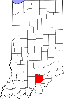 Washington County's location in Indiana | |
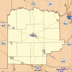 Daisy Hill Location of Daisy Hill in Washington County | |
| Coordinates: 38°30′24″N 85°56′21″W / 38.50667°N 85.93917°WCoordinates: 38°30′24″N 85°56′21″W / 38.50667°N 85.93917°W | |
| Country | United States |
| State | Indiana |
| County | Washington |
| Township | Polk |
| Elevation[1] | 791 ft (241 m) |
| Time zone | UTC-5 (Eastern (EST)) |
| • Summer (DST) | UTC-4 (EDT) |
| ZIP code | 47165 |
| Area code(s) | 812, 930 |
| GNIS feature ID | 452098 |
Daisy Hill is an unincorporated community in Polk Township, Washington County, in the U.S. state of Indiana.[2]
History
According to tradition, Daisy Hill was so named on account of there being a cemetery near the town site.[3]
Daisy Hill was mostly destroyed by a powerful tornado in the 1974 Super Outbreak.[4] This tornado was rated EF5[4] and completely leveled farms in the Daisy Hill area.
Geography
Daisy Hill is located at 38°30′24″N 85°56′21″W / 38.50667°N 85.93917°W.
References
- ↑ "US Board on Geographic Names". United States Geological Survey. October 25, 2007. Retrieved 2016-06-21.
- ↑ "Daisy Hill, Indiana". Geographic Names Information System. United States Geological Survey. Retrieved July 26, 2017.
- ↑ Indiana Names, v.4. Terre Haute, IN: Indiana State University. 1973. p. 58.
- 1 2 "Violent Tornadoes in Indiana". National Weather Service. Retrieved December 26, 2015.
This article is issued from
Wikipedia.
The text is licensed under Creative Commons - Attribution - Sharealike.
Additional terms may apply for the media files.