Horton, Ontario
- For other places with the same name, see Horton (disambiguation).
| Horton | |
|---|---|
| Township (lower-tier) | |
| Township of Horton | |
 Municipal building | |
 Horton | |
| Coordinates: 45°30′N 76°40′W / 45.500°N 76.667°WCoordinates: 45°30′N 76°40′W / 45.500°N 76.667°W | |
| Country |
|
| Province |
|
| County | Renfrew |
| Government | |
| • Mayor | Bob Kingsbury |
| • Governing body | Horton Council |
| • MP | Cheryl Gallant |
| • MPP | John Yakabuski |
| Area[1] | |
| • Total | 158.53 km2 (61.21 sq mi) |
| Population (2011)[1] | |
| • Total | 2,719 |
| • Density | 17.2/km2 (45/sq mi) |
| Time zone | UTC-5 (EST) |
| • Summer (DST) | UTC-4 (EDT) |
| Area code(s) | 613 |
| Website | www.hortontownship.ca |
Horton is a township in eastern Ontario, Canada, at the confluence of the Bonnechere River and the Ottawa River in Renfrew County. The Town of Renfrew was originally part of Horton Township.
Robert A. Johnson was re-elected as Reeve in 2006.
Communities
- Castleford
- Castleford Station
- Cotieville
- Fergusons Beach
- Goshen
- Lochwinnoch
- Mayhew
- Thompson Hill
Demographics
| Canada census – Horton, Ontario community profile | |||
|---|---|---|---|
| 2011 | 2006 | ||
| Population: | 2719 (-3.0% from 2006) | 2803 (9.2% from 2001) | |
| Land area: | 158.53 km2 (61.21 sq mi) | 158.38 km2 (61.15 sq mi) | |
| Population density: | 17.2/km2 (45/sq mi) | 17.7/km2 (46/sq mi) | |
| Median age: | 44.1 (M: 43.3, F: 44.8) | ||
| Total private dwellings: | 1234 | 1287 | |
| Median household income: | $55,546 | ||
| References: 2011[2] 2006[3] earlier[4] | |||
Attractions
See also
References
- 1 2 "Horton census profile". 2011 Census of Population. Statistics Canada. Retrieved 2012-02-10.
- ↑ "2011 Community Profiles". Canada 2011 Census. Statistics Canada. July 5, 2013. Retrieved 2012-02-10.
- ↑ "2006 Community Profiles". Canada 2006 Census. Statistics Canada. March 30, 2011. Retrieved 2012-02-10.
- ↑ "2001 Community Profiles". Canada 2001 Census. Statistics Canada. February 17, 2012.
External links
Places adjacent to Horton, Ontario | |
|---|---|
| Cities | 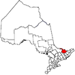 | |
|---|---|---|
| Towns | ||
| Townships | ||
| First Nations | ||
| Indian reserves | ||
| ||
This article is issued from
Wikipedia.
The text is licensed under Creative Commons - Attribution - Sharealike.
Additional terms may apply for the media files.