Laurentian Valley
| Laurentian Valley | |
|---|---|
| Township municipality (lower-tier) | |
| Township of Laurentian Valley | |
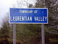 Sign on Round Lake Road | |
 Laurentian Valley Location of Laurentian Valley in Southern Ontario | |
| Coordinates: 45°46′05″N 77°13′26″W / 45.76806°N 77.22389°WCoordinates: 45°46′05″N 77°13′26″W / 45.76806°N 77.22389°W[1] | |
| Country |
|
| Province |
|
| County | Renfrew |
| Established | January 1, 2000 |
| Government | |
| • Mayor | Steve Bennett |
| Area[2] | |
| • Land | 552.44 km2 (213.30 sq mi) |
| Population (2011)[2] | |
| • Total | 9,657 |
| • Density | 17.5/km2 (45/sq mi) |
| Time zone | UTC-5 (Eastern Time Zone) |
| • Summer (DST) | UTC-4 (Eastern Time Zone) |
| Area code(s) | 613, 343 |
| Website |
www |
Laurentian Valley is an township municipality[1] in Renfrew County in eastern Ontario, Canada.[1] It borders on the Ottawa River, the city of Pembroke and the town of Petawawa.
This township was created on January 1, 2000 from the former townships of Stafford-Pembroke and Alice and Fraser.[3]
Communities
The township comprises the communities of Alice, Cotnam Island, Davis Mills, Fairview, Forest Lea, French Settlement, Gorr Subdivision, Government Road, Greenwood, Hiam, Huckabones Corners, Indian, Kathmae Siding, Locksley, Lower Stafford, Micksburg, Pleasant View, Shady Nook, Stonebrook and Trautrim Subdivision.
Demographics
According to the Canada 2011 Census:
- Population: 9,657
- % Change (2006–2011): 4.2
- Total Private Dwellings: 3,807
- Area (km².): 552.44
- Density (persons per km².): 17.5
Population trend:[4]
- Population in 2011: 9657
- Population in 2006: 9265
- Population in 2001: 8733
- Population in 1996: 8978 (combined figure for former townships)
Budget
For the 2010–2011 fiscal year, the township will spend C$2,700,000.[5]

The township office on Witt Road.
See also
References
- 1 2 3 "Laurentian Valley". Geographical Names Data Base. Natural Resources Canada. Retrieved August 11, 2011.
- 1 2 Statistics Canada 2011 Census – Laurentian Valley Census Profile
- ↑ Restructured municipalities – Ontario map #5 (Map). Restructuring Maps of Ontario. Ontario Ministry of Municipal Affairs and Housing. 2006. Retrieved August 11, 2011.
- ↑ Statistics Canada: 1996, 2001, 2006, 2011 census
- ↑ Peplinkskie, Tina (June 16, 2010). "Budget passes with 5.57% tax increase". Pembroke Observer. Retrieved June 16, 2010.
External links
Places adjacent to Laurentian Valley | |
|---|---|
| Cities | 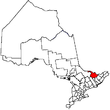 | |
|---|---|---|
| Towns | ||
| Townships | ||
| First Nations | ||
| Indian reserves | ||
| ||
This article is issued from
Wikipedia.
The text is licensed under Creative Commons - Attribution - Sharealike.
Additional terms may apply for the media files.