Hillsdale, Portland, Oregon
| Hillsdale | |
|---|---|
| Neighborhood | |
 | |
 Hillsdale | |
| Coordinates: 45°28′43″N 122°41′43″W / 45.478722°N 122.695294°WCoordinates: 45°28′43″N 122°41′43″W / 45.478722°N 122.695294°W | |
| Country | United States |
| State | Oregon |
| City | Portland |
| Government | |
| • Association | Hillsdale Neighborhood Association |
| • Coalition | Southwest Neighborhoods, Inc. |
| Area | |
| • Total | 2.01 sq mi (5.20 km2) |
| Population (2000)[1] | |
| • Total | 7,436 |
| • Density | 3,700/sq mi (1,400/km2) |
| Housing[1] | |
| • No. of households | 3397 |
| • Occupancy rate | 97% occupied |
| • Owner-occupied | 2216 households (65%) |
| • Renting | 1181 households (35%) |
| • Avg. household size | 2.19 persons |
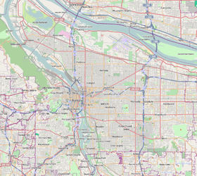
The Hillsdale district is a neighborhood in the southwest section of Portland, Oregon, United States. It is centered on the Hillsdale retail and business area, a series of strip malls on SW Capitol Highway between SW Sunset Boulevard and SW Bertha Boulevard. It is home to the Hillsdale Farmer's Market, which takes place on Sundays during the summer and every other Sunday during the winter.

Hillsdale borders Southwest Hills, Healy Heights, and Homestead on the north, South Portland on the east, South Burlingame and Multnomah on the south, and Hayhurst and Bridlemile on the west.
Oregon Route 10 connects Hillsdale to Downtown Portland to the north and to Raleigh Hills and Beaverton to the west.
Education
- Wilson High School
- Robert Gray Middle School
- Mary Rieke Elementary School
See also

References
External Links
| Buildings | |
|---|---|
| Geography | |
| |
This article is issued from
Wikipedia.
The text is licensed under Creative Commons - Attribution - Sharealike.
Additional terms may apply for the media files.