Ardenwald-Johnson Creek, Portland, Oregon
| Ardenwald-Johnson Creek | |
|---|---|
| Neighborhood | |
 Ardenwald-Johnson Creek | |
| Coordinates: 45°27′19″N 122°37′47″W / 45.4554°N 122.6298°WCoordinates: 45°27′19″N 122°37′47″W / 45.4554°N 122.6298°W | |
| Country | United States |
| State | Oregon |
| City | Portland |
| Government | |
| • Association | Ardenwald-Johnson Creek Neighborhood Association |
| • Coalition | Southeast Uplift Neighborhood Program |
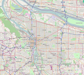
Ardenwald-Johnson Creek (also called simply Ardenwald) is a neighborhood straddling the border between Portland (and Multnomah County) and Milwaukie (and Clackamas County), Oregon. It is recognized by both Portland's Office of Neighborhood Involvement as well as Milwaukie's Neighborhoods Program.
Ardenwald was named in 1888 for Arden M. Rockwood, whose father platted the community.[1] The last syllable of Rockwood is rendered in German and spliced onto the first name.[1][2] . The neighborhood is centered around Ardenwald Elementary School.
The Tideman Johnson Natural Area (1940) is located along Johnson Creek in Ardenwald. Springwater Corridor Trail borders Johnson Creek, crossing along the north side of Ardenwald. The Ardenwald neighborhood has two access points for this 21-mile bike trail between Portland and Boring, found at the north end of SE 28th Avenue and from the Johnson Creek Boulevard Trailhead (where the trail crosses the road).[3][4]
Ardenwald was featured along the 8-mile loop of the 2017 Sellwood-Milwaukie Sunday Parkways, an annual 1-day event where streets are closed to vehicle traffic.[5]
The community puts on a summer concert series in Ardenwald Park, next to Ardenwald Elementary School. Water Tower Park features a unique play area along 40th Avenue.[6] An area of undeveloped lots, between SE 32nd Avenue, SE Roswell Street, and SE Barba Street, are widely used as an unofficial dog park for the neighborhood. The neighborhood's newest park, Balfour Park is located on Balfour Street off SE 32nd Ave and is currently undeveloped.[7]
Providence Milwaukie Hospital is located at the south end of Ardenwald at 10150 SE 32nd Avenue.
Gallery
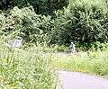 Bicycles in Tideman Johnson Natural Area
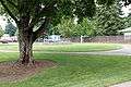 Ardenwald Park
 The old Ardenwald Elementary School
 Ardewald Park
 The new Ardenwald Elementary School
See also
- SE Tacoma/Johnson Creek MAX Station
- Kerf (sculpture), public art installed at the station
References
- 1 2 McArthur, Lewis A.; McArthur, Lewis L. (2003) [1928]. Oregon Geographic Names (7th ed.). Portland, Oregon: Oregon Historical Society Press. p. 30. ISBN 978-0875952772.
- ↑ Temple, Robert D. Edge Effects: The Border-Name Places, (2nd edition, 2009), iUniverse, ISBN 978-0-595-47758-6, page 323.
- ↑ "Springwater Corridor Brochure" (PDF). portlandoregon.gov. City of Portland. Retrieved 2018-03-31.
- ↑ "Springwater Corridor Trail in Clackamas County". clackamas.us. Clackamas County. Retrieved 2018-03-31.
- ↑ "Sellwood-Milwaukie Sunday Parkways". portlandoregon.gov. City of Portland. Retrieved 2017-10-21.
- ↑ "Water Tower Park". milwaukieoregon.gov. City of Milwaukie. Retrieved 2017-10-21.
- ↑ "Welcome to the Ardenwald-Johnson Creek Neighborhood" (PDF). ardenwald.org. Ardenwald-Johnson Creek Neighborhood Association. Retrieved April 2, 2018.