Brentwood-Darlington, Portland, Oregon
| Brentwood-Darlington | |
|---|---|
| Neighborhood | |
 Brentwood-Darlington | |
|
Coordinates: 45°28′07″N 122°35′50″W / 45.46863°N 122.59715°WCoordinates: 45°28′07″N 122°35′50″W / 45.46863°N 122.59715°W PDF map | |
| Country | United States |
| State | Oregon |
| City | Portland |
| Government | |
| • Association | Brentwood/Darlington Neighborhood Association |
| • Coalition | Southeast Uplift Neighborhood Program |
| Area | |
| • Total | 1.75 sq mi (4.53 km2) |
| Population (2010)[1][2] | |
| • Total | 12,994 |
| • Density | 7,400/sq mi (2,900/km2) |
| Housing[1] | |
| • No. of households | 12,846 |
| • Occupancy rate | 94% occupied |
| • Owner-occupied | 3210 households (67%) |
| • Renting | 1590 households (33%) |
| • Avg. household size | 2.68 persons |
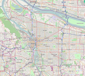
Brentwood-Darlington is a neighborhood on the southern edge of Portland, Oregon, bordering SE 45th Avenue to the west, SE Duke Street to the north, and SE 82nd Avenue to the east. The county line separating Multnomah County from Clackamas County forms most the neighborhood's (and the city's) southern boundary, though small portions of the neighborhood and the city extend into Clackamas County. (Conversely, some areas in the neighborhood in Multnomah County are outside Portland city limits.) Roughly, the southern boundary is SE Harney Drive on the eastern one-fourth, and SE Clatsop Street on the other three-quarters.
The Brentwood-Darlington Neighborhood Association dates to 1974 when it was founded as the Errol Heights Improvement Association, serving the neighborhoods of Errol Heights, Brentwood, Darlington, Harney Park, Woodmere, and Crystal Springs.[3] In 2013, the Brentwood-Darlington Neighborhood Association held a 'visioning' process to determine future plans for the neighborhood.[4]
The Brentwood-Darlington Community Center, run by a local non-profit agency, Impact NW, provides early childhood services to families in the community. Schools in the area include: the nonprofit alternative middle and high school, Mt.Scott Middle School, and the public schools: Woodmere Elementary School, Whitman Elementary School, and Lane Middle School.
The neighborhood is home to several large scale urban gardening projects, including the Brentwood Community Garden, which was improved and expanded in 2010 through a grant from The Home Depot and Fiskars.[5] It is also home to the Portland State University Learning Gardens Laboratory.[6]
Brentwood-Darlington includes Brentwood Park (1951), Errol Heights Natural Area (1966), and Hazeltine Park (2001), which was named after longtime neighborhood resident and leader, Dick Hazeltine.[7]
In 2010, a new, full-service grocery store opened in the neighborhood.[8]
See also
References
- 1 2 Demographics (2010)
- ↑ http://www.portlandoregon.gov/oni/article/375837
- ↑ http://www.brentwooddarlington.org/Documents/Brochure.pdf Archived March 15, 2007, at the Wayback Machine. Brentwooddarlinton.org
- ↑ "Brentwood-Darlington neighborhood looks to the future and the past with 'visioning' project". OregonLive.com. Retrieved 1 April 2016.
- ↑ "Find a Park - The City of Portland, Oregon". Retrieved 1 April 2016.
- ↑ "Portland State Graduate School of Education: Educational Leadership & Policy - Learning Gardens Laboratory". Retrieved 1 April 2016.
- ↑ "Find a Park - The City of Portland, Oregon". Retrieved 1 April 2016.
- ↑ "Full-service Grocery Store Opens In Brentwood-Darlington - East PDX News". Retrieved 1 April 2016.
External links
| Wikimedia Commons has media related to Brentwood-Darlington, Portland, Oregon. |
- Guide to Brentwood Darlington Neighborhood (PortlandNeighborhood.com)
- Brentwood-Darlington neighborhood looks to the future and the past with 'visioning' project (Steven Beaven, The Oregonian, May 3, 2013)
- Alternative middle school moves into Brentwood Darlington Community Center (Merry MacKinnon, The Bee, September 2, 2006)
- Brentwood-Darlington Street Tree Inventory Report