Highway M14 (Ukraine)
| |
|---|---|
| Автошлях M14 | |
.png) | |
| Route information | |
|
Part of | |
| Length |
624.3 km (387.9 mi) 652.5 km (405.4 mi) with access roads |
| Major junctions | |
| West end |
|
|
| |
| East end | Russian border at Novo-azovsk |
| Location | |
| Regions: | Odessa Oblast, Mykolaiv Oblast, Kherson Oblast, Zaporizhia Oblast, Donetsk Oblast |
| Highway system | |
| Roads in Ukraine | |
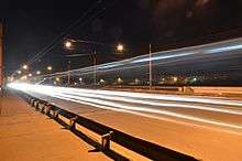
Highway M14 in Mykolaiv
Highway M14 is a Ukrainian international highway (M-highway) connecting Odessa to the Russian border east of Mariupol, where it continues into Russia as the A280.[1]
General overview
The M14 is a major transnational corridor and along with the M16 combines into the southern branch of European route E58 in Ukraine (another one in Zakarpattia).[2] The highway is also part of the Eurasian transportation corridor and the Black-Sea Economic Association transportation corridor (ChES). It runs along the coastal line of Black and Azov seas, connecting two major ports of Ukraine in Odessa and Mariupol. The M14 connects two major European routes: E95 and E105.
Main Route
Main route and connections to/intersections with other highways in Ukraine.
| Marker | Main settlements | Notes | Highway Interchanges |
|---|---|---|---|
| 0 km | Odessa | ||
| Mykolaiv | |||
| Kherson | |||
| Melitopol | |||
| Mariupol | |||
| 624 km | Novo-azovsk / Border (Russia) |
See also
References
External links
- International Roads in Ukraine in Russian
- European Roads in Russian
| E-roads in Ukraine | ||
|---|---|---|
| International | ||
| National | ||
| Regional |
| |
| ||
This article is issued from
Wikipedia.
The text is licensed under Creative Commons - Attribution - Sharealike.
Additional terms may apply for the media files.