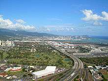
Interstate H-1
| ||||
|---|---|---|---|---|
| Queen Lili'uokalani Freeway | ||||
|
H-1 highlighted in red | ||||
| Route information | ||||
| Maintained by HDOT | ||||
| Length | 27.16 mi[1] (43.71 km) | |||
| Existed | 1959 – present | |||
| History | Completed in 1986 | |||
| Major junctions | ||||
| West end |
| |||
|
| ||||
| East end |
| |||
| Highway system | ||||
| ||||

Interstate H-1 (abbreviated H-1) is the busiest Interstate Highway in the US state of Hawaii. The highway is located on the island of O‘ahu. Despite the number, this is an east–west highway; the 'H'-series (for Hawaii) numbering reflects the order in which routes were funded and built. H-1 goes from Route 93 (Farrington Highway) in Kapolei to Route 72 (Kalanianaole Highway) in Kāhala. East of Middle Street in Honolulu (exit 19A), H-1 is also known as the Lunalilo Freeway and is sometimes signed as such at older signs in central Honolulu. West of Middle Street, H-1 is also known as the Queen Liliʻuokalani Freeway; this name is shown on some roadmaps. It is both the southernmost and westernmost signed Interstate Highway in the United States.
Route description
Interstate H-1 begins near the Campbell Industrial Park in the town of Kapolei, Hawaii. West of this point, Hawaii State Route 93 (Farrington Highway) continues toward Waianae. The freeway continues east, passing the community of Makakilo until reaching the junction with SR 750 (north to Kunia) and SR 76 (south to Ewa Beach).[2]
H-1 then continues along the northern edge of Waipahu approximately 3 miles (4.8 km) until its junction with Interstate H-2. It then continues east through the towns of Pearl City and Aiea for approximately 5 miles (8.0 km) to the complex Halawa Interchange, where it meets Interstates H-3 and H-201. The highway then turns south for two miles (3 km), then east soon after the exits for Hickam Air Force Base and Pearl Harbor. At this point, the highway runs along a viaduct above State Route 92 (Nimitz Highway), passing to the north of Honolulu International Airport.[2]
Two miles past the airport exit, three lanes exit the freeway at exit 18A to join Nimitz Highway toward Waikiki, while half a mile later the remaining two lanes make a sharp turn south as H-1 reaches another major interchange with the east end of Interstate H-201. Access is provided by a left exit from H-1 east only. H-1 west does not have access to H-201 at this point.
From here H-1 runs through the city of Honolulu along a series of underpasses and viaducts. A flyover interchange leading to downtown Honolulu has a westbound exit and an eastbound entrance. H-1 ends in the Kahala district of Honolulu near Kahala Mall, where State Route 72 (Kalanianaole Highway) ends.
H-1 has a maximum posted speed limit of 60 miles per hour (97 km/h) west of the Kunia-Ewa-Waipahu interchange; a 55-mile-per-hour (89 km/h) speed limit between the H-201/H-1 split and the H-1/H-2 merge, 50-mile-per-hour (80 km/h) speed limit between Kahala and the University area, with a 45-mile-per-hour (72 km/h) section between University and the H-201/H-1 split.
During morning commute hours on weekdays, an eastbound contraflow express lane is deployed from just west of exit 7 to exit 18A, where it connects to the beginning of the Nimitz Highway contraflow lane. The H-1 contraflow lane is often referred to as a "Zipper Lane" due to the use of a movable concrete barrier and a Zipper Machine. The H-1 and Nimitz Highway contraflow lanes are restricted to buses, motorcycles, and vehicles with two or more occupants while in operation.
History
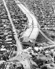
Interstate H-1 was authorized as a result of the Statehood Act of 1960.[4] The portion of H-1 that runs through downtown Honolulu opened in 1953 as the Mauka Arterial; it was added to the Interstate system when Hawaii became a state. This section has been largely unchanged since its inception and its design suffers from having too many on/off ramps, short distanced on-ramps, and on-ramps that enter the freeway almost immediately before an off-ramp (opposite of current design standards). The 'new' section of H-1 was, however, built to modern freeway standards.
The Hawaiian Interstate shields have gone through several changes. Early shields contained the hyphen as per the official designation (e.g. H-1); however, these shields have been updated with the hyphen removed (e.g. H1). As in other states across the contiguous United States, early interstate shields also included the writing of 'Hawaii' above the interstate route number and below the 'Interstate' writing.[5] While the "Queen Liliuokalani" section of the Interstate H-1 has signs designating it as such (one eastbound at exit 1, the other westbound after exit 19), there are no similar name signs for the Lunalilo Freeway portion (the remainder of the freeway).[4]
Interstate H-4
| |
|---|---|
| Location | Honolulu |
| Length | 6.5 mi (10.5 km) |
In the 1960s a fourth freeway, which would have been Interstate H-4 (H-4), was proposed for the city of Honolulu. The intent of H-4 was to provide relief to the congested H-1 through downtown Honolulu. Had it been built, the 6.5-mile-long (10.5 km) route of H-4 would have started at exit 18 (H-1/Nimitz Highway interchange) and followed the Honolulu waterfront to the Kapiolani interchange (exit 25B).[6] The idea, however, was unpopular and the freeway was never built.[4]
Exit list
The entire route is in Honolulu County.
| Location | mi[7] | km | Exit | Destinations | Notes |
|---|---|---|---|---|---|
| Kapolei | 0.00 | 0.00 | Continuation beyond western terminus | ||
| 1A | Campbell Industrial Park, Barbers Point Harbor (Route 95) | ||||
| 1.12 | 1.80 | 1B | Farrington Highway | ||
| 1.18 | 1.90 | 1C | Makakilo, Kapolei, Kalaeloa | Eastbound exit and entrance | |
| 2.21 | 3.56 | 2 | Makakilo, Kapolei, Kalaeloa (Route 901) | No eastbound exit | |
| 3 | Kapolei, Ewa | Formerly North–South Road,[8] now designated Route 8390 | |||
| Waipahu | 6.49 | 10.44 | 5 | Northern terminus of Route 76; southern terminus of Route 750; signed as exits 5A (south) and 5B (north) westbound | |
| 8.20 | 13.20 | 7 | Waikele, Waipahu | ||
| 9.40 | 15.13 | 8 | Southern terminus of Route 99; eastbound exits and westbound entrances; signed as exits 8A (south) and 8C (north) | ||
| 9.74 | 15.68 | 8B | Southern terminus of H-2; signed as exit 8A westbound | ||
| Waipahu (Route 7101) | Westbound exit and eastbound entrance | ||||
| Pearl City | 11.62 | 18.70 | 10 | Pearlridge, Pearl City, Waimalu | |
| Halawa | 14.20 | 22.85 | 13A | H-3 not signed westbound; western terminus of H-3 | |
| 14.61 | 23.51 | 13B | Halawa Heights, Stadium (H-201) | Eastbound signage; western terminus of H-201 | |
| Westbound signage | |||||
| Honolulu | 16.65 | 26.80 | 15A | Westbound exit and eastbound entrance; eastern terminus of Route 99 | |
| 16.85 | 27.12 | 15B | Signed as exit 15 eastbound | ||
| 17.77 | 28.60 | 16 | |||
| Aolele Street, Paiea Street | No westbound exit | ||||
| 19.12– 19.60 | 30.77– 31.54 | 18A | Signed as exit 18 westbound; eastern terminus of Route 92 | ||
| 19.34 | 31.12 | 18B | Dillingham Boulevard, Middle Street (Route 7415) | Eastbound exit and westbound entrance | |
| 20.36 | 32.77 | 19A | Middle Street (Route 7415) | Westbound exit only | |
| 19B | Westbound left exit and eastbound left entrance; eastern terminus of H-201/Route 78 | ||||
| 20.56 | 33.09 | 20A | Southern terminus of Route 63 | ||
| 20B | Houghtailing Street | Westbound exit and eastbound entrance | |||
| 20.80 | 33.47 | Eastbound exit and westbound entrance; western terminus of Route 98 | |||
| 21.35 | 34.36 | 20C | Palama Street | Westbound exit only | |
| 22.31 | 35.90 | 21A | School Street | Westbound exit and eastbound entrance | |
| Signed as exit 21B westbound | |||||
| 22.77 | 36.64 | 21B | Punchbowl Street | Eastbound exit and westbound entrance | |
| 22 | Westbound exit and eastbound entrance; eastern terminus of Route 98 | ||||
| 23.10 | 37.18 | Kinau Street | Eastbound exit and entrance | ||
| 23 | Lunalilo Street | No eastbound exit | |||
| 24.06 | 38.72 | Punahou Street – Manoa, Waikiki | Eastbound exit and westbound entrance | ||
| 25.07 | 40.35 | 24A | Bingham Street | Eastbound exit and westbound entrance | |
| Wilder Avenue | Westbound exit only | ||||
| 25.30 | 40.72 | 24B | University Avenue | Access to University of Hawaii at Manoa | |
| 25.62 | 41.23 | 25A | King Street – Waikiki, Honolulu Zoo | ||
| 25B | Kapiolani Boulevard | Westbound exit and eastbound entrance | |||
| 26.10 | 42.00 | 6th Avenue | Eastbound exit and westbound entrance | ||
| 26.83 | 43.18 | 26A | Koko Head Avenue | Eastbound exit and westbound entrance | |
| 27.53 | 44.31 | 26B | Waialae Avenue | Signed as exit 26 westbound | |
| 28.16 | 45.32 | 27 | Kilauea Avenue | Westbound exit and eastbound entrance | |
| At-grade intersection; highway continues east as Route 72 | |||||
| 1.000 mi = 1.609 km; 1.000 km = 0.621 mi | |||||
Auxiliary routes
- A portion of the Moanalua Freeway is designated as Interstate H-201. Until mid-2004, it was signed as Route 78.
References
- ↑ Adderly, Kevin (December 31, 2014). "Table 1: Main Routes of the Dwight D. Eisenhower National System of Interstate and Defense Highways as of December 31, 2014". Route Log and Finder List. Federal Highway Administration. Retrieved May 25, 2015.
- 1 2 Google Maps street maps and USGS topographic maps, accessed December 2007 via ACME Mapper
- ↑ Watanabe, June. "Kokua Line". Honolulu Star-Advertiser. Retrieved 21 November 2010.
- 1 2 3 "Interstate H-1". Interstate-Guide. Retrieved 24 November 2010.
- ↑ Voss, Oscar (June 2006). "Hawaii Road Sign Photos (Page 2 of 3)". Hawaii Highways. Retrieved May 25, 2015.
- ↑ Proposed Route H-4, Interstate and Defense Highway System Extension (PDF) (Report). State of Highway Department of Transportation. October 1968. Retrieved August 7, 2016.
- ↑ DeLorme (2007). Street Atlas USA (Map). DeLorme. Toggle Measure Tool.
- ↑ Hawaii Department of Transportation (February 11, 2010). "North–South Road Completed, New Name Unveiled" (Press release). Hawaii Department of Transportation. Archived from the original on October 3, 2012.
External links
| Wikimedia Commons has media related to Interstate H-1. |
Route map:
| Signed | |
|---|---|
| Unsigned | |
| Lists | |
| Other | |
Major Interstates highlighted | |