Grobelno, Šmarje pri Jelšah
| Grobelno | |
|---|---|
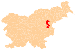
 Grobelno Location in Slovenia | |
| Coordinates: 46°12′54.2″N 15°26′50.7″E / 46.215056°N 15.447417°ECoordinates: 46°12′54.2″N 15°26′50.7″E / 46.215056°N 15.447417°E | |
| Country |
|
| Traditional region | Styria |
| Statistical region | Savinja |
| Municipality | Šmarje pri Jelšah & Šentjur |
| Area | |
| • Total | 2.96 km2 (1.14 sq mi) |
| Elevation | 265 m (869 ft) |
| Population (2002) | |
| • Total | 528 |
| [1] | |
Grobelno (pronounced [ˈɡɾoːbɛlnɔ]) is a settlement in eastern Slovenia. The core of the settlement lies in the Municipality of Šmarje pri Jelšah and the northern part in the Municipality of Šentjur. The area was traditionally part of Styria. The municipality is now included in the Savinja Statistical Region.[2] The railway line from Celje to Zagreb runs through the settlement, with the junction with the line towards Maribor just west of the settlement.
References
External links

| Settlements | Administrative centre: Šentjur
|  | ||||
|---|---|---|---|---|---|---|
| Landmarks |
| |||||
| Notable people | ||||||
This article is issued from
Wikipedia.
The text is licensed under Creative Commons - Attribution - Sharealike.
Additional terms may apply for the media files.