Great Portland Street tube station
| Great Portland Street | |
|---|---|
 Station as seen from above looking north towards Regents Place | |
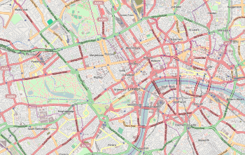 Great Portland Street Location of Great Portland Street in Central London | |
| Location | Great Portland Street |
| Local authority | City of Westminster |
| Managed by | London Underground |
| Number of platforms | 2 |
| Fare zone | 1 |
| London Underground annual entry and exit | |
| 2013 |
|
| 2014 |
|
| 2015 |
|
| 2016 |
|
| 2017 |
|
| Key dates | |
| 1863 | Opened |
| Other information | |
| Lists of stations | |
| External links | |
| WGS84 | 51°31′26″N 0°08′38″W / 51.5238°N 0.1438°WCoordinates: 51°31′26″N 0°08′38″W / 51.5238°N 0.1438°W |
|
| |
Great Portland Street is a London Underground station near Regent's Park. It is between Baker Street and Euston Square on the Hammersmith & City, Circle and Metropolitan lines. Great Portland Street station is listed as a building of National Significance and lies in Travelcard Zone 1.[2]
History
The station was part of the world's first underground railway, the Metropolitan Railway, which opened between "Bishop's Road" (now Paddington) on the Hammersmith & City line and "Farringdon Street" (close to the present-day Farringdon station). It was opened on 10 January 1863 as "Portland Road", changed to its present name on 1 March 1917 but was renamed "Great Portland Street and Regents Park" in 1923 and then reverted to its present name in 1933.[3] The current structure was built in 1930 on a traffic island on the Marylebone Road at its intersection with Great Portland Street and Albany Street. Its construction is a steel framed cream terracotta clad exterior, with the perimeter providing shops and originally a car showroom with office space over the station. Great Portland Street was at a major sales location for the motor industry. It was designed by the Metropolitan Railway's architect C. W. Clark and was Grade II-listed in January 1987.[4]
The station lies at the northern end of Great Portland Street – a main road which marks the border between Marylebone and Fitzrovia.[5][6]
The local neighbourhood plan identified the gyratory around Great Portland Street Underground Station as one where public realm improvements and traffic calming should be made.[7]
Services
The station is served by the Metropolitan, Hammersmith & City and Circle lines, between Euston Square in the east and Baker Street to the west. All three lines share the same pair of tracks from Baker Street Junction to Aldgate Junction making this section of track one of the most intensely used on the London Underground network.
Circle line
The typical service in trains per hour (tph) is:[8]
- 6 tph Clockwise via Kings Cross St Pancras and Liverpool Street
- 6 tph Anti-Clockwise to Hammersmith via Paddington
Hammersmith & City line
The typical service in trains per hour (tph) is:[8]
- 6 tph Eastbound to Barking
- 6 tph Westbound to Hammersmith via Paddington
Metropolitan line
The Metropolitan Line is the only line to operate express services, though currently this is only during peak times (Eastbound 06:30–09:30 / Westbound 16:00–19:00). Fast services run non-stop between Wembley Park, Harrow-On-The-Hill and Moor Park, Semi-fast services run non-stop between Wembley Park and Harrow-On-The-Hill.[9]
The typical off-peak service in trains per hour (tph) is:[10]
- 12 tph Eastbound to Aldgate
- 2 tph Westbound to Amersham (all stations)
- 2 tph Westbound to Chesham (all stations)
- 8 tph Westbound to Uxbridge (all stations)
Off-peak services to/from Watford terminate at Baker Street
The typical peak time service in trains per hour (tph) is:[10]
- 14 tph Eastbound to Aldgate
- 2 tph Westbound to Amersham (fast in the evening peak only)
- 2 tph Westbound to Chesham (fast in the evening peak only)
- 4 tph Westbound to Watford (semi-fast in the evening peak only)
- 6 tph Westbound to Uxbridge (all stations)
Connections
London Buses routes 18, 27, 30, 88, 205, 453 and C2 and night routes N18 and N205 serve the station.
Gallery
- Station as seen from above looking north
 Original Metropolitan Steam Train passes through Great Portland Street Station
 Platform roundel
 View of station location circa 1790
 Station tunnel running under Marylebone Road
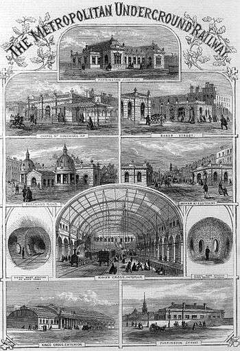 Shown as the Metropolitan Railway's Portland Road Station in 1862
 Thomas Crane's 1883 poster of Portland Road Station
 Trial 1862 train journey passing Portland Road station.
References
- 1 2 3 4 5 "Multi-year station entry-and-exit figures" (XLSX). London Underground station passenger usage data. Transport for London. January 2018. Retrieved 22 July 2018.
- ↑ Historic England. "Details from listed building database (1213650)". National Heritage List for England. Retrieved 28 September 2015.
- ↑ Forgotten Stations of Greater London by J. E. Connor and B. Halford
- ↑ London Underground Station Heritage Board, accessed 10 January 2013
- ↑ "About us". Fitzrovia Neighbourhood Association. Retrieved 10 May 2014.
- ↑ "The Marylebone Association Constitution" (PDF). 14 May 1996. Retrieved 10 May 2014.
- ↑ Fitzrovia West Neighbourhood Forum (2017-05-06). "PEDESTRIANISATION OF OXFORD STREET | FitzWest". fitzwest.org. Retrieved 2018-06-15.
- 1 2 "Circle and Hammersmith & City line WTT" (PDF). Transport for London. Archived from the original (PDF) on 11 November 2016.
- ↑ "CULG – Metropolitan Line". www.davros.org. Retrieved 2017-03-19.
- 1 2 "Metropolitan line WTT" (PDF). Transport for London. Archived from the original (PDF) on 1 July 2016.
External links
| Wikimedia Commons has media related to Great Portland Street tube station. |
| Preceding station | Following station | |||
|---|---|---|---|---|
towards Hammersmith | Circle line | |||
| Hammersmith & City line | towards Barking |
|||
| Metropolitan line | towards Aldgate |
|||
| Former services | ||||
towards Hammersmith | Metropolitan line Hammersmith branch (1864–1990) | towards Barking |
||
| Stations |
| ||||||
|---|---|---|---|---|---|---|---|
| Rolling stock | |||||||
| History |
| ||||||
| See also | |||||||
| |||||||
| Stations |
| ||||
|---|---|---|---|---|---|
| Rolling stock | |||||
| History |
| ||||
| See also | |||||
| |||||