Grand Bank
| Grand Bank | ||
|---|---|---|
| Town | ||
 | ||
| ||
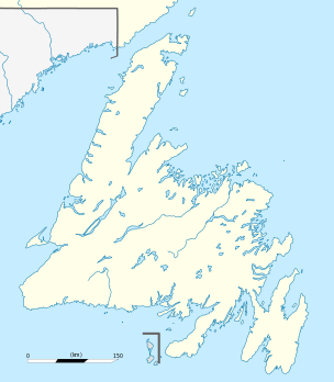 Grand Bank Location of Grand Bank in Newfoundland | ||
| Coordinates: 47°06′N 55°47′W / 47.100°N 55.783°W | ||
| Country |
| |
| Province |
| |
| Settled | 1640 | |
| Incorporated | 1943 | |
| Government | ||
| • Type | Town Council | |
| • Mayor | Rex C. Matthews | |
| • MHA |
Carol Anne Haley, (LIB), Burin-Grand Bank | |
| • MP |
Churence Rogers (LIB), Bonavista—Burin—Trinity | |
| Area | ||
| • Total | 16.97 km2 (6.55 sq mi) | |
| Elevation | 7 m (23 ft) | |
| Population (2016) | ||
| • Total | 2,310 | |
| • Density | 136.1/km2 (52.5/sq mi) | |
| down 4.3% since 2011 (2415) | ||
| Time zone | UTC-3:30 (Newfoundland Time) | |
| • Summer (DST) | UTC-2:30 (Newfoundland Daylight) | |
| Area code(s) | 709 | |
| Highway 220 | The Heritage Run | |
| Website | The Town of Grand Bank | |
|
| |
| Location |
Grand Bank Newfoundland Canada |
|---|---|
| Coordinates | 47°06′04.7″N 55°44′57.8″W / 47.101306°N 55.749389°W |
| Year first constructed | 1890 (first) |
| Year first lit | 1922 (current) |
| Construction |
wooden tower (first) concrete tower (current) |
| Tower shape | octagonal frustum tower with balcony and lantern (current) |
| Markings / pattern | white tower, red lantern (current) |
| Height | 7 metres (23 ft) |
| Focal height | 8 metres (26 ft) |
| Original lens | eighth-order dioptric lens |
| Range | 5 nautical miles (9.3 km; 5.8 mi) |
| Characteristic | Q G |
| Admiralty number | H0322 |
| CHS number | CCG 106 |
| NGA number | 2248 |
| ARLHS number | CAN-686 |
| Managing agent | Canadian Coast Guard[1][2] |
Grand Bank, Newfoundland and Labrador, Canada or 'Grand Banc' as the first French settlers pronounced it, is a small rural town with a population of 2,580. It is located on the southern tip or "toe" of the Burin Peninsula (also known as "the boot"), 360 km from the province's capital of St. John's.
Grand Banc was inhabited by French fisherman as early as 1640 and started as a fishing settlement with about seven families. It was given the name "Grand Banc" because of the high bank that extends from Admiral's Cove to the water's edge on the west side of the harbour.[3]
The Town of Grand Bank can attribute much of its past and present growth and prosperity to its proximity to the fishing grounds and its ice-free harbour. Original settlers thrived on trade with the French and a vigorous inshore fishing industry. Grand Bank became the nucleus of the bank fishing industry for Newfoundland and a service centre for Fortune Bay. With the decline of the salt fish industry, the town's emphasis quickly shifted to fresh fish production. Enterprising businessmen and town planners prepared the way for a fresh fish plant (present day Grand Bank Seafoods Inc.) and a fleet of trawlers.
Timeline
- 1640 - French fishermen were said to be in Grand Bank during this time.
- 1687 - First French Census taken in Newfoundland shows "Grand Banc" with a population of 45 (39 servants, 2 masters, 3 women and 1 child). The first community had one church, 3 houses and 18 muskets.
- 1693 – Census takers recorded some of the prominent names: Bourney, Commer, Chevallier and Grandin.
- 1713 - Treaty of Utrecht, France relinquishes its claim to Newfoundland including St. Pierre et Miquelon. The French Population moved to Ile Royale (Cape Breton).
- 1714 - William Taverner surveys the coast for the English Government.
- 1763 - Peace Treaty of Paris: French are given St. Pierre et Miquelon, forcing the English population at St. Pierre to relocate to Grand Bank and Fortune Bay. First record of English settlement.
- 1765 - Captain James Cook mapped out the area and moored his ship at Admiral’s Cove. Came ashore and gathered buds off the small spruce tree to brew beer (excellent source of vitamin C) for his crew.
- 1836 – Census list 45 dwellings and a population of 236 residents.
- 1850s - By the end of the 1850s, Grand Bank had a school, a doctor, a judicial system, a postal service and a road system.
- 1870s - A change in fishing vessel from a shallop to a schooner. With the change in vessel came a change in fishing gear. The trawl was introduced. However, the trawl could not be set directly from the schooner. There was a need for a smaller boat, different from the punt; we have the first appearance of the dory.
- 1879 - Breakwater and Dredging legislation was passed.
- 1881 - Bank Fishery began and Samuel Harris’s first season on the banks was a success. In short order, a number of other Grand Bankers with schooners followed (some of which include George Abraham Buffett, Simeon N. Tibbo and Daniel Tibbo). The demand for schooners dramatically increased. There were at one point (1885 & 1886) seven schooners being built in Grand Bank.
- 1890-1940 – Grand Bank had a fleet of banking and foreign-going ships and earned the distinction "The Bank Fishing Capital" of Newfoundland.
- 1955 - Modern fresh fish processing plant was built in Grand Bank and the schooners were replaced with modern steel trawlers.
Today, Grand Bank is the home of a shell fishing industry, a modern plant owned by Grand Bank Seafoods (A division of Clearwater Seafoods). It is also home to Dynamic Air Shelters - Manufactures of specialized, inflatable industrial shelters for the oil and gas sector, as well as structures for promotional and ‘first response’ uses.
Tourist attractions
- Southern Newfoundland Seamans Museum[4]
- Grand Bank Regional Theatre Festival
- Annual Grand Bank Summer Festival
- Harris House[4]
- Mariner's Memorial[4]
- Bait Depot
- Grand Bank Lighthouse
- Grande Meadows Golf Course - Just 30 km away. 9-hole, par 36, open May to October.
- St. Pierre and Miquelon - France's last outpost in North America.
Just minutes by air from Winterland or 70 minutes by sea from nearby Fortune (just 5 km from Grand Bank)
In recent years Grand Bank has seen a tripling of visitors interested in the Queen Anne architecture in the older homes, the traditions of a seafaring people and the heritage still evident in the older businesses, stores, halls and museums. Heritage Canada's Main Street program has been a great success, as evident in the face-lift of many storefront properties. This program was designed to assist in the revitalization of the downtown of Grand Bank using its four components - organization, marketing, design and economic development.
Climate
| Climate data for Grand Bank | |||||||||||||
|---|---|---|---|---|---|---|---|---|---|---|---|---|---|
| Month | Jan | Feb | Mar | Apr | May | Jun | Jul | Aug | Sep | Oct | Nov | Dec | Year |
| Record high °C (°F) | 13 (55) |
14 (57) |
15 (59) |
18 (64) |
24.5 (76.1) |
27 (81) |
29.5 (85.1) |
30 (86) |
29 (84) |
21.5 (70.7) |
18 (64) |
13 (55) |
30 (86) |
| Average high °C (°F) | −0.5 (31.1) |
−0.6 (30.9) |
2 (36) |
6.5 (43.7) |
12.2 (54) |
16.4 (61.5) |
20.6 (69.1) |
21.1 (70) |
17.4 (63.3) |
11.7 (53.1) |
6.7 (44.1) |
2 (36) |
9.6 (49.3) |
| Daily mean °C (°F) | −4.1 (24.6) |
−4.4 (24.1) |
−1.7 (28.9) |
2.7 (36.9) |
7.4 (45.3) |
11.4 (52.5) |
15.8 (60.4) |
16.6 (61.9) |
13.1 (55.6) |
7.9 (46.2) |
3.5 (38.3) |
−1.1 (30) |
5.6 (42.1) |
| Average low °C (°F) | −7.7 (18.1) |
−8.2 (17.2) |
−5.4 (22.3) |
−1.1 (30) |
2.5 (36.5) |
6.4 (43.5) |
11 (52) |
12 (54) |
8.9 (48) |
4.1 (39.4) |
0.3 (32.5) |
−4.1 (24.6) |
1.6 (34.9) |
| Record low °C (°F) | −21 (−6) |
−26 (−15) |
−22.5 (−8.5) |
−14 (7) |
−7 (19) |
−1 (30) |
1 (34) |
4 (39) |
0 (32) |
−6 (21) |
−13 (9) |
−20 (−4) |
−26 (−15) |
| Average precipitation mm (inches) | 127.4 (5.016) |
122.7 (4.831) |
117.1 (4.61) |
124.8 (4.913) |
112.5 (4.429) |
112.1 (4.413) |
92.3 (3.634) |
87.3 (3.437) |
143.5 (5.65) |
153 (6.02) |
140.1 (5.516) |
128.2 (5.047) |
1,461.1 (57.524) |
| Average rainfall mm (inches) | 75.4 (2.969) |
77.3 (3.043) |
92.3 (3.634) |
113.6 (4.472) |
111.9 (4.406) |
112.1 (4.413) |
92.3 (3.634) |
87.3 (3.437) |
143.5 (5.65) |
152.4 (6) |
131.9 (5.193) |
90.8 (3.575) |
1,280.9 (50.429) |
| Average snowfall mm (inches) | 52 (2.05) |
45.4 (1.787) |
24.9 (0.98) |
11.1 (0.437) |
0.5 (0.02) |
0 (0) |
0 (0) |
0 (0) |
0 (0) |
0.6 (0.024) |
8.2 (0.323) |
37.5 (1.476) |
180.2 (7.094) |
| Source: Environment Canada[5] | |||||||||||||
- The climate of Grand Bank is classified as Boreal (Koppen Dfb).[6]
- It enjoys one of the most favourable climates of Newfoundland and Labrador, mainly due to its position on the extreme southern coast of the Burin Peninsula.
- The winters are relatively mild winters with considerable variation in snow cover and heavy rainfall from October through December.
- The average air temperature in January is -0.5 °C - one of the warmest for all of Newfoundland and Labrador.
- Surface wind speeds average 20–30 km/hour, with 50–80 km/h typically sustained during low pressure systems. Very strong gusts (120–140 km/h) are a common feature along the south coast.[7]
- During strong Arctic air outbreaks the "windchill equivalent temperature" is typically in the -25 to -35 °C range on the island.
- July has a mean temperature of 20.6 °C. Summers are generally cooled by low clouds and fog.
- There is less fog in Grand Bank than at the other location on the south coast where records are kept. Fog can often be seen around Grand Bank when the community itself is free of it. This is thought to be caused by a combination of the inland hills and ridges that cause the fog to evaporate before it reaches the town.[8]
- Mean annual precipitation is 1461.1mm, which is high due to the occurrence of cyclonic storms and in which most of the precipitation falls as rain (1280.9mm or 81%).
- Snowfall in Grand Bank is about 180.2mm annually.
Schools
Media
Newspaper
The Southern Gazette is a newspaper that covers the entire Burin Peninsula.
Television
- Channel 5 - CBC Television
- Channel 11 - NTV
Radio
- AM 740: CHCM ("VOCM"), news/talk/country music
- FM 90.3: CBNM, CBC Radio One
- FM 91.7: CBN-FM-5, CBC Radio 2
- FM 96.3: CHOZ ("OZFM"), hot AC
- FM 99.5: VOAR-2, Christian radio
See also
References
- ↑ Southeastern Newfoundland The Lighthouse Directory University of North Carolina at Chapel Hill. Retrieved 12 February 2017
- ↑ List of Lights, Pub. 110: Greenland, The East Coasts of North and South America (Excluding Continental U.S.A. Except the East Coast of Florida) and the West Indies (PDF). List of Lights. United States National Geospatial-Intelligence Agency. 2016.
- ↑ Riggs Bert. "Grand Bank" In Joseph R. Smallwood, ed. Encyclopedia of Newfoundland and Labrador. Vol. 2. St.John's:Newfoundland Book Publishers (1967) Ltd., 1984, p.677
- 1 2 3 The Town of Grand Bank History
- ↑ Environment Canada—Canadian Climate Normals 1971–2000. Retrieved May 30, 2010.
- ↑ Climate and Weather of Newfoundland and Labrador, Banfield, C.E., St. John's Creative Publishing.
- ↑ Heritage Newfoundland
- ↑ Atmospheric Environment Service. Canadian Climate Normals. Environment Canada
External links
| Wikimedia Commons has media related to Grand Bank. |
- The Town of Grand Bank Website
- Grand Bank - Encyclopedia of Newfoundland and Labrador, vol. 2, p. 677-682.
- Aids to Navigation Canadian Coast Guard
Coordinates: 47°06′N 55°47′W / 47.100°N 55.783°W
| Census divisions | |
|---|---|
| Cities | |
| Other communities |
|
| |