Chateauguay River
| Chateauguay River | |
|---|---|
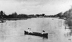 Canoeing on the river in Châteauguay, Quebec, 1910 | |
| Other name(s) | Chateaugay River |
| Countries | United States, Canada |
| Locations | New York, Quebec |
| Physical characteristics | |
| River mouth | Saint Lawrence River |
| Length | 121 km (75 mi)[1] |
| Basin features | |
| Basin size | 2,543.4 km2 (982.0 sq mi) |
The Chateauguay River (or Chateaugay River[2] in the United States) has its source at the Chateaugay Lakes in the Adirondack Mountains of northern New York state in the United States. It winds its way northward through several towns and villages in Quebec, Canada, such as Elgin, Hinchinbrooke, Huntingdon, Dewittville, Ormstown and Châteauguay, before emptying into the Saint Lawrence River near Montreal.
The river is home to many species of birds and fish and is a major stopping-point for migrating ducks and Canada geese.
Although polluted for many years, the river has been cleaned up and is beginning to be an eco-tourism destination for canoeing and kayaking.
The drainage basin and surrounding area is known as the Chateauguay Valley.
| Wikimedia Commons has media related to Rivière Châteauguay. |
See also
References
- ↑ "Liste des rivières du Québec par ordre alphabétique - List of Quebec rivers in alphabetic order" (PDF) (in French). Retrieved June 8, 2015.
- ↑ U.S. Geological Survey Geographic Names Information System: Chateaugay River
This article is issued from
Wikipedia.
The text is licensed under Creative Commons - Attribution - Sharealike.
Additional terms may apply for the media files.