Gladstone, Michigan
| Gladstone, Michigan | |
|---|---|
| City | |
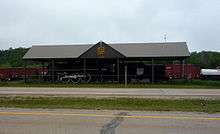
 Welcome sign with Little Bay de Noc in the background | |
 Location of Gladstone, Michigan | |
| Coordinates: 45°50′45″N 87°1′49″W / 45.84583°N 87.03028°W | |
| Country | United States |
| State | Michigan |
| County | Delta |
| Area[1] | |
| • Total | 7.92 sq mi (20.51 km2) |
| • Land | 5.00 sq mi (12.95 km2) |
| • Water | 2.92 sq mi (7.56 km2) |
| Elevation | 604 ft (184 m) |
| Population (2010)[2] | |
| • Total | 4,973 |
| • Estimate (2016)[3] | 4,796 |
| • Density | 630/sq mi (240/km2) |
| Time zone | UTC-5 (Eastern (EST)) |
| • Summer (DST) | UTC-4 (EDT) |
| ZIP code | 49837 |
| Area code(s) | 906 |
| FIPS code | 26-32300[4] |
| GNIS feature ID | 1620021[5] |
Gladstone is a city in Delta County in the U.S. state of Michigan. It is also known locally as "Happy Rock", a play on words of Gladstone. First settled in 1877, Gladstone's original name was Minnewasca. The population was 4,973 at the 2010 census.
U.S. Highways 2 and 41 run concurrently through the city, connecting with Escanaba, nine miles (14 km) to the south. US 41 runs north to Marquette and US 2 runs east to Manistique. M-35 runs northwest 52 miles (84 km) to Gwinn and merges with US 2/US 41 south to Escanaba.
History
First settlers
Throughout the early 19th century, the area where Gladstone exists was largely uninhabited other than Ojibwe hunters in the area or the occasional Euro-American trapper or fisherman. Gladstone was first settled in 1859 when the Hamilton Corporation of Fayette began using it as a shipping point for selling and transporting of their iron ore.[6]
The town was originally named Minnewasca by the Soo Line Railroad, the Ojibwa name meaning "white water."[7] When the name was filed with the county and Secretary of State in Lansing, Senator W. D. Washburn, who had an interest in building the railroad, persuaded officials to change the name to Gladstone in honor of British premier, William Evert Gladstone.[8]
Earliest development was on Saunders Point, so named for Capt. Nate Saunders who headquartered there when fishing at various points along the bay, was the location for the initial build-up of Gladstone.[8] Today, Saunder’s Point still exists as a small peninsula east of Gladstone’s city park system, located in Little Bay De Noc.
Expanding beyond its iron ore roots into a shipping point for lumber, coal, and copper during the American civil war, throughout the 1860s and 1870s, Gladstone grew into a busy port.
Change of name
In 1876, the Hamilton Corporation had to move its operations when their mine dried up. The new mine location, further south, meant shipping their ore through the Escanaba port. Arthur Delano, the president of Soo Line Railroad, had commissioned a train depot built in Saunder’s Point during the previous winter to start land shipping for the Hamilton Corporation.[9] However, since this was no longer possible, Delano began commissioning local industries.
Gladstone was in corporated as a village in 1887 and as a city in 1889.[10] Gladstone is named after the English statesman William Ewart Gladstone.[11]
Geography

The city is on a small projection into the Little Bay de Noc, which opens onto Green Bay on Lake Michigan.
According to the United States Census Bureau, the city has a total area of 7.92 square miles (20.51 km2), of which 5.00 square miles (12.95 km2) is land and 2.92 square miles (7.56 km2) is water.[1]
Climate
Due to the city’s proximity to Lake Michigan, Gladstone consistently has high humidity and experiences four distinct seasons. Summers are warm and humid, with average high temperatures in the mid 80s and average lows in the mid 60s. Winters are cold, snowy and windy with temperatures often below freezing. Spring and fall are mild with low humidity. According to the National Weather Service, Gladstone’s record low comes in at -60 on January 7, 1896 . To this day, this storm is referred to by Gladstone residents as "les morte a doigts," since so many of the city’s residents lost fingers due to frostbite. On July 19, 1992, Gladstone experienced a rare tornado which caused moderate damage throughout the city.
Neighborhoods
Although Gladstone is a relatively small city, it has several distinct sections: Downtown (which hosts most of the local businesses), The Buckeye (located on the western side of the city, bordering the Brampton, MI township), and the Bluff (which hosts most of the new residential expansion, as well as Gladstone High School). Gladstone High School sports teams are referred to as the Braves, which along with the Escanaba Eskimos give Delta County two schools bearing indigenous symbols.
Culture
Tourism and parks
Gladstone is often referred to as "The Year Round Playground" because of its myriad parks and activities. Gladstone’s main park is Van Cleve, which hosts a playground (Kid’s Kingdom), a skateboarding park, baseball field, basketball court, fitness trail, a beach with water slide, boardwalk, as well as a harbor with boat ramps and fish cleaning station.
Another Gladstone attraction is the Gladstone Sports Park, which hosts several baseball fields, skiing and snowboarding runs and a tubing facility. The Park itself is often rented out for other activities, including wedding receptions, and high school graduation parties.
Gladstone also hosts the Days River Trails, which are hiked and biked in the spring, summer, and fall. In the winter, these trails are used primarily for cross-country skiing.
Gladstone had much more tourism in the 70's. The decline started when the state built I75 from St. Ignace to Sault St. Marie, routing the "Around the Lake" tourism directly out of the state into Canada. The second death blow Gladstone is beginning to recover from was building the only 4 lane highway in the U.P., which completely bypasses Gladstone (and only Gladstone) thus causing limited access from one end of Gladstone to the other.
These two acts committed Gladstone to bedroom community status for the future. All shopping and many jobs are in Escanaba.
However, the white sand beaches and clear warm water are still there and the many crafty tourists return every year and are not letting on. The rest of the U.P. and Wisconsin coasts are exposed with cold lake water. Only in Gladstone's Little Bay de Noc do these conditions hold true. (Sources: The highway features are still there.)
Economy
Despite economic troubles in the region, Gladstone is the home of many thriving businesses including Marble Arms, Besse Forest Products, Canadian National Railway, VanAire Inc, Independent Machine Co., Pardon Inc., Bramco Containers, Hoegh Pet Caskets, Brampton Bike and Ski, Bay de Noc Lure Company (makers of the "Swedish Pimple" and "Do-Jigger"), Main Street Pizza, D&M Subs, The Dairy Flo, Gladstone Square Pharmacy, and The Saloon. Many of Gladstone’s residents also find work in Escanaba, particularly with one of the New Page Corporation's mills, which is the area’s largest employer.
Media
Gladstone was featured in the 2010 documentary film Catfish.
Transportation


Obviously, the US Highway Department had high expectations for Gladstone in its original 1926 highway plan.

- Indian Trails provides daily intercity bus service between St. Ignace and Ironwood, Michigan[12] and between Hancock and Milwaukee, WI with a stop in Gladstone.[13]
Notable people
- Terry Ahola, professional ski racer, member of US Ski Team
- Robert John Cornell, former member of the United States House of Representatives from Wisconsin, Roman Catholic priest
- Becky Iverson, professional golfer
- Frank Smith, cartoon animator and film director
- Bart Stupak, former member of the United States House of Representatives, Upper Peninsula of Michigan
- Kevin Tapani, professional baseball pitcher
Demographics
| Historical population | |||
|---|---|---|---|
| Census | Pop. | %± | |
| 1890 | 1,337 | — | |
| 1900 | 3,380 | 152.8% | |
| 1910 | 4,211 | 24.6% | |
| 1920 | 4,953 | 17.6% | |
| 1930 | 5,170 | 4.4% | |
| 1940 | 4,972 | −3.8% | |
| 1950 | 4,831 | −2.8% | |
| 1960 | 5,267 | 9.0% | |
| 1970 | 5,237 | −0.6% | |
| 1980 | 4,533 | −13.4% | |
| 1990 | 4,565 | 0.7% | |
| 2000 | 5,032 | 10.2% | |
| 2010 | 4,973 | −1.2% | |
| Est. 2016 | 4,796 | [3] | −3.6% |
| U.S. Decennial Census[14] | |||
2010 census
As of the census[2] of 2010, there were 4,973 people, 2,182 households, and 1,374 families residing in the city. The population density was 994.6 inhabitants per square mile (384.0/km2). There were 2,431 housing units at an average density of 486.2 per square mile (187.7/km2). The racial makeup of the city was 95.4% White, 0.2% African American, 1.9% Native American, 0.3% Asian, 0.3% from other races, and 1.8% from two or more races. Hispanic or Latino of any race were 1.0% of the population.
There were 2,182 households of which 27.9% had children under the age of 18 living with them, 49.5% were married couples living together, 9.3% had a female householder with no husband present, 4.1% had a male householder with no wife present, and 37.0% were non-families. 32.4% of all households were made up of individuals and 17.4% had someone living alone who was 65 years of age or older. The average household size was 2.27 and the average family size was 2.84.
The median age in the city was 43.6 years. 22.7% of residents were under the age of 18; 6.5% were between the ages of 18 and 24; 22.3% were from 25 to 44; 27.5% were from 45 to 64; and 21.1% were 65 years of age or older. The gender makeup of the city was 47.7% male and 52.3% female.
2000 census
As of the census[4] of 2000, there were 5,032 people, 2,126 households, and 1,392 families residing in the city. The population density was 1,015.2 per square mile (391.7/km²). There were 2,289 housing units at an average density of 461.8 per square mile (178.2/km²). The racial makeup of the city was 96.76% White, 0.14% African American, 1.47% Native American, 0.22% Asian, 0.08% Pacific Islander, 0.04% from other races, and 1.29% from two or more races. Hispanic or Latino of any race were 0.42% of the population. 14.3% were of French, 14.0% German, 12.2% Swedish, 10.3% French Canadian, 6.1% English, 5.2% Irish and 5.0% Belgian ancestry according to Census 2000. 99.5% spoke English as their first language.
There were 2,126 households out of which 29.7% had children under the age of 18 living with them, 52.6% were married couples living together, 9.9% had a female householder with no husband present, and 34.5% were non-families. 30.8% of all households were made up of individuals and 16.1% had someone living alone who was 65 years of age or older. The average household size was 2.36 and the average family size was 2.94.
In the city, the population was spread out with 24.9% under the age of 18, 7.3% from 18 to 24, 25.7% from 25 to 44, 23.1% from 45 to 64, and 19.0% who were 65 years of age or older. The median age was 40 years. For every 100 females, there were 90.6 males. For every 100 females age 18 and over, there were 87.6 males.
The median income for a household in the city was $34,328, and the median income for a family was $47,899. Males had a median income of $43,400 versus $25,662 for females. The per capita income for the city was $17,973. About 7.8% of families and 10.2% of the population were below the poverty line, including 13.9% of those under age 18 and 9.5% of those age 65 or over.
References
- 1 2 "US Gazetteer files 2010". United States Census Bureau. Archived from the original on 2012-01-24. Retrieved 2012-11-25.
- 1 2 "American FactFinder". United States Census Bureau. Retrieved 2012-11-25.
- 1 2 "Population and Housing Unit Estimates". Retrieved June 9, 2017.
- 1 2 "American FactFinder". United States Census Bureau. Archived from the original on 2013-09-11. Retrieved 2008-01-31.
- ↑ "US Board on Geographic Names". United States Geological Survey. 2007-10-25. Retrieved 2008-01-31.
- ↑ Gladstone Centennial Book Community (1987). Gladstone Centennial History. Gladstone Centennial Book Community. Pp 12–47. ASIN B0010K5HFW
- ↑ "Gladstone, Michigan: A Little Town with a Big Name".
- 1 2 "City of Gladstone".
- ↑ The Trains staff (November 1990). Timeline. Trains, pp. 21–47
- ↑ Walter Romig, Michigan Place names, p. 224
- ↑ Gannett, Henry (1905). The Origin of Certain Place Names in the United States. Govt. Print. Off. p. 138.
- ↑ "ST. IGNACE-SAULT STE. MARIE-IRONWOOD" (PDF). Indian Trails. January 15, 2013. Archived from the original (PDF) on 2014-07-04. Retrieved 2013-02-28.
- ↑ "HANCOCK-MARQUETTE-GREEN BAY-MILWAUKEE" (PDF). Indian Trails. January 12, 2012. Archived from the original (PDF) on 2014-02-22. Retrieved 2013-02-27.
- ↑ "Census of Population and Housing". Census.gov. Archived from the original on May 12, 2015. Retrieved June 4, 2015.
External links
Municipalities and communities of Delta County, Michigan, United States | ||
|---|---|---|
| Cities | 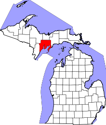 | |
| Village | ||
| Townships | ||
| Unincorporated communities | ||
| Ghost town | ||
| Indian reservation | ||
| Footnotes | ‡This populated place also has portions in an adjacent county or counties | |
Coordinates: 45°51′10″N 87°01′18″W / 45.85278°N 87.02167°W