Ghansikuwa
| Ghansikuwa घाँसीकुवा | |
|---|---|
| Village development committee | |
 Prithvi Highway at Ghansikuwa | |
 Ghansikuwa Location in Nepal | |
| Coordinates: 27°58′N 84°22′E / 27.97°N 84.36°ECoordinates: 27°58′N 84°22′E / 27.97°N 84.36°E | |
| Country |
|
| Zone | Gandaki Zone |
| District | Tanahu District |
| Population (1991) | |
| • Total | 6,573 |
| Time zone | UTC+5:45 (Nepal Time) |
Ghansikuwa is a village development committee in Tanahu District in the Gandaki Zone of central Nepal. At the time of the 1991 Nepal census it had a population of 6573 people living in 1264 individual households.It is named after the place Ghanshikuwa which named after a pond made by ghasi.The famous cities of this VDC includes Kamalbari,Ghanshikuwa,Deurali,Chabdibarahi,Chirkanne and so on.The popular temple chabdi barahi is also partially located here. In 2016,by the implementation of new law many wards of this VDC (2-8) is merged to Vyas municipality and remaining is merged with Bandipur VDC.[1]
References
- ↑ "Nepal Census 2001", Nepal's Village Development Committees, Digital Himalaya, archived from the original on 12 October 2008, retrieved 15 November 2009 .
External links
Headquarters: Damauli (today part of Byas Municipality) | ||
| Municipalities | 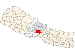 | |
| Rural municipalities |
| |
| Former VDCs |
| |
This article is issued from
Wikipedia.
The text is licensed under Creative Commons - Attribution - Sharealike.
Additional terms may apply for the media files.