Galguduud
| Galguduud | |
|---|---|
| Region | |
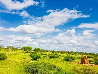 Guriceel District countryside | |
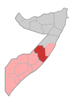 Location in central Somalia. | |
| Coordinates: 5°20′13″N 46°37′13″E / 5.33694°N 46.62028°ECoordinates: 5°20′13″N 46°37′13″E / 5.33694°N 46.62028°E | |
| Country |
|
| Regional State |
|
| Capital | Dusmareb |
| Government | |
| • Governor | Ahmadnur Ali Jimale |
| Population (2018) | |
| • Total | 800,000[1] |
| Time zone | UTC+3 (EAT) |
Galguduud (Somali: Galgaduud, Arabic: جلجدود) is an administrative region (gobol) in central Galmudug state of Somalia.[2] It's administrative capital is Dusmareb.
Overview
It is bordered by Ethiopia, the Somali regions of Mudug, Hiran and Middle Shebelle (Shabeellaha Dhexe), and the Indian Ocean. Galguduud's capital is Dusmareb.
The region of Galgaduud and southern half of Mudug have formed the Galmudug State, which considers itself an autonomous state within the larger Federal Republic of Somalia, as defined by the provisional constitution of Somalia.[3]
Districts
The Galguduud region consists of eight districts:[4]
Major towns
Small towns
- Wahbo
- Masagaway
- Waniinle
- Garablo
- Maraysuuley
- Ceelqooxle
- Tuulo aflax
- EL QOXLE
- ceel la halay
- EL meygaag
- El garas
- Gadoon
Notes
- ↑ http://www.fsnau.org/downloads/Somalia%202017%20Post%20Deyr%20Acute%20Food%20Insecurity%20Rural%2C%20Urban%20and%20IDP%20Population%20Stressed%2C%20in%20Crisis%20and%20Emergency%20%28Projection%2C%20February-%20June%202018%29.pdf
- ↑ "Somalia". The World Factbook. Langley, Virginia: Central Intelligence Agency. Retrieved 6 December 2013.
- ↑ "Somalia's Federal Govt Endorses Central State". All Africa. Retrieved 18 June 2016.
- ↑ "Galgaduud Region" (PDF). Retrieved 30 January 2014.
External links
| History |
|  | |||||||
|---|---|---|---|---|---|---|---|---|---|
| Geography |
| ||||||||
| Politics |
| ||||||||
| Economy | |||||||||
| Society |
| ||||||||
| |||||||||
This article is issued from
Wikipedia.
The text is licensed under Creative Commons - Attribution - Sharealike.
Additional terms may apply for the media files.